Manaslu Circuit Trek

44 reviewsBest Seller
Trip Fact:
  • Duration 12 Days
  • Difficulty Level Moderate
  • DestinationNepal
  • Max AltitudeLarkya La Pass, 5,160 m / 16,929 ft
  • AccommodationTeahouse
  • MealsAll meals (breakfast, lunch, and dinner)
  • Trip Start/EndMachha Khola, Besisahar
  • Group Size1-7 trekkers
  • Best SeasonSpring (March to May) and autumn (September to November)

The Manaslu Circuit Trek is a quieter Himalayan trekking route in Nepal known for its gradual altitude progression, remote mountain villages, and the dramatic crossing of Larkya La Pass.

This itinerary is designed for trekkers looking for a more balanced mountain journey with proper acclimatization, realistic walking days, and a less crowded trail experience compared to many of Nepal’s busier trekking regions.

Restricted Area RouteLarkya La Pass CrossingSmall Group & Private TreksKathmandu Round Trip

Why Trek With Our Local Team?

Our team has been organizing treks in the Manaslu region for many years, focusing on safe route planning, proper acclimatization, and realistic trekking pace throughout the journey. From permits and transportation to guides and mountain logistics, the trek is managed directly by our Nepal-based local team.

Registered Nepal Trekking CompanyTAAN & NMA AffiliatedLicensed Through Nepal Tourism BoardExperienced Local Himalayan GuidesPorter Insurance & Safety Support

Manaslu Circuit Trek Overview

The Manaslu Circuit Trek is a 12-day Himalayan trekking journey that follows the Budhi Gandaki valley from the lower subtropical foothills to the high mountain terrain below Larkya La Pass (5,160 m). 

The route gradually moves through riverside villages, forest trails, suspension bridges, alpine landscapes, and Tibetan-influenced mountain settlements before descending into the upper Marsyangdi region after crossing the pass.

The trek begins from Machha Khola, a small riverside village along the Budhi Gandaki River. The name “Machha Khola” means “fish river” in Nepali, reflecting the lifestyle of local communities living along the river valley. 

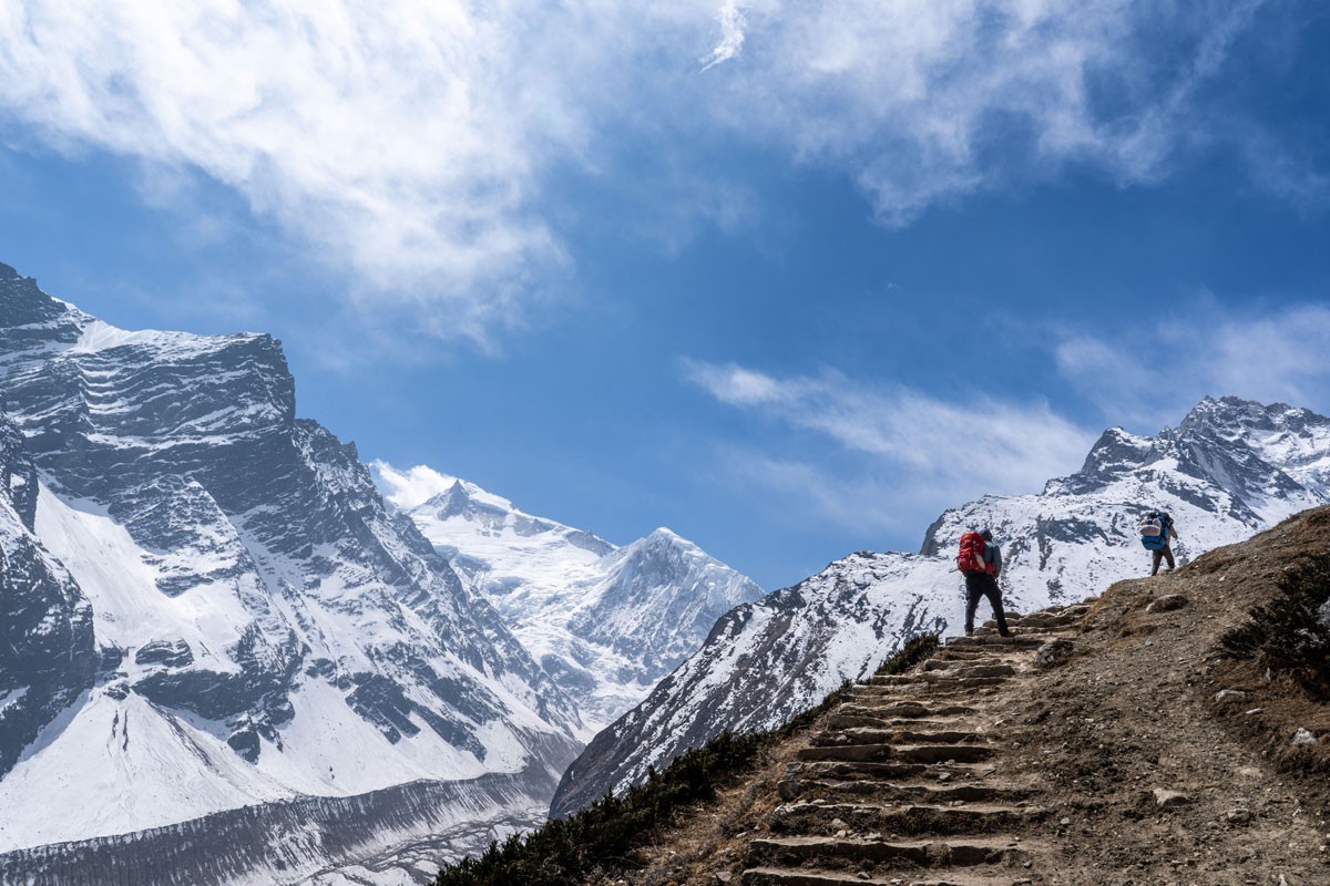
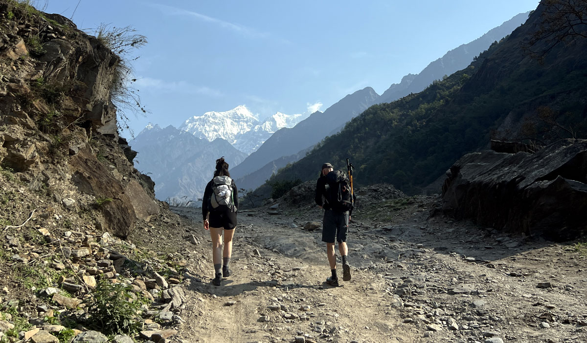
Lower sections of the trail between Machha Khola and Deng follow narrow valley paths with stone staircases, waterfalls, and suspension bridges above the river.

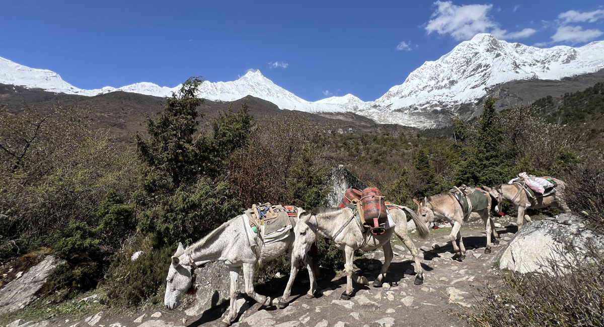
Along the lower trail, mule caravans, local porters, and daily village movement remain part of everyday life in the Budhi Gandaki valley. Some gradual forest sections also include short “Nepali flat” stretches with small ups and downs rather than continuous steep climbing.

As the trek moves higher, the landscape changes noticeably from humid lower valleys to drier and more exposed alpine terrain near Samagaun, Samdo, and Dharmasala. 

Compared to Nepal’s busier trekking routes like the Everest Base Camp Trek, the Manaslu region still feels more traditional and less commercially developed, especially in the upper Nubri Valley.

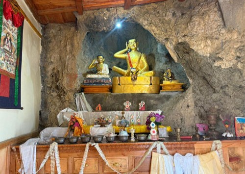
Higher sections of the trail reflect strong Tibetan Buddhist influence, with monasteries, mani walls, prayer flags, and stone-carved mantras appearing more frequently as the route climbs deeper into the mountains.

Samdo itself has long been connected to seasonal trade and yak herding traditions near the Tibetan border, adding another distinct cultural layer to the upper valley experience.

After Samdo, tree lines gradually disappear, and the trekking environment begins to feel colder, windier, and more exposed before the final approach toward Dharmasala and Larkya La Pass.

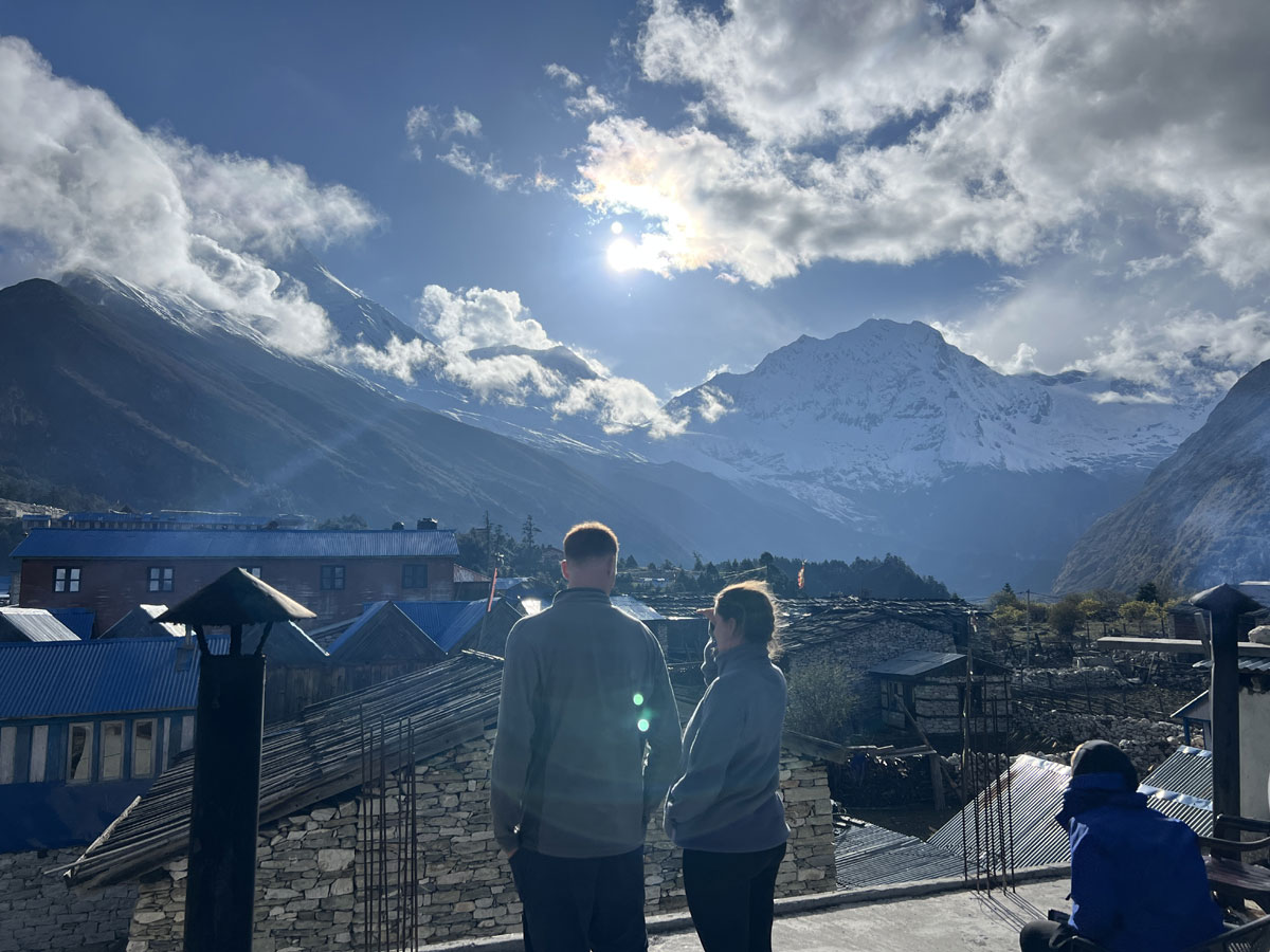
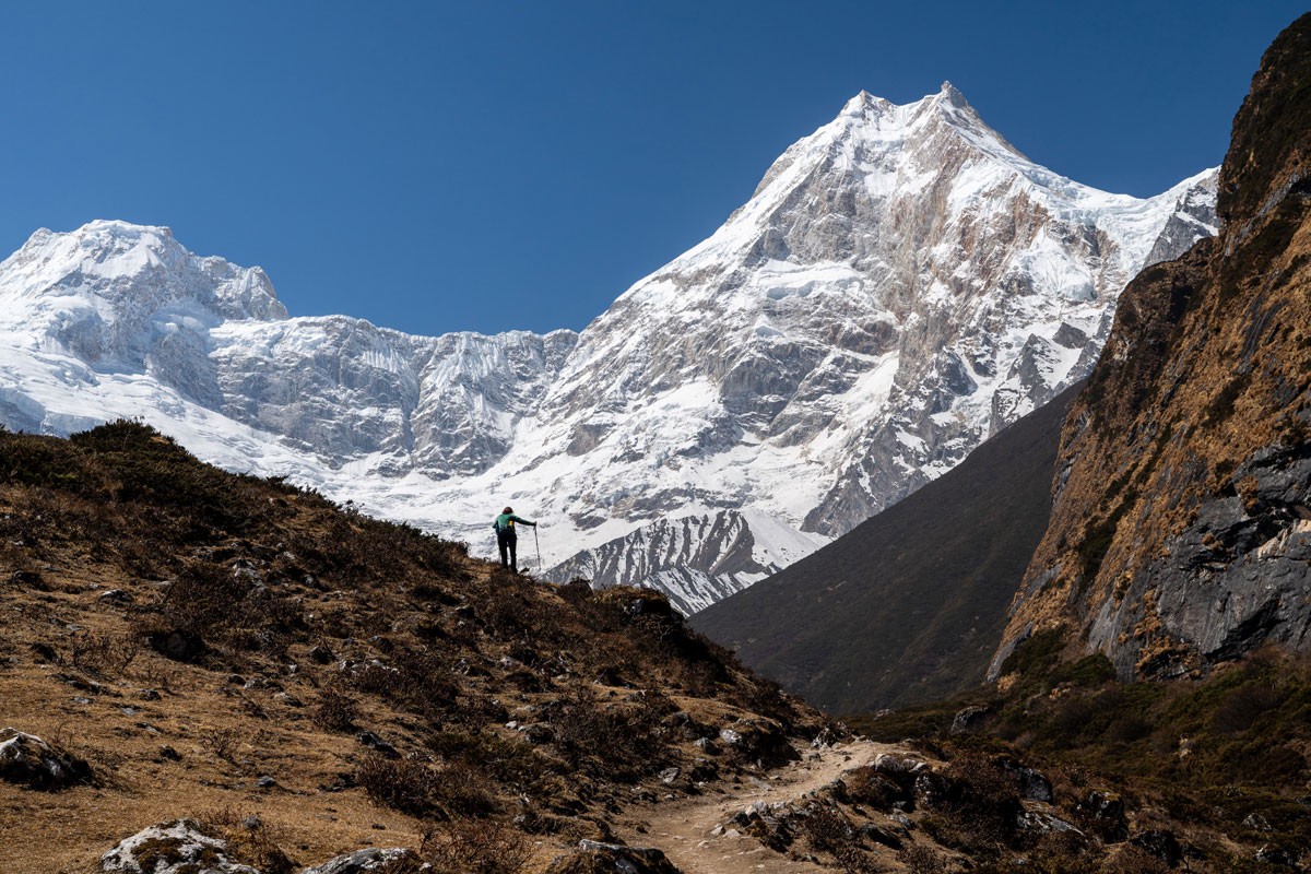
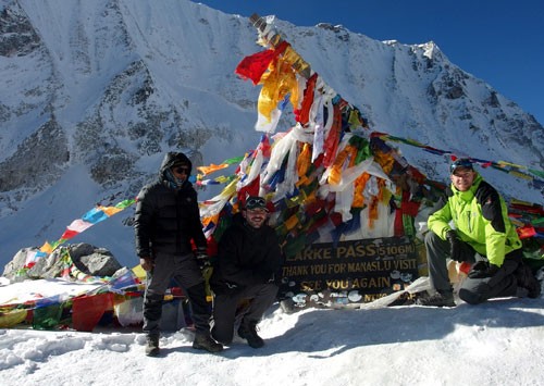
Best view of Mount Manaslu during the Manaslu Circuit Trek near Shyala village

This itinerary is designed around realistic trekking pace, altitude progression, and current road access conditions. The route now begins from Machha Khola and finishes near Tilje, helping avoid unnecessary road walking while still keeping important acclimatization stops in Samagaun and Samdo before crossing the pass. 

Accommodation throughout the trek is in local tea houses run by mountain families. In villages like Namrung and Samagaun, some tea houses now even serve fresh bakery items, espresso coffee, and cappuccino, while higher stops such as Dharmasala remain very basic due to the altitude and limited infrastructure in the upper valley.

The Manaslu Circuit Trek does not require technical climbing skills, but it does require good stamina, steady pacing, and preparation for changing mountain weather conditions. 

For trekkers looking for a high-altitude trekking route in Nepal with strong landscape variation, Tibetan-influenced mountain culture, and a more continuous mountain trail environment, the Manaslu Circuit remains one of Nepal’s most balanced high-altitude tea house trekking routes.

Last Updated: March 2026
Updated with the latest 22 March, 2026 Manaslu permit regulations, including the new solo trekking rule allowing single trekkers to trek with a licensed guide without requiring a minimum of two people.

Manaslu Circuit Trek Highlights

  • Circle Mount Manaslu (8,163 m), the world’s eighth-highest peak, on one of Nepal’s most scenic and quieter trekking routes
  • Experience traditional Nubri and Tibetan Buddhist culture in upper Manaslu villages
  • Walk past ancient mani walls, chortens, monasteries, and prayer flags throughout the trail
  • Enjoy well-planned acclimatization days with optional hikes to Birendra Lake, Manaslu Base Camp, and nearby viewpoints
  • Explore Samdo, a traditional stone village near the Tibetan border, where yak herding and cross-border trade continue
  • Stay at Dharmasala (Larkya Phedi), one of the most remote high-altitude stops before crossing the pass
  • Cross Larkya La Pass (5,160 m), the most challenging and rewarding part of the trek with wide Himalayan views
  • Witness dramatic landscape changes from river valleys to alpine terrain and green valleys around Bimthang
  • Walk through diverse terrain including suspension bridges, forest trails, stone steps, and occasional landslide sections
  • Stay in small, family-run teahouses offering simple accommodation and local hospitality
  • Trek along a restricted Himalayan route that still retains a strong connection to traditional mountain life and quieter trail conditions
  • Experience the full journey from low river valleys to remote high Himalayan landscapes in a single circuit

Who is the Manaslu Circuit Trek for?

The Manaslu Circuit Trek is suitable for trekkers looking for a longer high-altitude journey that combines varied terrain, traditional mountain villages, and a quieter tea house trekking environment.

It is especially suitable for trekkers who enjoy longer trekking days, changing mountain conditions, and a journey that gradually moves from lower valleys into high Himalayan terrain.

This trek can be completed by fit beginners as well as experienced trekkers who are comfortable walking around 5 to 7 hours a day on varied terrain. Previous trekking experience is helpful but not essential with proper preparation and a steady pace.

With proper preparation and realistic pacing, the trek can also be suitable for older trekkers and younger participants who are comfortable with basic mountain conditions and multi-day walking.

You can also read our detailed guide on What Is the Age Limit for Manaslu Circuit Trek? to better understand who this trek is suitable for.

What Makes the Manaslu Circuit Trek Different?

One of the defining characteristics of the Manaslu Circuit Trek is how naturally the route changes as the journey moves deeper into the mountains. The transition is gradual, both in landscape and culture, which makes the trek feel continuously evolving rather than centered around a single destination.

The lower section follows the Budhi Gandaki valley through subtropical forests, riverside trails, suspension bridges, and terraced hillside villages. As the elevation increases, the environment slowly shifts toward alpine terrain, glacier valleys, and more isolated mountain settlements.

The cultural atmosphere also changes noticeably in the upper part of the trail. Beyond Namrung and Lho, Tibetan Buddhist influence becomes a stronger part of everyday village life, especially around Samagaun and Samdo, where monasteries, mani walls, prayer flags, and seasonal yak herding remain closely connected to the region’s daily rhythm.

Compared to some of Nepal’s busier trekking routes, many sections of the Manaslu Circuit still feel quieter and less commercialized, particularly between Deng and Dharmasala.

Another important difference is the trek’s acclimatization-based progression. The route gradually prepares trekkers for higher elevation before the crossing of Larkya La Pass (5,160 m), which often feels like the natural conclusion of a longer mountain journey rather than a single viewpoint destination.

Life Along the Manaslu Circuit Trail

The experience along the Manaslu Circuit changes gradually as the trail moves deeper into the mountains.

After leaving Kathmandu, the lower section of the route passes through riverside villages, terraced farmland, suspension bridges, and subtropical forest along the Budhi Gandaki valley. In many villages, trekkers often see local shops, mule caravans carrying supplies, and children walking to school early in the morning.

As the trail climbs higher beyond Namrung and Lho, the surroundings begin to feel more connected to mountain life and Tibetan Buddhist culture. Stone houses, mani walls, prayer flags, yak sheds, and heavy wool clothing become more common in villages like Samagaun and Samdo.

In the upper part of the region, daily life becomes more physically demanding because of altitude, colder weather, and the remoteness of the mountain settlements. Many supplies, construction materials, and food items are still transported by mule, porter, or yak along narrow mountain trails.

The atmosphere changes again after crossing Larkya La Pass. The terrain becomes more open and alpine before gradually descending toward the greener valleys around Bimthang and the Annapurna region.

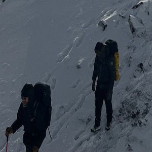
Mountain conditions can also vary noticeably from season to season. During spring 2026, the upper section near Larkya La Pass received heavier snowfall than usual even into mid-April, which created slower trail conditions around Dharmasala and the pass crossing for several days. During this period, some acclimatization hikes above Samdo also became more difficult because of deep snow in the higher sections.

Why Dharamsala Feels Different on the Manaslu Trekking Route

Dharamsala, also known as Larkya Phedi, is one of the most distinct stops on the Manaslu trekking route. Dharamsala feels noticeably different from the lower villages on the Manaslu Circuit, both in the surrounding landscape and in the overall atmosphere of the trail.

The landscape is more open and exposed, with no trees and very little natural shelter. The air feels colder, and the wind can be stronger, especially later in the day. By this stage of the trek, the environment already feels fully alpine, with wider open terrain and very little separation between the trail and the surrounding mountains.

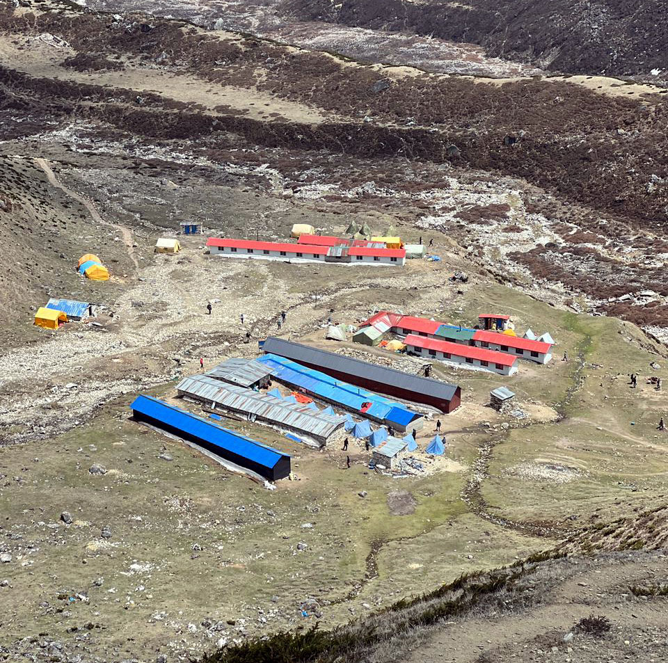
Accommodation at Dharamsala is very basic compared to other villages on the trek. During busy trekking periods, rooms are often shared, and the overall focus here is more on rest and preparation than comfort. 

Local teahouse accommodation at Dharmashala (Larkya Phedi) on the Manaslu Circuit Trek

What makes this place stand out most is the change in mindset. By the time you reach Dharamsala, the next day becomes the main focus. Trekkers prepare their clothing, organize their gear, and plan for an early start. The atmosphere becomes quieter, and most people prefer to rest early.

Dharamsala is not a place for long stops or exploration. It functions mainly as a short rest and preparation point before crossing Larkya La Pass. By this stage of the trek, the atmosphere often feels mentally different, as attention shifts fully toward the high mountain crossing ahead.

Why This Manaslu Circuit Trek Nepal Itinerary Is Designed for 12 Days

This 12-day Manaslu Circuit Trek itinerary is designed around actual trekking conditions, road access, acclimatization needs, and daily walking rhythm to create a more practical and realistic high-altitude journey.

The itinerary includes acclimatization days in Sama Gaun and Samdo before crossing the higher sections near Larkya La Pass (5,160 m). These rest days also provide time to explore the surrounding mountain environment around Sama Gaun and Samdo instead of simply moving quickly between overnight stops.

Another key factor is updated route planning based on current road conditions. The drive now reaches Machha Khola, allowing trekkers to start directly from the main trail without unnecessary walking on lower road sections. Similarly, after crossing the pass and reaching Tilje, road access is available, so there is no need to continue walking on dusty road tracks toward Besisahar.

Based on our experience organizing Manaslu treks, most trekkers prefer to avoid unnecessary road walking where possible, especially after long days at higher altitude.

Daily trekking hours are planned to maintain a steadier walking rhythm throughout the route, with the longer and more demanding sections placed where they fit best within the overall altitude progression.

Compared to shorter itineraries, the route feels less rushed and allows more time to adjust naturally before the higher mountain sections. At the same time, the itinerary avoids adding unnecessary extra days that do not meaningfully improve the trekking experience.

The overall route design focuses on keeping the trekking pace realistic while still allowing enough time to experience the changing terrain and mountain villages along the route.

Manaslu Circuit Trek Cost (Updated 2026)

The cost of a guided Manaslu Circuit Trek usually starts from around USD 985 per person for a standard 12-day trekking package. The final price mainly depends on group size, transportation choice, trekking season, accommodation preference, and overall service level during the journey.

Since the Manaslu region is a restricted trekking area, all trekkers must travel with a licensed guide through a registered local agency. Most trekking packages normally include permits, guide service, teahouse accommodation, transportation, and meals during the trek.

Cost FactorDetails
Starting PriceFrom USD 985 per person
Trek Duration12 Days
Maximum AltitudeLarkya La Pass - 5,160 m / 16,929 ft
Permits IncludedManaslu RAP, MCAP, ACAP
AccommodationLocal teahouses during the trek
Meals IncludedBreakfast, Lunch, and Dinner
TransportationKathmandu to Machha Khola and return transportation included
Guide RequirementLicensed trekking guide mandatory
Porter ServiceAvailable at additional cost
Private Jeep UpgradeAvailable at extra cost

Private jeep transportation, porter service, single room requests, and extra hotel nights in Kathmandu can increase the overall trek cost depending on the level of comfort and flexibility required during the journey.

For a more detailed breakdown of permits, transportation, seasonal pricing, and additional trekking expenses, you can also explore our complete Manaslu Circuit Trek Cost guide.

12 Days Manaslu Circuit Trek Outline Itinerary

Day 1: Drive from Kathmandu to Machha Khola - 930 m / 3,051 ft

Day 2: Trek from Machha Khola to Jagat - 1,410 m / 4,625 ft

Day 3: Trek from Jagat to Deng - 1,804 m / 5,918 ft

Day 4: Trek from Deng to Namrung - 2,630 m / 8,628 ft

Day 5: Trek from Namrung to Sama Gaon - 3,530 m / 11,581 ft

Day 6: Acclimatization day in Sama Gaon (Optional hike to Manaslu Base Camp or Birendra Lake)

Day 7: Trek from Sama Gaon to Samdo - 3,875 m / 12,713 ft

Day 8: Acclimatization day in Samdo (Optional hike toward the Tibet border viewpoint)

Day 9: Trek from Samdo to Dharmasala - 4,480 m / 14,698 ft

Day 10: Trek from Dharmasala to Bimthang via Larkya La Pass - 5,160 m / 16,929 ft

Day 11: Trek from Bimthang to Tilje - 2,300 m / 7,546 ft

Day 12: Drive from Tilje to Besisahar and continue by road to Kathmandu

Manaslu Circuit Trek Itinerary

Your journey toward the Manaslu region begins early in the morning. After breakfast at your hotel in Kathmandu, your trekking guide meets you and accompanies you to the bus station at Machha Pokhari, which is about a 10–15 minute drive from Thamel depending on traffic.

Local buses for the Manaslu route usually depart between 6:30 and 6:45 AM. The drive itself is long, but it is an important part of the experience, gradually taking you away from the busy city into the rural landscapes of western Nepal.

In the first few hours, the road is smooth as you follow the Prithvi Highway along rivers, small towns, and terraced farmland. As you move further toward Gorkha Bazaar, the scenery begins to change. Gorkha is historically important as the birthplace of King Prithvi Narayan Shah, and it marks the transition point from highway travel to more remote hill roads.

Beyond Gorkha Bazaar, the road becomes narrower, rougher, and more adventurous. Expect dusty sections, uneven tracks, and occasional bumps, especially as the route follows the Budhi Gandaki River. This part of the journey gives your first real glimpse of the remote terrain you will be trekking through in the coming days.

The bus makes a few short stops along the way for tea, meals, and toilet breaks. While the local bus is not as comfortable as a tourist vehicle, it offers a more authentic travel experience and connects you with local life along the route.

By late afternoon, you reach Machha Khola, a small riverside village that serves as the starting point of the Manaslu Circuit Trek. 

The village itself is simple, with basic teahouses, small shops, and a quiet atmosphere. Surrounded by green hills, waterfalls, and the sound of the river, it feels far removed from city life. This is where your trekking journey truly begins.

You will stay overnight in a local teahouse, where you can relax, enjoy a warm meal, and prepare for your first day of trekking ahead.

Drive Distance: 140km/ 87 miles
Kathmandu Altitude: 1,400m/ 4,593ft
Machha Khola: 930m/ 3,051ft
Altitude Loss: 470m/ 1,541ft

  • Guest House/Lodges
  • Breakfast/Lunch/Dinner/Local cuisine

Wake up a bit early in the cool mountain air and enjoy a warm breakfast, your first real breakfast on the trail, surrounded by the quiet rhythm of the Himalayas. Your first trekking day begins gently, following the Budhi Gandaki River as it winds through the valley. The morning feels warm and fresh, and the trail moves through a mix of stone steps, sandy paths, and sections shaded by bamboo and subtropical forest.

As you walk, you pass small villages like Khorlabesi and Tatopani, where daily life unfolds quietly. Villagers greet you with a simple smile, goats and mules move along the trail, and the river stays close beside you, sometimes calm and sometimes rushing through narrow gorges.

After crossing a suspension bridge, you reach Tatopani, a natural hot spring where steam rises into the cool morning air. This place has long been used by locals for relaxation and healing, offering a brief but memorable stop along the route.

Beyond Tatopani, the trail enters one of the most dramatic sections of the lower Manaslu region. The path narrows and climbs along cliffs, carved carefully into the rock. Waterfalls drop beside you, and far below, the Budhi Gandaki roars through the canyon.

You continue through forested sections, crossing wooden bridges and passing small landslide areas shaped by the river and monsoon seasons. The terrain changes constantly, from narrow cliff sections to forested paths and riverside crossings.

As you approach Jagat, the climb becomes more defined. Stone steps lead you upward toward the village, which appears suddenly like a small fortress set above the river.

Jagat (1,340 m) is one of the most important villages on the Manaslu Circuit. The name “Jagat” in Nepali historically refers to a place where tax or customs duties were collected, and this village once served as a checkpoint along old trade routes connecting remote regions. Its strategic location made it an important control point for movement through the valley.

Today, Jagat still feels organized and structured. A carved gateway marks the official entry into the Manaslu Restricted Area, where your permits are checked. The village is neatly arranged, with stone-paved paths, traditional houses, prayer flags, and small courtyards. The influence of both Hindu and Buddhist cultures can be seen in daily life here.

Children play in narrow alleys, locals carry goods along the trail, and the pace of life feels steady and grounded. Compared to lower villages, Jagat already feels more remote and connected to the mountain environment.

Trek Distance: 22km/ 13.6 miles
Jagat Altitude: 1,410m/ 4,625ft
Altitude Gain: 480m/ 1,574ft

  • Guest House/Lodges
  • Breakfast/Lunch/Dinner/Local cuisine

The day begins early in Jagat, with a simple breakfast around 6:30 AM. The morning air feels fresh, and the sound of the Budhi Gandaki River sets the rhythm as you start walking. The trail follows the river corridor, gradually moving deeper into the valley.

Within about 20 minutes, you reach Salleri (1,353 m), where terraced hills stretch across the slopes. Farmers are often seen working in the fields, growing crops like millet and potatoes using traditional methods. The path then continues gently to Sirdibas (1,420 m), a small settlement with stone houses and a quiet village atmosphere.

After about an hour of steady walking, you arrive at Philim, one of the most important villages on this section of the trek. Crossing a suspension bridge, the trail climbs up into the old part of the village. Philim is a large Gurung settlement and serves as a local administrative center of the region. It reflects a mix of traditional village life and community organization, with schools, open fields, and well-structured stone pathways.

The village has a strong cultural identity, with Buddhist influence visible in prayer walls, chortens, and a local gompa (monastery). From certain points, you can also catch beautiful views of Singri Himal, adding to the scenic value of this stop. This is also one of the key checkpoints where your trekking permits are verified before continuing further into the restricted area.

Leaving Philim, the trail becomes quieter and more natural. After about an hour, you reach Ekle Bhatti, a small stop surrounded by forest and river views. Continuing ahead, you arrive at Chisapani, where most trekkers stop for lunch. This is a good place to rest, refuel, and enjoy a warm meal before heading into a more remote section of the trail.

Beyond Chisapani, the valley begins to narrow, and the environment feels more rugged. You pass Nyak Phedi, an important junction where one trail leads toward the Tsum Valley, while the main route continues toward the Manaslu Circuit. This point marks a clear split between two distinct trekking experiences.

Continuing further, you reach Pewa Gaun, a small village with scattered houses and a peaceful atmosphere. The trail here feels more isolated, with fewer settlements and a stronger connection to the surrounding forest and river.

After a steady walk, you finally arrive at Deng (around 1,804 m), a quiet village located along the riverbank. The houses here are simple, built from stone and wood, reflecting traditional mountain architecture. Life moves slowly, and the environment feels calm and less influenced by outside activity.

After checking into a teahouse, you can relax with tea or coffee and take some time to explore the surroundings. From Deng, you may catch views of peaks like Budi Himal and Siring Himal, especially if the weather is clear.

As evening sets in, the village becomes quiet. The sound of the river echoes through the valley, and the simple warmth of the teahouse creates a comfortable end to the day. It is also a good time to discuss the next day’s route with your guide and prepare for the gradual transition into higher and more remote terrain.

Trek Distance: 20km/ 12.4 miles
Deng Altitude: 1,804m/ 5,918ft
Altitude Gain: 394m/ 1293 ft

  • Guest House/Lodges
  • Breakfast/Lunch/Dinner/Local cuisine

Like the previous day, you start early, waking up around 6:15 AM. After breakfast, the trail begins with a crossing over the Budhi Gandaki River, gradually leaving Deng behind and moving deeper into the valley.

Within about 45 minutes, you reach Rana (1,910 m), a small settlement surrounded by forest and river sounds. The trail then continues steadily to Bhi Phedi (1,990 m), where the landscape begins to feel more enclosed and rugged. From here, the path becomes more adventurous, following what locals call “bhir ko bato”; a narrow trail carved into steep cliff sections. Walking here requires attention, but it is part of the authentic Himalayan trekking experience, with the river flowing far below and forest rising above.

After about two hours of steady walking, you arrive at Ghap (around 2,000 m). This section of the trail is especially beautiful, combining both natural and cultural elements. You walk past carved mani stones, ancient prayer tablets, and small wooden bridges crossing side streams. Prayer wheels spin slowly beside the trail, and long mani walls stretch along the path, reminding you of the deep Buddhist influence in this region.

The forest around Ghap is one of the most peaceful sections of the trek. Tall fir and pine trees surround the trail, with soft earth underfoot and filtered sunlight creating a calm atmosphere. You may hear birds, distant river sounds, and sometimes only the quiet rhythm of your own steps.

Leaving Ghap, the climb toward Namrung begins gradually. As you gain altitude, the air feels cooler and clearer. The landscape slowly opens, and for the first time on this trek, you begin to see larger Himalayan peaks appearing behind the ridges. This is often a memorable moment, as the mountains start to feel closer and more present.

Reaching Namrung (2,630 m) feels like entering a different cultural zone. The village has a strong Tibetan influence, with stone houses, carved wooden windows, and neatly arranged courtyards. The atmosphere is calm and organized, reflecting a long-standing mountain lifestyle shaped by both agriculture and trade.

Namrung is also an important permit checkpoint, where documents are verified again before continuing into higher sections of the Manaslu region. The village offers impressive views of Siring Himal and Ganesh Himal, especially in clear weather, making it one of the first places where the true scale of the Himalayas becomes visible.

A short walk around the village reveals small monasteries such as Namrung (Namla) Gompa, prayer flags, and local people engaged in daily activities. The influence of Buddhism is strong here, visible not only in structures but also in the quiet, respectful rhythm of life.

After checking into a teahouse, you can relax and enjoy a warm meal. Compared to lower villages, Namrung offers slightly better facilities and food, making it a comfortable and rewarding stop. As evening falls, the air becomes cooler, and the mountains begin to dominate the skyline, reminding you that you are now entering a higher Himalayan environment.

Trek Distance: 19.5km/ 12.1 miles
Namrung Altitude: 2,630m/ 8,628ft 6 hours
Altitude Gain: 826m/ 2,709ft

  • Guest House/Lodges
  • Breakfast/Lunch/Dinner

The morning in Namrung feels fresh and crisp, with clear mountain air and early sunlight touching the peaks. After a warm breakfast, you begin your walk, gradually moving into a higher and more open Himalayan landscape.

Within about an hour, you reach Lihi (2,920 m), a small but scenic village spread across a wide hillside. This is one of the first places where the mountains begin to open up clearly. From here, you can enjoy beautiful views of Himal Chuli rising above the valley. The village itself reflects traditional mountain life, with stone houses, prayer flags, and terraced fields carefully maintained by local families.

Continuing along the trail, you reach Sho village after another hour of walking. Sho sits quietly along the hillside and offers your first clear views of Mount Manaslu, along with Manaslu North and Naike Peak. The houses are built from stone with wooden roofs, and daily life revolves around farming, livestock, and simple routines shaped by the mountain environment.

After Sho, the trail becomes more open and scenic. You pass chortens, mani walls, and prayer flags, showing the strong Tibetan Buddhist influence in this region. The forest begins to thin out, and the landscape transitions into a wider alpine setting.

After about one and a half hours, you reach Lho village (3,180 m), one of the most beautiful and culturally rich stops of the day. Lho offers one of the first close and powerful views of Mount Manaslu, rising directly above the valley. Above the village stands Ribung (Ribum) Gompa, a peaceful monastery where monks continue daily rituals. The village itself is clean and well-organized, with carved wooden windows, stone pathways, and a strong sense of traditional life.

From Lho, the trail continues toward one of the most stunning viewpoints of the entire trek — Shyala (around 3,500 m). After about two hours of walking, you arrive in a wide open valley surrounded by mountains on all sides.

Shyala is often considered the best viewpoint for Mount Manaslu. Here, you are surrounded by a 360-degree Himalayan panorama, including Mount Manaslu, Himal Chuli, Peak 29, and other surrounding peaks. The landscape feels vast and open, with fewer houses and more raw natural beauty. Many trekkers feel that this is one of the most memorable places on the entire Manaslu Circuit.

The atmosphere in Shyala is calm and expansive, with prayer flags moving in the wind and mountains dominating every direction. It is a place where you truly feel the scale of the Himalayas.

From Shyala, the trail continues for about two more hours toward Samagaun. The walk is gradual, crossing open terrain with wide views and glacial surroundings. As you approach Samagaun, the valley opens even more, with the massive presence of Mount Manaslu standing close above the village.

Arriving in Samagaun (3,520 m) feels like reaching the heart of the Manaslu region. This is one of the largest villages on the trek, with stone houses, monasteries, and a strong Tibetan cultural influence. The people here live closely with the mountain environment, relying on livestock, small-scale farming, and seasonal trade.

After checking into a teahouse, you can explore the village, observe local life, and enjoy the surrounding mountain views. The air is thinner now, and the mountains feel much closer, marking your true arrival into high-altitude Himalayan terrain.

Trek Distance: 19.5km/ 12.1 miles
Sama Gaon Altitude: 3,530m/ 11,581ft
Altitude Gain: 900m/ 2,952ft

  • Guest House/Lodges
  • Breakfast/Lunch/Dinner/Local cuisine

Samagaun sits quietly beneath the massive north face of Mount Manaslu, and waking up here feels both peaceful and powerful. This is your acclimatization day, but it is also one of the most meaningful parts of the trek. The village itself reflects strong Tibetan influence, with stone houses, prayer flags, mani walls, and chortens spread across the settlement.

Life in Samagaun moves slowly and naturally. Most families depend on yak herding, small-scale farming, and seasonal tourism. You may see locals drying crops on rooftops, spinning wool, or working in the fields. There is a small school in the village, and basic local administration, including a police checkpoint due to the restricted border area. The people are calm, respectful, and welcoming, offering a quiet glimpse into traditional Himalayan life.

This day is important for your body to adjust to the altitude. Instead of complete rest, short hikes help improve acclimatization following the “climb high, sleep low” principle.

Option 1: Hike to Birendra Lake

Birendra Lake is one of the most beautiful and peaceful places near Samagaun. The hike takes about 1.5 to 2 hours round trip, making it a gentle and enjoyable option.

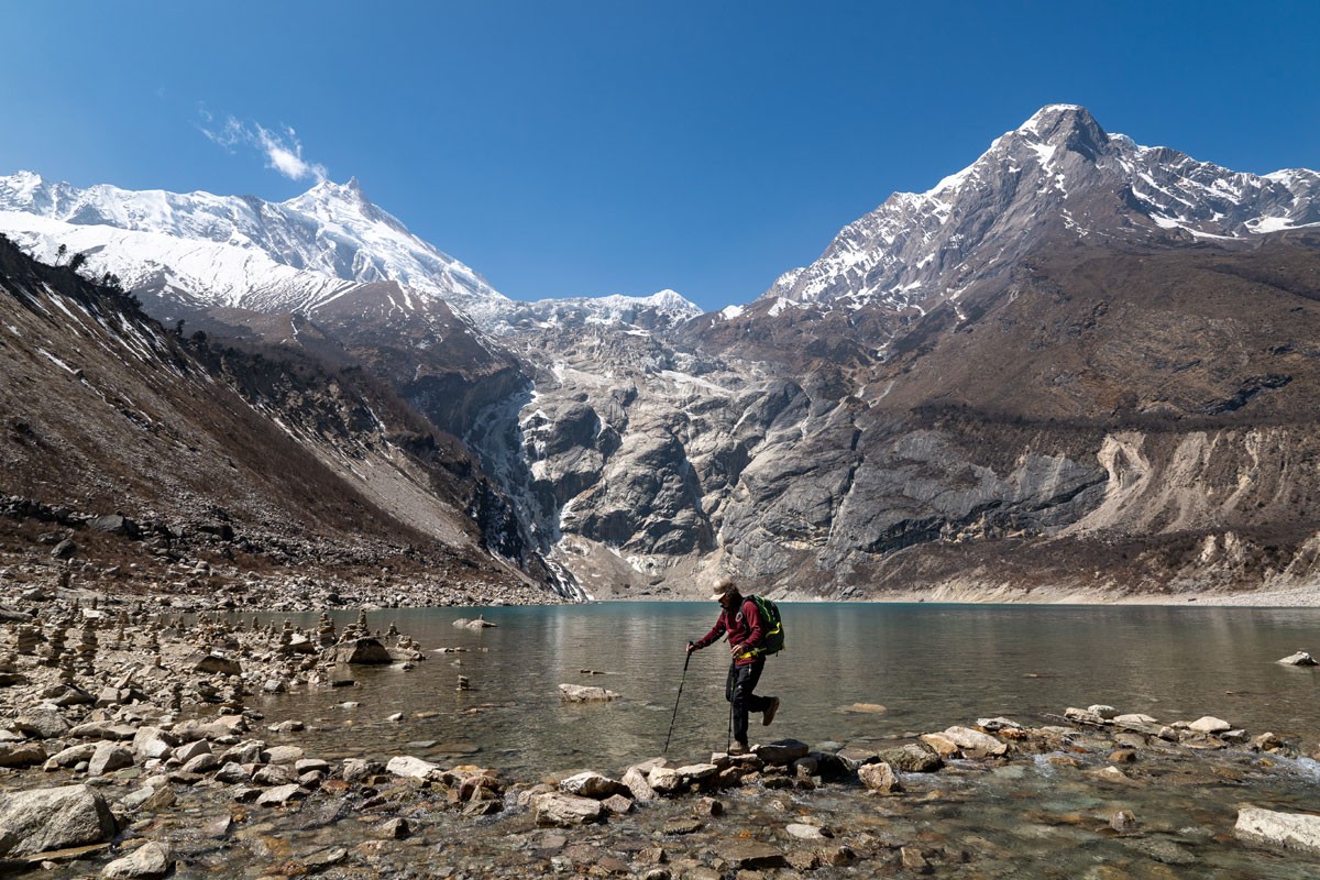
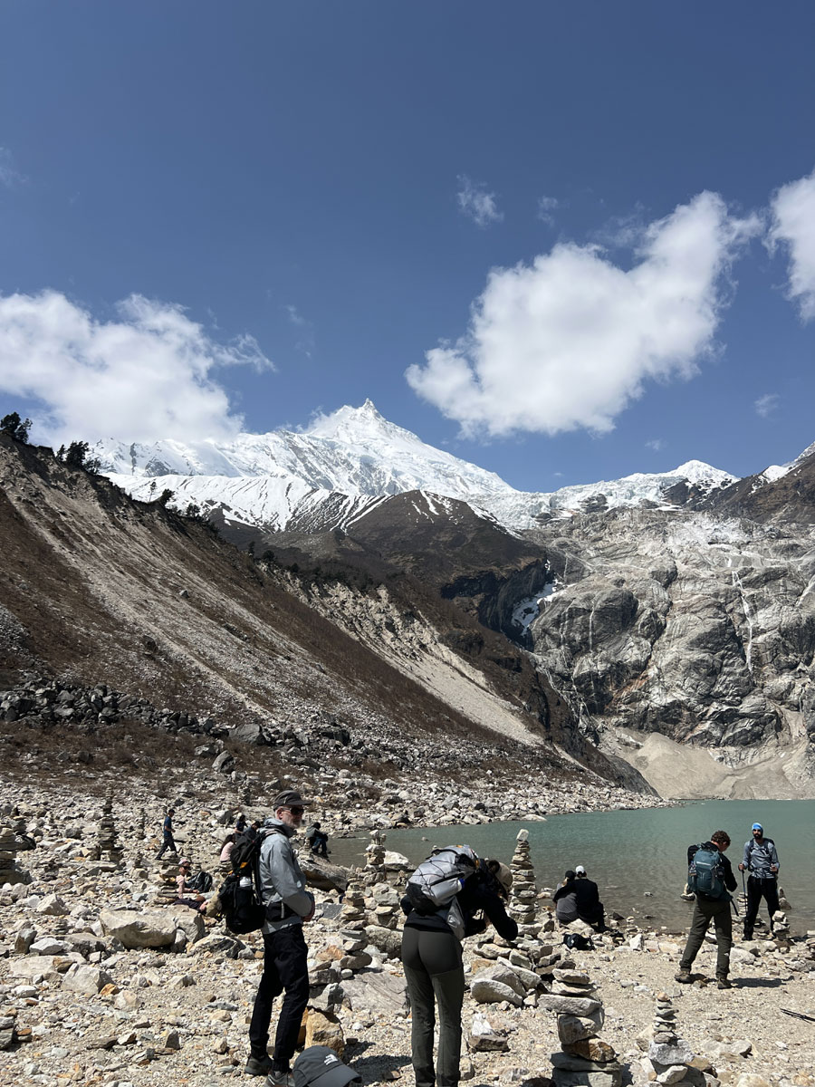
The trail leads across open terrain toward a glacial lake formed from the Manaslu Glacier. The water is cold, clear, and turquoise in color, often reflecting the surrounding peaks. The environment feels quiet and untouched, making it a perfect place to sit, rest, and take in the natural beauty.

This option is ideal for trekkers who want a shorter walk while still experiencing high-altitude scenery.

Option 2: Hike to Manaslu Base Camp

For those looking for a more challenging and rewarding experience, the hike to Manaslu Base Camp is a highlight of the trek.

This hike takes around 6 to 7 hours round trip, following a steady climb through rocky trails and glacial terrain. As you gain altitude, the air becomes thinner and the effort increases, but the views become more dramatic.

At the base camp, you are surrounded by towering ice walls and the massive presence of Mount Manaslu. During the autumn climbing season, you may see expedition teams and tents set up for summit attempts. The views from here are powerful and unforgettable, offering one of the closest perspectives of the mountain.

Explore Samagaun Village and Gompa

After your hike, if time permits, you can explore the village and visit a nearby monastery such as Pungyen Gompa. These monasteries are peaceful places where monks continue their daily rituals, surrounded by prayer flags and mountain views.

Walking around the village, you may see yaks grazing, locals working, and children returning from school. These small moments give a real sense of life in this high Himalayan settlement.

The evening in Samagaun is calm and quiet. As the temperature drops, you gather in the teahouse dining area, enjoy a warm meal, and prepare for the higher sections of the trek ahead.

Trek Distance: 12km/ 7.4 miles
Manaslu Base Camp Altitude: 4,800m/ 15,748ft
Pun Gyen Gompa Altitude: 4,050m/ 13,287ft
Altitude Gain: 1,270m/ 4,166ft

  • Guest House/Lodges
  • Breakfast/Lunch/Dinner/Local cuisine

The morning in Samagaun begins slowly, with soft sunlight touching the peaks of Manaslu. After breakfast around 7:00 AM, you leave the village behind and start walking toward a quieter and more open part of the Himalayas.

The trail today is shorter, but it carries you deeper into high-altitude terrain. As you walk out of Samagaun, the landscape begins to change quickly. The last clusters of trees fade away, replaced by wide open valleys, dry ground, and glacial surroundings. The air feels thinner and drier, and each step becomes more controlled and steady.

The trail follows a gentle path along the valley, with gradual elevation gain. You walk past long mani walls carved with Buddhist prayers, some of them weathered by centuries of wind and time. These stone carvings guide your path, reminding you of the strong spiritual presence in this region.

Along the way, you may see yaks grazing quietly across the open fields, their bells echoing softly in the still air. Occasionally, you pass small stone shelters used by herders during seasonal movement. There are very few permanent settlements here, and the silence feels deeper and more ancient compared to lower sections of the trek.

The valley widens dramatically as you move forward, giving a sense of space that is hard to find in the narrow gorges below. The landscape begins to resemble the Tibetan plateau, both in appearance and atmosphere.

After about 3 hours of steady walking, you reach Samdo (3,875 m), a small village set on a ridge overlooking multiple valleys. One of these valleys leads toward the Tibetan border, reflecting the historical trade routes that once connected these regions.

Samdo is a traditional Tibetan-influenced village, with stone houses, flat roofs, and simple courtyards. Life here is shaped by altitude and remoteness. The people depend mainly on yak herding, trade, and seasonal activities. You may see locals moving with yak caravans, children playing in open dusty spaces, and prayer flags moving in the strong mountain wind.

After arriving, you take lunch at the teahouse and spend some time resting. In the afternoon, you can take a short acclimatization hike to a nearby viewpoint or visit Choeling Gompa, a small monastery above the village. From here, you can enjoy views of surrounding peaks such as Naike Peak and Pang Phuchi (Pan Poche), along with wide valley landscapes stretching toward Tibet.

Spending time here, you may find yourself simply sitting quietly, looking out across the mountains and valleys. The silence, the wind, and the scale of the landscape create a unique feeling that is difficult to describe.

As evening arrives, temperatures drop quickly. The sky becomes clear, and the stars appear brighter than anywhere lower on the trail. You begin to feel the altitude more, but also a growing sense of anticipation for the higher and more remote sections ahead.

Trek Distance: 16.5km/ 10.2 miles
Samdo Altitude: 3,875m/ 12,713ft
Altitude Gain: 345m/ 1,131ft

  • Guest House/Lodges
  • Breakfast/Lunch/Dinner/Local cuisine

This day is planned as an optional acclimatization day in Samdo, although it is not always included in standard itineraries. Many trekking companies continue directly toward Dharamsala, but based on our experience and feedback from previous trekkers, keeping this extra day can be very helpful.

For some trekkers, especially senior travelers or those who feel the altitude more strongly, this additional day provides valuable time to rest, recover, and adjust before moving higher. It also works as a practical weather backup day, allowing flexibility in case conditions change before crossing Larkya La Pass.

At the same time, this day is not only about rest. It offers one of the most beautiful and meaningful short hikes of the entire trek.

Optional Hike Toward Tibet Border Ridge
Today’s hike follows a trail used for generations by local herders and traders moving toward the Tibetan border. The path climbs gradually above Samdo, and as you gain height, the environment changes noticeably.

As you gain height, the wind becomes colder and the mountain views begin to open wider toward the Tibetan border.

With each step, the valley below feels larger and more distant.

From the higher ridge, you can enjoy wide views of:

  • Samdo Peak rising sharply above the village
  • Larkya Glacier shimmering in the distance
  • Valleys stretching toward the Tibetan border
  • Long layers of mountains fading into blue and white

The air is thin, but the silence is powerful. It is not just a viewpoint, but a place to pause, breathe, and take in the vastness of the Himalayas.

After spending some time at the viewpoint, you return to Samdo for lunch. The full hike usually takes around 3 to 4 hours round trip, depending on pace.

Flexible Plan Based on Condition
If you feel strong, well-acclimatized, and the weather is stable, it is also possible to continue directly to Dharamsala on this day. In that case, you cross Larkya La Pass the following day as planned, and later use an extra day at Bimthang as a recovery or exploration day.

This flexible approach works well for trekkers who prefer to move steadily and adjust the itinerary based on real conditions rather than following a fixed plan.

  • Guest House/Lodges
  • Breakfast/Lunch/Dinner/Local cuisine

The morning in Samdo feels colder and quieter. After a warm breakfast around 7:00 AM, you begin your walk toward Dharamsala, also known as Larkya Phedi, the final stop before crossing Larkya La Pass.

Although today’s walking distance is relatively short, the altitude gain is significant. This is one of those days where the distance feels easy, but the height makes it more demanding. As you leave Samdo, your body starts to feel the altitude more clearly, so it is important to walk slowly, stay hydrated, and maintain a steady rhythm.

The trail begins with a gentle climb across wide, barren hillsides. From here, the landscape has fully changed into a high alpine environment. There are no trees, no farms, and no jungle, only rock, ice, wind, and open sky. The valley feels wider than ever, shaped by ancient glaciers that have left behind a raw and powerful terrain.

You follow a gradual ascending contour path along the valley, walking through open ground with wide views in every direction. The trail is mostly rocky and dry, with some loose sections and occasional snow patches depending on the season. You cross small streams using simple wooden planks and pass stone shelters built by yak herders for seasonal use.

There is almost no vegetation at this altitude, and very little wildlife. The silence here feels deep and ancient, broken only by the sound of the wind and your footsteps. This part of the trek gives a strong feeling of isolation and true high-mountain wilderness.

As you move higher, the air becomes thinner and cooler. The surrounding mountains feel closer, and the scale of the landscape becomes more dramatic. The entire walk is exposed, with very little protection from wind, so proper layering is important.

After about 3 to 4 hours of steady walking, you reach Dharamsala (4,480 m), a small and very basic settlement located at the base of Larkya La Pass. This is not really a village, but a temporary stop used by trekkers preparing for the high pass.

As you arrive, the environment becomes truly alpine:

  • Sharp winds sweep across the open slopes
  • Snow patches linger on the ground
  • The temperature drops noticeably
  • Birds disappear; only the wind remains

Accommodation here is very simple. There are only a few teahouses with limited rooms, and during busy seasons, trekkers may need to share rooms or stay in dorm-style arrangements. In some cases, temporary tents are also used when space is limited. The simplicity of this place adds to its atmosphere.

The rest of the afternoon is spent resting, rehydrating, and preparing for the next stage of the trek. Inside the teahouse, the atmosphere feels calm and focused. Trekkers quietly drink hot tea, repack their bags, and organize essential gear for the early start ahead.

Guides usually take time to brief everyone carefully about the next day’s plan, including weather expectations, walking pace, layering, and hydration strategy for crossing Larkya La Pass.

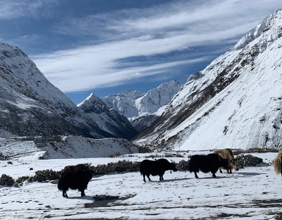
Outside, the environment remains raw and silent. Occasionally, you may see yaks moving slowly across the valley, while the wind continues to shape the open landscape.

As evening sets in, the temperature drops quickly. The sky becomes incredibly clear, and stars appear sharp and bright above the mountains.

Most trekkers head to bed early.
The biggest and most challenging day of the journey is now very close.

Trek Distance: 12km/ 7.4 miles
Dharmalsala Altitude: 4,480m/ 14,698ft
Altitude Gain: 605m/ 1,984ft

  • Guest House/Lodges
  • Breakfast/Lunch/Dinner/Local cuisine

A long day with an early climb across one of Nepal’s highest trekking passes.

The day begins very early, around 4:00 AM, in the cold darkness of Dharamsala. After a simple early breakfast, you start walking with your headlamp lighting the trail ahead. The air is sharp and cold, and every step feels slow and steady as you move into high-altitude terrain.

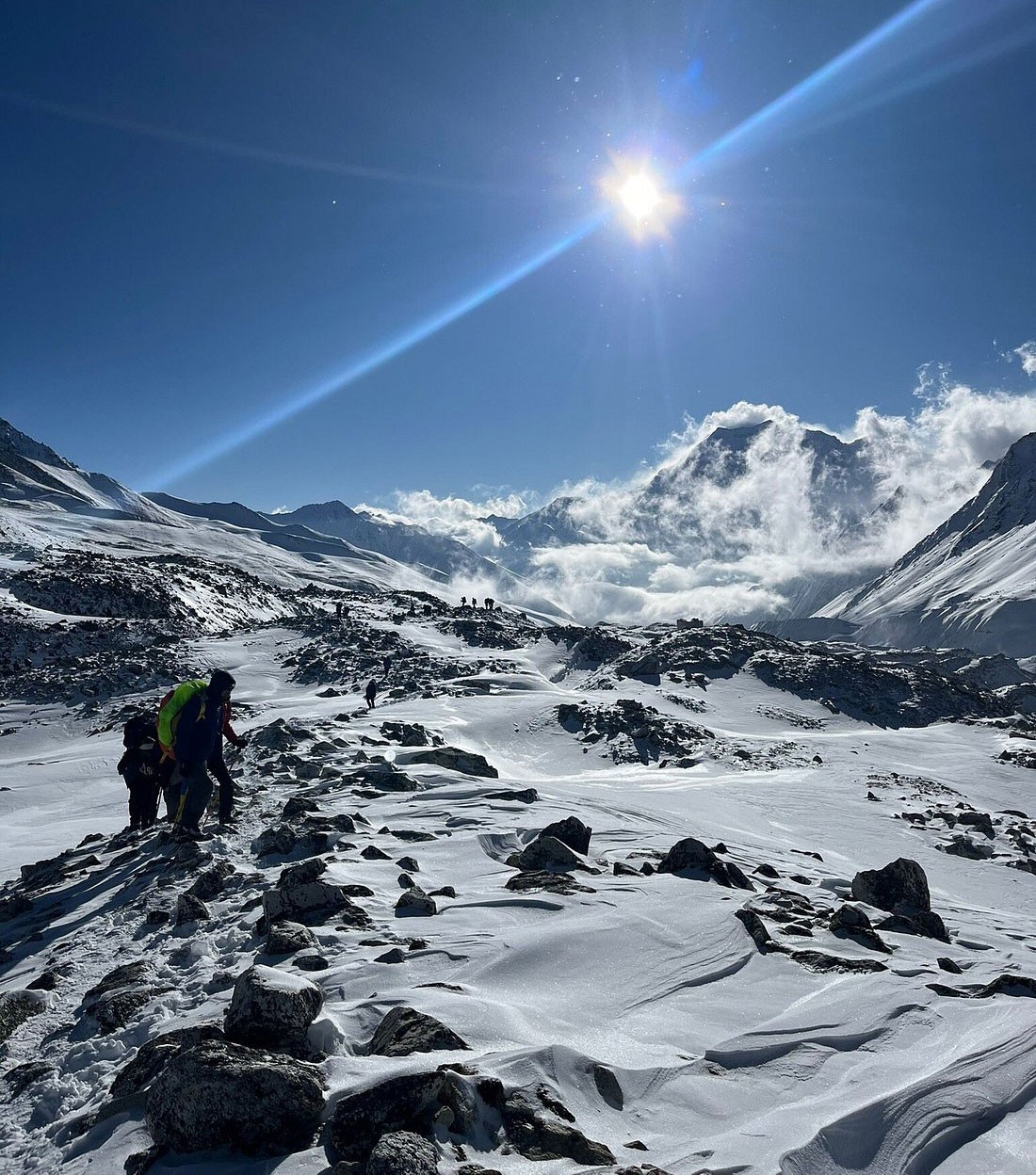
The trail climbs gradually over rocky and sometimes snowy ground. It is mostly uneven, with loose stones and occasional snow patches depending on the season. The group moves quietly, with only the sound of boots on frost and the wind across the slopes. At this altitude, the body naturally slows down, and the focus is on maintaining a steady rhythm rather than speed.

As you continue climbing, the sky slowly begins to change. Darkness fades into deep blue, then purple, and finally a golden line appears across the horizon. Sunrise at this altitude is a powerful moment. The surrounding peaks begin to glow:

  • Himlung Himal shines in soft silver
  • Cheo Himal rises sharply against the sky
  • Kang Guru stands like a frozen wall
  • Behind you, the Manaslu range stretches across the horizon

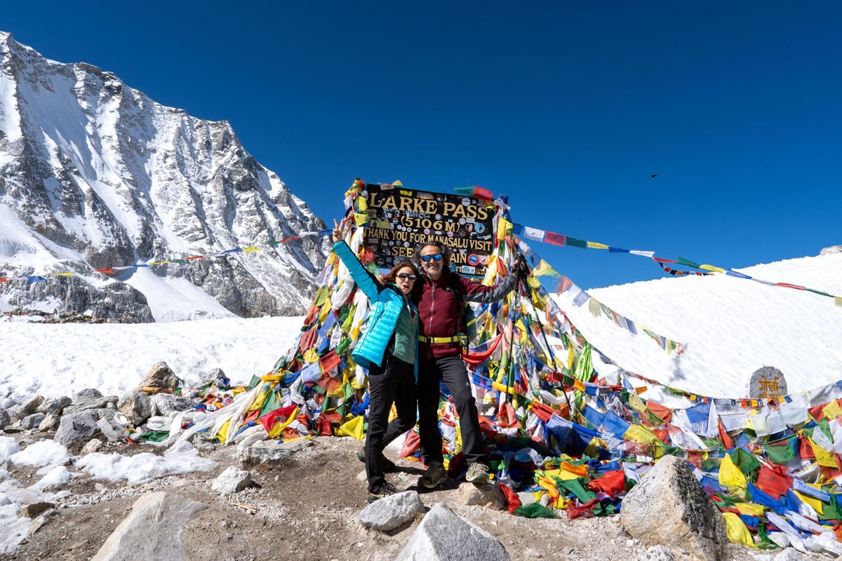
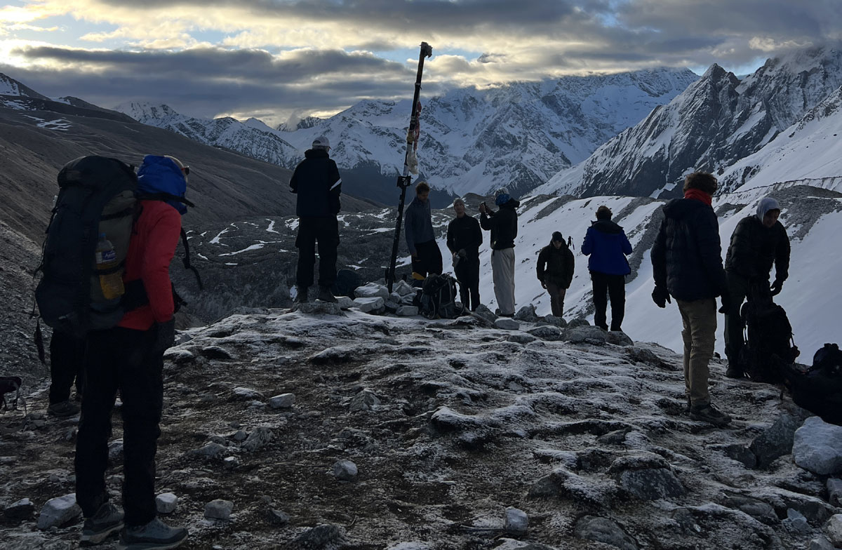
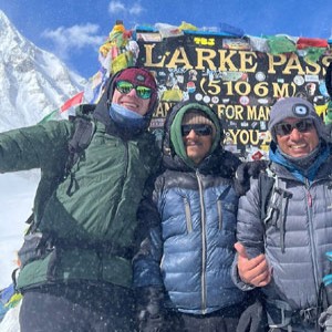
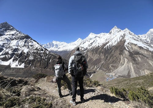
After about 3 to 4 hours of steady climbing, you reach the top of Larkya La Pass (5,160 m). Prayer flags mark the summit, moving strongly in the wind. This is also where many trekkers feel the altitude most strongly, with every breath becoming slow and deliberate. Reaching the top brings a strong sense of relief and achievement after the long climb.

At the top, the world feels wide and open, surrounded by snowfields, glaciers, and distant peaks. It is one of the most rewarding viewpoints of the entire Manaslu Circuit.

After spending some time at the pass, you begin the descent. The first section is steep and can be challenging, especially if there is snow or ice. Walking poles are very helpful here. As you descend, the landscape slowly changes from white snowfields to rocky slopes.

After about 2 to 3 hours of descending, you reach a small and very basic tea shelter along the trail. This place is simple, often just a stone structure with limited space, but it plays an important role. For trekkers who are very tired, feeling unwell, or for senior trekkers who may struggle to continue, this becomes an important safety option.

In rare situations, when continuing to Bimthang feels too difficult due to fatigue, altitude, or changing weather conditions, it is possible to stay here overnight. The facilities are extremely basic, with shared space, minimal bedding, and limited food, but the warmth of shelter and the presence of others can bring a strong sense of comfort in a challenging environment.

After a short rest and tea break, you continue descending. The trail becomes easier and more gradual, and in about 1 to 1.5 hours, you reach Bimthang (3,720 m), a wide and beautiful valley surrounded by mountains.

Bimthang offers stunning views of Manaslu North, Lamjung Himal, Cheo Himal, and Himlung Himal. The environment feels greener and calmer, with grassy meadows, flowing streams, and a noticeable increase in oxygen.

After arriving, you check into a teahouse, enjoy a warm meal, and take time to rest. If energy allows, you can also visit Ponkar Lake, about an hour away, a peaceful glacial lake that adds a quiet ending to this powerful day.

By the time you reach Bimthang, you feel the change immediately. Oxygen returns to your lungs, warmth returns to your body, and a deep sense of achievement settles inside.

For many trekkers, this becomes one of the most memorable days of the entire journey.

  • Guest House/Lodges
  • Breakfast/Lunch/Dinner/Local cuisine

Morning in Bimthang feels peaceful, with the massive Manaslu and Lamjung Himal ranges glowing behind you. After breakfast, you begin your descent, leaving the high alpine valley and slowly returning toward greener landscapes.

The trail immediately enters a beautiful forest zone. You walk through rhododendron, pine, and fir trees, with soft ground underfoot and moss-covered stones along the path. Small wooden bridges cross clear streams, and waterfalls appear along the way. After the harsh, rocky terrain of the previous days, this section feels refreshing and alive.

Within about 1 to 1.5 hours, you reach Yak Kharka (around 3,020 m), a seasonal grazing area where yaks are often seen during warmer months. The air already feels richer in oxygen, and breathing becomes noticeably easier.

Continuing downhill, the trail becomes more varied, with gentle ups and downs through forest and open sections. After about 2 hours, you reach Kharche (also known as Surki Khola, around 2,700 m), a small riverside stop where many trekkers take lunch. The sound of the river returns strongly here, and the environment feels more connected to life again.

After lunch, the trail continues with a mix of short climbs and longer descents. You cross bridges, pass through small clearings, and begin to see more signs of village life. The path becomes wider and more defined compared to the high mountain trails above.

As you continue, you pass through villages like Gho, where traditional houses, prayer flags, and farming fields reappear. Children may be seen playing outside, and locals continue their daily routines, bringing a sense of warmth back into the journey.

Finally, after a steady walk, you reach Tilje (around 2,300 m), a charming village with a mix of Gurung and Tibetan-influenced culture. Compared to earlier stops, Tilje feels more lively and comfortable, with better-developed teahouses and welcoming local hospitality.

The village is known for its traditional houses, small monasteries, and friendly atmosphere. After days in remote high-altitude terrain, Tilje offers a relaxing environment where you can enjoy a warm meal, rest comfortably, and reflect on your journey.

Trek Distance: 12km/ 8 miles
Tilje Altitude: 2,300 m / 7546 ft
Altitude Loss: 1,420 m/ 4,658 ft

  • Guest House/Lodges
  • Breakfast/Lunch/Dinner/Local cuisine

After breakfast in Tilje, you begin your journey back toward Kathmandu. Instead of continuing on foot along the dusty road section, you take a local shared jeep from Tilje to Besisahar, which makes the return more comfortable and efficient.

The jeep ride takes around 3 to 4 hours, following rough mountain roads along the Marsyangdi River. The drive is bumpy but very scenic. You pass through lush green valleys, steep cliffs, waterfalls, and small villages along the way. Apple orchards and terraced fields appear as you descend, bringing a strong contrast to the high alpine landscapes you have just left behind.

This section of the route would otherwise involve long hours of walking on dusty roads, so taking the jeep is a practical and preferred option for most trekkers. It helps shorten the itinerary and avoids less enjoyable road walking.

After reaching Besisahar, you continue your journey to Kathmandu by local bus, which usually takes around 6 to 7 hours depending on traffic and road conditions. The road gradually improves as you leave the hills behind and rejoin the main highway.

For those who prefer more comfort, there is also an option to travel by private jeep or car from Besisahar to Kathmandu, but this can be arranged at additional cost.

As the journey continues, the landscape slowly shifts from quiet rural hills to the familiar movement and energy of Kathmandu city.

By evening, you arrive at your hotel tired, dusty, and hungry, but with a deep sense of satisfaction.

Drive Distance: 224km/ 139 miles
Besisahar Altitude: 760 m/ 2,493ft
Altitude Loss: 1,540m/ 5,052ft

  • Your Hotel
  • Breakfast
Note

Important Travel Information and Flexibility

We follow the Manaslu Circuit Trek itinerary as outlined in your package. However, trekking in the Himalayas depends on weather, trail conditions, and other local factors, so occasional adjustments may be necessary.

Conditions such as weather changes, landslides, road situations, health concerns, or local events can sometimes affect the planned schedule. In these situations, your guide will assess the conditions and make practical decisions to ensure safety and a smooth continuation of the trek.

We kindly ask trekkers to remain flexible and cooperative if changes are required. This is a normal part of trekking in remote mountain regions, and a flexible approach helps ensure a safer and more enjoyable experience.

We also recommend keeping one or two extra contingency days in your overall travel plan to avoid stress in case of delays.

Arrival and Preparation in Kathmandu

Please plan to arrive in Kathmandu at least one day before your trek begins. This allows time to rest after travel, check your equipment, complete permit arrangements, and attend the pre-trek briefing with your guide.

Arriving early helps you start the trek well prepared, relaxed, and ready for the journey ahead.

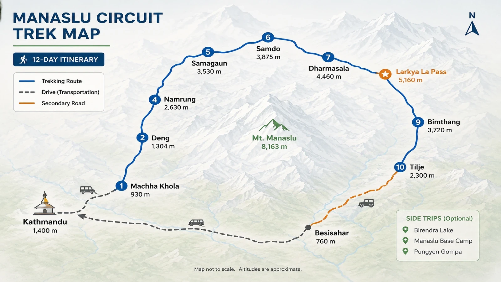
Manaslu Circuit Trek Map

Manaslu Circuit Trek map

Cost Details

Includes

  • All necessary airport pickups and drops ( request with your flight details)
  • 11 nights accommodation in Mountain ( guest house/lodges)
  • Meals for the entire trip ( breakfast/lunch/dinner)
  • Trekking guide for entire trip ( Kathmandu to Kathmandu)
  • Special Manaslu (Restricted area) permit
  • ACAP and MCAP permits for the trek
  • A comprehensive medical kit
  • All necessary equipment for the staff
  • All the government and local taxes
  • Kathmandu to Machhakhola and Besisahar to Kathmandu by bus
  • Tilje to Besisahar drive by local sharing jeep

Excludes

  • Hotel and Meals in Kathmandu
  • Necessary porter for the trip ( USD 300 for entire trip)
  • Travel insurance for your trek
  • Any other expenses
Add-Ons & Options

Porter Services:  Make your journey hassle-free with our porter service. Our experienced porters are ready to assist you with your baggage. Each porter can carry up to 20-22 kg of luggage, ensuring a comfortable and convenient experience for you. Sit back, relax, and let our porters handle your belongings with care.
Porter Cost: $300 USD for the entire trip per porter.

Private Jeep: Experience the convenience of our private jeep service for your travels. Each private jeep can accommodate up to 7 passengers, making it an ideal choice for groups or families. Enjoy a comfortable and personalized journey with our experienced drivers.
Private Jeep Cost: $180 USD per jeep.

Dates & Price

Trip DatePriceAvailability 
Start DateThursdayMay 28, 2026End DateMondayJune 08, 2026StatusStatusGuaranteedPricePriceUS $985
Start DateSaturdayMay 30, 2026End DateWednesdayJune 10, 2026StatusStatusGuaranteedPricePriceUS $985

Our company offers small group trips designed for independent travelers, friends, and families seeking a more personalized travel experience. With group sizes limited to no more than 7 people, we ensure better attention, comfort, and meaningful connections throughout the journey. Simply choose your preferred date from our calendar and secure your spot for an unforgettable adventure.

Good to Know

Why Many Trekkers Choose Manaslu Circuit

The Manaslu Circuit is a strong choice for trekkers who want a high-altitude circuit trek without relying on mountain flights. Unlike the Everest Base Camp route, the journey begins with an overland drive to Machha Khola and finishes by road through the Annapurna side after crossing Larkya La Pass.

Compared with the Annapurna Circuit Trek, the Manaslu route follows stricter permit regulations and requires a licensed guide because it passes through a restricted area.

The trek follows a complete circuit-style route through the Budhi Gandaki valley before crossing Larkya La Pass at 5,160 meters and descending toward Bimthang and Dharapani. This creates a natural trekking flow with a clear beginning, high mountain crossing, and exit route without repeating the same trail.

Manaslu Circuit vs Everest Base Camp vs Annapurna Circuit

Trek

Crowd Level

Max Altitude

Flight Needed

Culture

Route Style

Manaslu Circuit

Low

5,160 m

No

Tibetan-influenced

Restricted circuit

Everest Base Camp

High

5,545 m

Yes

Sherpa

Out-and-back

Annapurna Circuit

Medium

5,416 m

No

Mixed

Road-connected circuit

Trail and Walking Conditions on the Manaslu Circuit

  • Lower Budhi Gandaki Valley

In the lower Budhi Gandaki valley, from Machha Khola to Deng, the trail is more rugged and varied. You walk on narrow paths carved into hillsides, cross multiple suspension bridges, and pass through sections with stone steps, rocky ground, and occasional landslide areas.

These lower sections feel more rugged and physically varied, especially after rain.

  • Namrung to Samagaun Section

From Deng to Namrung and Lho, the trail becomes more stable and passes through forested areas with a mix of gradual climbs and small ups and downs.

As the route moves higher toward Samagaun and Samdo, the landscape opens up noticeably. Trails become wider, drier, and more exposed, with fewer trees and broader mountain views.

  • Larkya La Pass Terrain

Above Samdo, toward Dharmasala and Larkya La Pass, the trekking environment becomes quieter, colder, and more rugged. The route crosses rocky terrain, glacial sections, alpine slopes, and exposed mountain paths before reaching the pass.

Early morning conditions near Larkya La may include frost, wind, or light snow depending on the season.

  • Descent Toward Bimthang

After crossing the pass, the trail descends toward Bimthang through a long downhill section with loose stones, alpine terrain, and eventually greener forest trails lower down the valley.

This section can feel tiring on the knees after the long pass-crossing day, especially on uneven ground.

Altitude and Acclimatization on the Manaslu Circuit

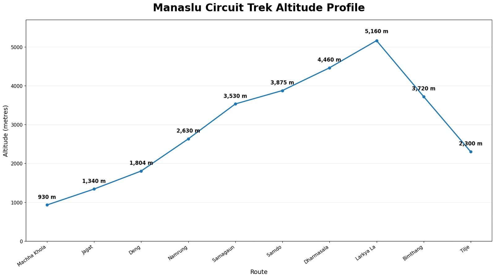
LocationAltitude
Machha Khola930 m
Namrung2,630 m
Samagaun3,530 m
Samdo3,875 m
Dharmasala4,460 m
Larkya La Pass5,160 m
Bimthang3,590 m

The Manaslu Circuit Trek begins at around 900 meters in Machha Khola and reaches its highest point at Larkya La Pass (5,160 m). As the trek moves higher through Deng, Namrung, Lho, and Samagaun, the air becomes thinner and walking naturally feels slower above 3,500 meters.

Samagaun (3,520 m) is the first main acclimatization stop on the trek. Trekkers usually spend an extra day here with short hikes toward Birendra Lake, Manaslu Base Camp, or nearby viewpoints before continuing higher into the valley.

The second acclimatization stop is Samdo (3,875 m), located close to the Tibetan border. Short hikes around Samdo are commonly used to help the body adjust before moving toward Dharmasala and the pass section.

After Samdo, the route enters a more exposed alpine environment toward Dharmasala, where temperatures become colder and weather conditions can change quickly before the crossing of Larkya La Pass.

Proper hydration, steady pacing, and regular rest play an important role throughout the trek, especially in the higher sections above Samagaun. For more detailed guidance, you can also explore our guide on Altitude Sickness and Trek Challenges on the Manaslu Circuit.

Best Time to Trek Manaslu Circuit

For most trekkers, spring (March to May) and autumn (September to November) provide the most reliable conditions for the Manaslu Circuit Trek, especially for crossing Larkya La Pass. During these periods, weather is usually more stable, visibility is clearer, and trail conditions are generally safer for high-altitude trekking.

Spring Season (March to May)

By late March and April, the lower Budhi Gandaki valley becomes greener and warmer, while upper villages such as Samdo and Dharmasala can still feel cold during mornings and evenings. Rhododendron forests begin blooming below Namrung, and higher sections near Larkya La sometimes still hold patches of snow from winter storms earlier in the season.

Mountain visibility is often clearest during mornings before clouds gradually build later in the day. Spring is also an active climbing season in the Himalayas, so villages like Samagaun become busier with trekking and expedition movement around the Manaslu region.

Autumn Season (September to November)

Autumn is usually the busiest trekking season on the Manaslu route because weather conditions tend to become more stable after the summer monsoon. Trails are generally drier, mountain views clearer, and temperatures more comfortable for long trekking days.

October and early November are often considered the most reliable months for crossing Larkya La Pass. Early mornings near Dharmasala can still feel very cold, especially before sunrise when most trekkers begin the pass crossing.

Winter Season (December to February)

Winter conditions become much colder above Samdo, especially around Dharmasala and Larkya La Pass where snowfall and strong wind can affect trail conditions quickly. Heavy snow sometimes makes the pass difficult or temporarily inaccessible depending on weather patterns during the season.

At the same time, stable winter weather can bring exceptionally clear mountain views and quieter trails for trekkers properly prepared for cold temperatures and changing mountain conditions.

Monsoon Season (June to August)

During the monsoon season, the lower Budhi Gandaki valley becomes wetter, greener, and more humid, with muddy sections, occasional landslides, and possible transportation delays after heavy rain.

However, parts of the upper Manaslu region near Samdo and Larkya La fall within a partial Himalayan rain-shadow zone, which sometimes creates drier conditions compared to lower trekking areas during the monsoon period. Even so, weather conditions in the higher mountains can still change quickly around the pass section.

In recent years, Himalayan weather patterns have become less predictable, and unexpected snowfall or sudden weather changes can occasionally affect the trail even during traditionally stable trekking months. Strong wind near Larkya La Pass, especially during colder mornings, can also make the crossing feel significantly colder than the actual temperature.

For a month-by-month season breakdown, read our full guide on the best time for Manaslu Circuit Trek.

Manaslu Circuit Trek Difficulty

The Manaslu Circuit Trek is considered a moderately challenging high-altitude trek, mainly because of the altitude, long walking days, and the crossing of Larkya La Pass (5,160 m).

Trek Difficulty at a Glance

  • Daily walking: Approximately 5-7 hours on most trekking days 
  • Highest point: Larkya La Pass (5,160 m) 
  • Most demanding day: Dharmasala to Bimthang via Larkya La Pass 
  • Trail type: Stone staircases, suspension bridges, alpine paths, and rocky mountain terrain 
  • Technical climbing: Not required 
  • Main challenge: Altitude, long walking days, and changing mountain weather conditions 
  • Best approach: Slow pacing, proper acclimatization, and steady energy management throughout the trek 

The difficulty increases gradually as the trek moves higher into the mountains. Above 3,500 meters, oxygen levels become lower, and walking naturally feels slower and more physically demanding, especially around Samagaun, Samdo, and Dharmasala. Even gradual uphill sections can feel tiring at higher altitude.

The trail itself changes throughout the journey and includes stone staircases, suspension bridges, narrow mountain paths, rocky terrain, and occasional landslide-prone areas. Weather conditions also affect the overall difficulty of the trek, especially near Dharmasala and Larkya La Pass, where frost, wind, or light snowfall may occur depending on the season.

Most trekkers begin the pass-crossing day before sunrise because weather and wind conditions are usually more stable during the early morning hours. Although the climb toward the pass is mostly gradual, the altitude and long walking duration make this section feel more physically demanding than many trekkers expect. The long descent afterward toward Bimthang can also feel tiring on uneven and rocky terrain.

The Manaslu Circuit Trek does not require technical climbing skills, but it does require good stamina, steady pacing, and proper acclimatization throughout the journey. Walking too fast during the early trekking days is one of the most common mistakes at higher altitude.

Some trekkers may experience mild altitude-related symptoms above 3,500 meters, including headache, disturbed sleep, lower appetite, or unusual tiredness. Proper acclimatization, hydration, rest, and guide support play an important role in helping trekkers adjust safely during the trek.

For more detailed preparation advice, you can also explore our guide on how difficult the Manaslu Circuit Trek is.

Accommodation and Meals on the Manaslu Circuit Trek

Accommodation on the Manaslu Circuit Trek is in traditional teahouses run by local families, offering a simple local mountain experience throughout the journey.

In the lower villages such as Machha Khola, Jagat, and Deng, teahouses are relatively comfortable, with basic private rooms, twin beds, blankets, and shared bathrooms. Some places may offer attached bathrooms and hot showers, depending on availability.

As you move higher toward Namrung, Lho, Samagaun, and Samdo, the facilities become more basic due to the remote location. Rooms are simple, usually with wooden beds, foam mattresses, and shared toilets. In higher villages, especially in Dharmasala, accommodation is very limited, and during busy seasons rooms may need to be shared.

Rooms are generally not heated along the entire Manaslu trail, while the shared dining area is usually the warmest part of the teahouse. Carrying a warm sleeping bag makes a big difference for comfort during colder nights.

Charging phones, power banks, hot showers, and Wi-Fi are usually available in many villages for an additional cost, although these services become more limited and less reliable at higher altitude.

Meals are freshly prepared in the teahouses using locally available ingredients. The most common and recommended meal is dal bhat (rice, lentil soup, vegetables, and pickles), which provides good energy and is often refillable. Other options include noodle soup, fried rice, pasta, potatoes, eggs, pancakes, and simple Western-style dishes.
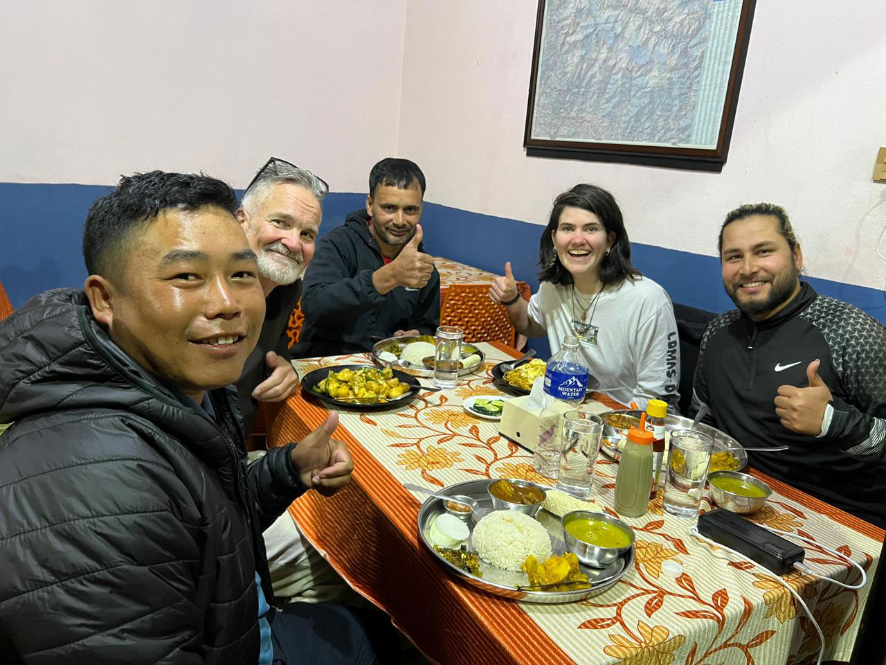
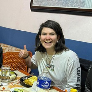
Typical meal on the Manaslu Circuit Trek served in a teahouse (dal, vegetables, and rice)

In villages like Namrung and Samagaun, some bakeries and teahouses now serve fresh bread, coffee, cappuccino, and simple espresso-based drinks, although facilities become much more basic after Samdo.

You can also explore our detailed Manaslu Circuit Trek Tea House Guide for more information about accommodation, meals, charging facilities, and sleeping conditions along the route.

Food is carried by mule or porter to higher villages, so menu options become more limited at higher altitude.

Along the descent from Larkya La Pass toward Bimthang, there is a very basic stop locally known as Phedi. This small shelter-style teahouse is sometimes used by trekkers who are unable to continue the full descent after crossing the pass, especially older trekkers or those feeling exhausted after the long high-altitude crossing.

Accommodation here is extremely basic, usually with simple mattresses and limited facilities, but basic meals and hot drinks are generally available when the teahouse is operating.

In the evenings, trekkers usually gather in the shared dining hall around the central stove to relax and warm up after the day’s walk. For many trekkers, this simple teahouse atmosphere becomes one of the memorable parts of the Manaslu Circuit Trek.

Manaslu Circuit Trek Permits

The Manaslu region is a restricted trekking area, and independent trekking without a licensed guide is not allowed. All trekkers must obtain special permits before entering the route.

Three permits are required for the Manaslu Circuit Trek:

  • Manaslu Restricted Area Permit (RAP) 
  • Manaslu Conservation Area Permit (MCAP) 
  • Annapurna Conservation Area Permit (ACAP) 

Permit checkpoints are located along the route, especially around Jagat and after crossing Larkya La Pass into the Annapurna region. During the trek, all permit checkpoints along the route are managed by your guide or local trek leader, including restricted-area and conservation permit verification points.

You can also read our detailed Manaslu Circuit Trek Permit guide for updated 2026 permit costs, solo trekking rules, required documents, and seasonal permit information.

As per current regulations, the maximum group size for the restricted area is 7 trekkers per departure. A local Chumnubri Rural Municipality fee (around NPR 1,000 per person) is also collected along the trail to support local conservation and community management.

All permit arrangements are handled in Kathmandu before the trek using your passport copy, Nepal visa details, and required documents.

Manaslu Circuit Trek Altitude Sickness and Safety

The Manaslu Circuit Trek reaches high-altitude terrain, so understanding altitude sickness and following proper safety practices is essential.

Altitude-related symptoms can begin above 3,000 meters. Common early signs include headache, loss of appetite, dizziness, nausea, difficulty sleeping, or unusual tiredness. These symptoms should never be ignored, as early attention helps prevent more serious conditions.

Safety on this trek is based on awareness, proper monitoring, and timely decision-making. Your guide carries an oximeter to regularly check oxygen saturation levels at higher altitudes, especially during acclimatization days and before crossing Larkya La Pass. This helps track how your body is adapting and identify early warning signs.

Our guides are trained in high-altitude safety, first aid, and real-time decision-making in remote mountain conditions. They carry a basic medical kit, including essential medicines for common issues such as headaches, stomach problems, and mild altitude discomfort. For more serious situations, immediate descent is always the first and safest response.

In higher villages such as Samagaun and Samdo, some teahouses and health posts may have access to emergency oxygen if required. While this is not a replacement for proper acclimatization, it can provide short-term support in certain situations.

Your guide monitors your condition daily and adjusts the pace, rest time, or itinerary if needed. Communication is key, and any unusual symptoms should be reported immediately so action can be taken early.
In remote sections of the Manaslu region, medical facilities are very limited. In case of serious emergencies, helicopter evacuation is the fastest and most reliable option, which can be arranged through your travel insurance.

With proper awareness, experienced guide support, regular monitoring, and a well-planned itinerary, most trekkers complete the Manaslu Circuit safely and comfortably.

Our guides are trained to prioritize safety at all times, ensuring that decisions are made based on real conditions rather than fixed schedules.

Culture and Local Experience on the Manaslu Circuit Trek

The Manaslu Circuit Trek passes through different cultural regions as the trail gradually moves from the lower Budhi Gandaki valley toward the upper Himalayan villages near the Tibetan border. This cultural transition is one of the most distinctive parts of the Manaslu Circuit trekking experience compared to many other high-altitude trekking routes in Nepal.

In the lower section of the trek, daily life is closely connected to farming, livestock, and local trade routes along the river valley. As the trail climbs higher toward Namrung, Lho, Samagaun, and Samdo, the cultural atmosphere gradually changes and becomes more closely connected to Tibetan-influenced mountain communities.

Samdo, located close to the Tibetan border, has historically been linked with seasonal trade and yak caravans moving through the high Himalayan valleys. Life here is shaped by altitude, weather, and limited mountain resources, creating a very different atmosphere from the lower villages earlier in the trek.

Respecting local customs remains an important part of the trekking experience. Walking clockwise around religious structures, dressing respectfully in villages and monasteries, and maintaining a calm approach around local communities help create a more meaningful connection along the route.

For trekkers interested in the cultural side of the region, our Manaslu Tsum Valley Trek guide explores the deeper Buddhist heritage, remote mountain villages, and traditional lifestyle found in the upper Himalayan valleys of the Manaslu region.

Practical Information for the Manaslu Circuit Trek

Understanding basic facilities along the trail helps you prepare better for the Manaslu Circuit Trek, especially in remote sections where services are limited.

Drinking Water

Clean drinking water is available in all villages along the route. Trekkers usually choose between boiled water from teahouses, bottled mineral water, or using purification methods such as tablets, UV filters, or filter bottles.

Boiled water is the most common and recommended option, as it is safe and helps reduce plastic waste. Bottled water is available in lower and mid-altitude villages but becomes more limited and expensive as you go higher.

Carrying a reusable water bottle or hydration system is highly recommended.

Toilets and Hygiene
Toilet facilities vary depending on altitude and location. In lower villages such as Machha Khola, Jagat, and Deng, many teahouses offer Western-style toilets with running water.

As you move higher toward Namrung, Samagaun, and Samdo, squat-style toilets become more common, and facilities are more basic. In remote places like Dharmasala (Larkya Phedi), toilets are very simple due to limited infrastructure.

Hot showers are available in most villages, usually for an additional cost. In lower areas, showers are often gas-heated, while at higher altitude they are typically bucket showers using boiled or solar-heated water.

Carrying basic personal hygiene items such as toilet paper, hand sanitizer, and wet wipes is recommended.

Internet and Connectivity

Mobile network coverage is available in some lower areas, but it becomes weak or unavailable as you go higher.

In villages like Machha Khola, Jagat, and Deng, NTC and Ncell networks may work in certain locations. Around Samagaun and Samdo, connectivity is very limited or unstable.

Many trekkers notice that mobile signal becomes much weaker after Namrung, especially during bad weather or in more remote valley sections. 

Many teahouses offer paid Wi-Fi, but the speed is basic and mainly suitable for messaging rather than streaming or large data use.

There is no reliable mobile network or Wi-Fi in Dharmasala (Larkya Phedi), so it is normal to be completely offline in this section of the trek.

Electricity and Charging

Electricity is available in most villages along the Manaslu Circuit Trek, but charging facilities are usually limited and may require a small fee.

In lower villages, charging is more reliable, while in higher areas it is often powered by solar energy, which depends on weather conditions.

At higher elevations, electricity often depends on solar power, so charging availability may vary depending on weather conditions. During busy trekking seasons, charging points in dining halls can also become crowded in the evening.

Charging points are usually available in dining halls rather than in rooms. Carrying a power bank, spare batteries, and charging cables is strongly recommended.

Money and Personal Expenses

There are no ATMs along the Manaslu Circuit Trek, so all necessary cash should be withdrawn in Kathmandu before starting the trek.

It is also a good idea to buy snacks, energy bars, batteries, and other small personal items in Kathmandu before starting the trek, as options become more limited and expensive in remote mountain villages.

Teahouses, shops, and services along the route accept cash only, and digital payments are generally not available.

In addition to your main package, personal expenses may include Wi-Fi, charging, hot showers, drinks, snacks, and tips for guides and porters.

A comfortable budget is typically around NPR 25,000 to 35,000 per person for the full trek, depending on spending habits. Carrying small notes is helpful, as change may not always be available in remote villages.

Guide and Porter Support on the Manaslu Circuit Trek

A strong and experienced support team is one of the most important parts of a successful Manaslu Circuit Trek.

As the Manaslu region is a restricted area, trekking with a licensed guide is compulsory. Beyond this requirement, your guide plays a key role in managing the overall journey, including navigation, daily planning, accommodation arrangements, and communication with local teahouses.

Guides are familiar with the route, local conditions, and cultural practices, which helps ensure a smooth and well-organized trekking experience. They also manage daily pacing, coordinate acclimatization stops, and assist in adjusting the plan when needed based on weather or trail conditions.

Porters provide essential support by carrying your main luggage, usually up to 20-22 kg, allowing you to walk comfortably with a light daypack. This makes a significant difference, especially on longer days and during the Larkya La Pass crossing, where conserving energy is important.

We follow an ethical porter policy, ensuring fair wages, proper clothing, safe load limits, and full insurance coverage. Our porters are experienced and accustomed to high-altitude conditions, and their role is essential in making the trek more comfortable and manageable.

Your guide and porter work as a team to support you throughout the trek, from the first day to the final descent. Their local knowledge, experience, and commitment help create a safer, more organized, and more enjoyable trekking experience.

Transportation for the Manaslu Circuit Trek

The Manaslu Circuit Trek begins and ends with overland travel, connecting Kathmandu to the starting and ending points of the trail.

The journey starts with a drive from Kathmandu to Machha Khola, which usually takes around 8 to 10 hours depending on road conditions and traffic.

The first part of the drive follows a paved highway, while the later section becomes rough and bumpy as the road follows the Budhi Gandaki valley. This final stretch is part of the remote mountain experience and gives an early sense of the terrain you will be trekking through.

Road conditions in the lower Manaslu region can change quickly after heavy rain or small landslides, especially during monsoon and early post-monsoon periods. Travel times sometimes become longer than expected depending on weather and road conditions.

Trekkers can choose between a local bus or a private jeep. Local buses are more economical but can be crowded and slower, while private jeeps offer a more comfortable ride, flexible stops, and shorter travel time.

After completing the trek and crossing Larkya La Pass, the route finishes near Tilje in the Annapurna region. From here, transportation is arranged by shared jeep to Besisahar, followed by either a local bus or private vehicle back to Kathmandu.

With the current road access up to Tilje, the trek can finish more comfortably without continuing on vehicle tracks, keeping the final section more efficient.

Travel time can vary depending on weather, road conditions, and seasonal factors such as landslides. All transportation is arranged as part of the trekking logistics to ensure a smooth and reliable connection before and after the trek.

Travel Insurance for the Manaslu Circuit Trek

Travel insurance is not compulsory for the Manaslu Circuit Trek, but it is strongly recommended, as the route enters remote and high-altitude terrain where medical facilities are very limited.

Your insurance policy should clearly cover high-altitude trekking up to at least 6,000 meters, including emergency helicopter evacuation. Many standard travel insurance plans do not include this level of coverage, so it is important to check the details carefully before your trip.

For solo travelers booking a private trip, travel insurance is required as part of the permit application and overall safety process for the Manaslu restricted area.

In case of serious illness, injury, or altitude-related problems, helicopter evacuation is often the fastest and safest option in this region. Our team assists with coordination and communication with your insurance provider if needed.

A comprehensive policy should also include medical treatment, trip delays, cancellations, and baggage coverage for a more secure travel experience.

While most trekkers complete the Manaslu Circuit without issues, having proper insurance provides peace of mind and allows you to focus fully on the trek.

Packing Checklist for the Manaslu Circuit Trek

Packing the right clothing and equipment makes the Manaslu Circuit Trek safer, warmer, and more comfortable. The route passes through warm lowlands and cold high-altitude terrain, so layering is the most effective way to stay comfortable throughout the trek.

Below is a recommended packing list based on real on-trail experience. Many items can also be rented or purchased in Kathmandu before the trek begins .

Essential Clothing

  • Warm thermal base layers
  • Light trekking shirts
  • Mid-layer fleece or soft-shell jacket
  • Insulated down jacket
  • Waterproof and windproof outer shell
  • Comfortable trekking pants
  • Thermal leggings for cold nights
  • Warm hat and sun hat
  • Buff or neck gaiter
  • Inner and outer gloves
  • Wool or synthetic trekking socks (multiple pairs)

Footwear

  • Strong, waterproof trekking boots (well broken-in)
  • Light shoes or sandals for teahouses
  • Optional gaiters in snowy conditions

Sleeping and Trekking Gear

  • Warm sleeping bag suitable for high altitude
  • 30-40L daypack with rain cover
  • Trekking poles
  • Headlamp with spare batteries
  • Reusable water bottles or hydration bladder
  • Dry bags or packing cubes
  • Power bank and charging cables
  • Lightweight towel

Personal and Medical Items

  • Sunscreen and lip balm
  • Basic toiletries
  • Wet wipes and hand sanitizer
  • Personal first-aid supplies
  • Altitude medication if prescribed
  • Any personal medicines

Optional Useful Items

  • Camera or GoPro
  • Notebook or book
  • Snacks such as nuts, chocolate, or energy bars
  • Water purification tablets or filter bottle

Packing light while keeping essential warm layers easily accessible makes the trek more comfortable. A porter usually carries your main duffel bag, while you walk with a small daypack containing water, snacks, and essential layers.

At higher altitudes, temperatures drop quickly in the evening, so keeping warm clothing easily accessible is important. For detailed preparation, you can check our complete Manaslu Circuit Trek Packing List to understand what to bring for different altitudes and conditions.

Local Experience in the Manaslu Region

Trail conditions in the Manaslu region can change noticeably from season to season depending on snowfall, weather patterns, road access, and conditions around the higher sections of the route.

During spring 2026, the upper section near Larkya La Pass received heavier snowfall than usual even into mid-April, which created slower trail conditions around Dharmasala and the pass crossing for several days.

During this period, some acclimatization hikes above Samdo also became more difficult because of deep snow in the higher sections.

Manaslu Circuit Trek FAQs

  • Q1. Can I do the Manaslu Circuit Trek solo?

    Solo travelers can undertake the trek with a licensed guide. Independent trekking without a guide is not allowed, and permits must be arranged through an authorized agency.

  • Popular side trips include Birendra Lake, Manaslu Base Camp, Pungyen Gompa and Tibet border viewpoint hike from Samdo.

  • Yes, most teahouses provide hot showers for a small fee. In higher villages, facilities become basic and water may be heated manually.

  • The Manaslu Circuit Trek is generally safe when done with proper planning, a well-paced itinerary, and an experienced guide. The main concern at higher altitude is altitude sickness, which can occur above 3,000 meters.

    Symptoms are managed through gradual ascent, acclimatization days, and regular monitoring by your guide. If any symptoms appear, the pace can be adjusted, additional rest can be taken, or descent can be arranged if necessary.

    With proper awareness, guide support, and a structured itinerary, most trekkers complete the trek safely and comfortably.

  • A porter is optional but highly recommended. A porter allows trekkers to walk with a lighter daypack, especially helpful at higher altitude.

  • Yes, Manaslu can be combined with Tsum Valley or extended toward Annapurna.

  • Compared to Everest Base Camp and Annapurna Circuit, the Manaslu Circuit Trek usually feels quieter and less commercial, especially in the upper sections near Samagaun, Samdo, and Dharmasala. However, tea houses can still become busy during the peak autumn trekking season.

  • Meals on the Manaslu Circuit Trek are simple but filling and suitable for long trekking days. Common foods include dal bhat, noodles, soups, rice, potatoes, eggs, pasta, and some basic Western dishes. Food is freshly prepared in local teahouses, although menu options become more limited at higher altitudes.

  • Most rental shops are located in Thamel, where trekkers can rent sleeping bags, down jackets, trekking poles, and other basic equipment before the trek.

  • If weather conditions near Larkya La Pass become unsafe due to heavy snow or strong wind, the itinerary may be adjusted, delayed, or rerouted based on guide assessment and local conditions.

  • Tipping is not mandatory but is appreciated for guides and porters.

  • Yes, vegetarian food is widely available, and vegan options are possible with limited choice.

  • Wi-Fi and mobile networks are available in lower and mid-altitude villages, but the connection is often slow and unreliable. Around Machha Khola, Jagat, and Deng, NTC and Ncell may work in certain areas, and some teahouses offer paid Wi-Fi for basic messaging.

    As you move higher toward Samagaun and Samdo, connectivity becomes weaker. In Dharmasala (Larkya Phedi), there is usually no reliable mobile signal or Wi-Fi, so being completely offline is normal in this section of the trek.

  • Yes, fit beginners can complete the trek with proper preparation, pacing, and guidance.

  • The standard Manaslu Circuit Trek usually takes around 12 trekking days, including important acclimatization days in Samagaun and Samdo before crossing Larkya La Pass. Shorter itineraries are possible, but they may increase fatigue and reduce proper altitude adjustment.

    If you have limited time, you can compare this route with our Short Manaslu Trek itinerary.

  • As per current Manaslu restricted area regulations, trekking groups are organized through a licensed agency with a registered guide. Group size is generally limited to a maximum of 7 trekkers under a single restricted area permit arrangement. Both small private groups and group-join treks are possible, although accommodation becomes more limited in higher villages during busy trekking seasons.

  • Accommodation becomes more basic as you go higher on the Manaslu Circuit Trek. In villages like Samagaun and Samdo, rooms are simple with twin beds, shared toilets, and no heating in the rooms, although dining areas are heated.

    At Dharmasala (Larkya Phedi), facilities are very limited due to the remote location. Rooms are basic, often shared during busy seasons, and services such as electricity, water, and toilets are minimal.

    Despite the simplicity, teahouses provide a warm place to rest before crossing Larkya La Pass, and this part of the experience reflects the true nature of high-altitude trekking.

  • The Manaslu Circuit Trek is considered moderately challenging because of its high altitude, long walking days, and the crossing of Larkya La Pass (5,106 m). The trek does not require technical climbing skills, but it does require good stamina and steady pacing.

    Most trekking days involve around 5 to 7 hours of walking on mixed terrain, with a longer day during the pass crossing. With proper acclimatization, preparation, and guide support, many fit beginners complete the trek successfully.

  • The Manaslu region is a restricted trekking area, so a government-licensed guide is compulsory for all trekkers. Independent trekking without a guide is not permitted.

  • You need the Manaslu Restricted Area Permit (RAP), Manaslu Conservation Area Permit (MCAP), and Annapurna Conservation Area Permit (ACAP). A local Chumnubri Rural Municipality fee is also collected along the trail.

  • The best time to do the Manaslu Circuit Trek is during spring (March to May) and autumn (September to November), when weather conditions are generally stable and mountain views are clear.

    Temperatures vary depending on altitude and season. Around Larkya La Pass (5,106 m), mornings and nights often drop below freezing, especially during spring, late autumn, and winter.

    Winter offers quieter trails and clear mountain views but much colder conditions, while the monsoon season brings rain, muddy lower trails, and less predictable weather.

  • Yes, travel insurance covering high-altitude trekking and helicopter evacuation is strongly recommended.

Manaslu Circuit Trek Reviews

  • Natalia Deakova
    Natalia DeakovaSlovakia |May 19, 2026
    TripAdvisor

    An unforgettable encounter with the Himalayas

    I did the Manaslu Circuit trek with the guide Gokul and the porter Dinanath, and both were excellent companions for my first exploration of the Himalayas. Gokul is an experienced guide who answered all my questions with great knowledge and insight.

    He was there whenever I needed him, while also giving me enough personal space to fully enjoy the trek in privacy and silence. Dinanath is a very humble and genuine person who makes you feel more than comfortable in his company.

    I could not have wished for better companions. The organization with Suman also went exceptionally smoothly, without the slightest problem.

  • Peter Boone
    Peter BooneNetherlands |May 06, 2026
    TripAdvisor

    Manaslu circuit trek

    My daughter and I did the Manaslu circuit trek. Everything beforehand and during the trek was arranged perfectly well by Dream Heaven Adventure. Also the guides Gukul and Denish took care of EVERYTHING. Hotels, breakfast, lunch and dinners were without exception excellent.

    Our porter Dinonat made sure our luggage was brought to our hotel in time. Besides the excellent planning we had a lot of fun and enjoyed the trek fully. The itinerary was rather flexible and was often adapted to our personal needs. If you plan to de the Manaslu Circuit Trek, Dream Heaven Adventure is the best choice. 

  • Jozefien Boone
    Jozefien BooneNetherlands |April 30, 2026
    TripAdvisor

    An amazing personal experience with a professional company

    My father and I did the Manaslu Circuit Trek. We look back at an unforgettable experience and would highly recommend booking with DreamHeavenAdventures.

    Before the start, the communication with Suman was very detailed and personal.
    During the trek, our guide Gokul arranged everything for us ánd allowed us the possibility to adapt the itinerary to our preference. Dinnanath carried our bags, which made it for us very comfortable to walk. Dinesh joined to gain experience as a guide on this trek and helped Gokul with everything. They explained about the culture, the people and could mention every mountain by name and height.
    Besides that there were no shortcomings in the organisation, we had a lot of fun together and it was very special to get to know each other in such a wonderful landscape.

    So if you're looking for a personal experience where everything is arranged in detail, this is your company.

  • Eelco Kandt
    Eelco KandtNetherlands |April 17, 2026
    TripAdvisor

    Super Manaslu Trek

    Our Manaslu trek was very well arranged by Suman. The guide Kumar was super nice and sociable. Highly recommended!

  • Jens Teije
    Jens TeijeNetherlands |April 12, 2026
    TripAdvisor

    Manaslu Circuit Trek was amazing

    Our experience with Dream Heaven Adventure was amazing! We did the Manaslu Circuit trek with the 2 of us and it was a bizarre experience.

Suggested Itineraries

Ask a Question