Trail and Walking Conditions on the Manaslu Circuit
- Lower Budhi Gandaki Valley
In the lower Budhi Gandaki valley, from Machha Khola to Deng, the trail is more rugged and varied. You walk on narrow paths carved into hillsides, cross multiple suspension bridges, and pass through sections with stone steps, rocky ground, and occasional landslide areas.
These lower sections feel more rugged and physically varied, especially after rain. During monsoon and early post-monsoon periods, some sections can also become muddy or temporarily affected by small landslides.
- Namrung to Samagaun Section
From Deng to Namrung and Lho, the trail becomes more stable and passes through forested areas with a mix of gradual climbs and small ups and downs.
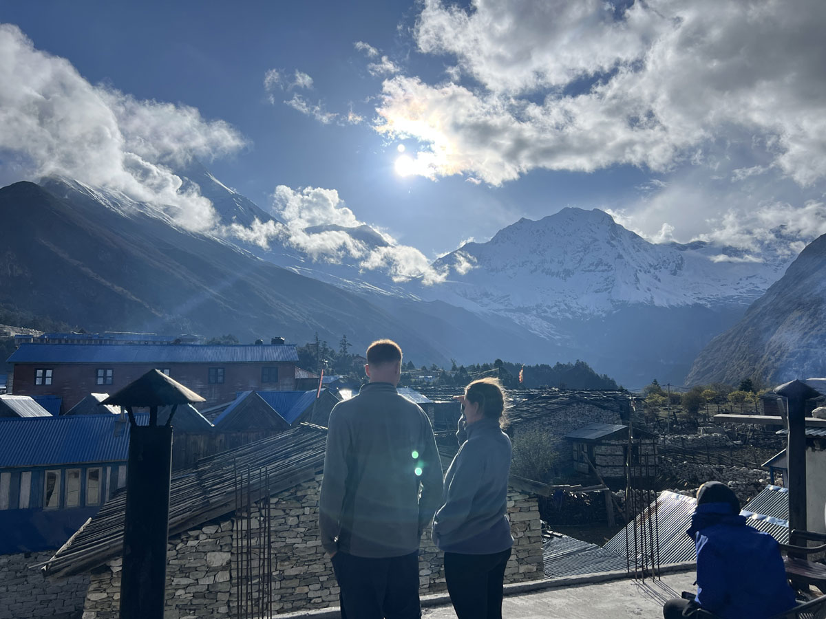
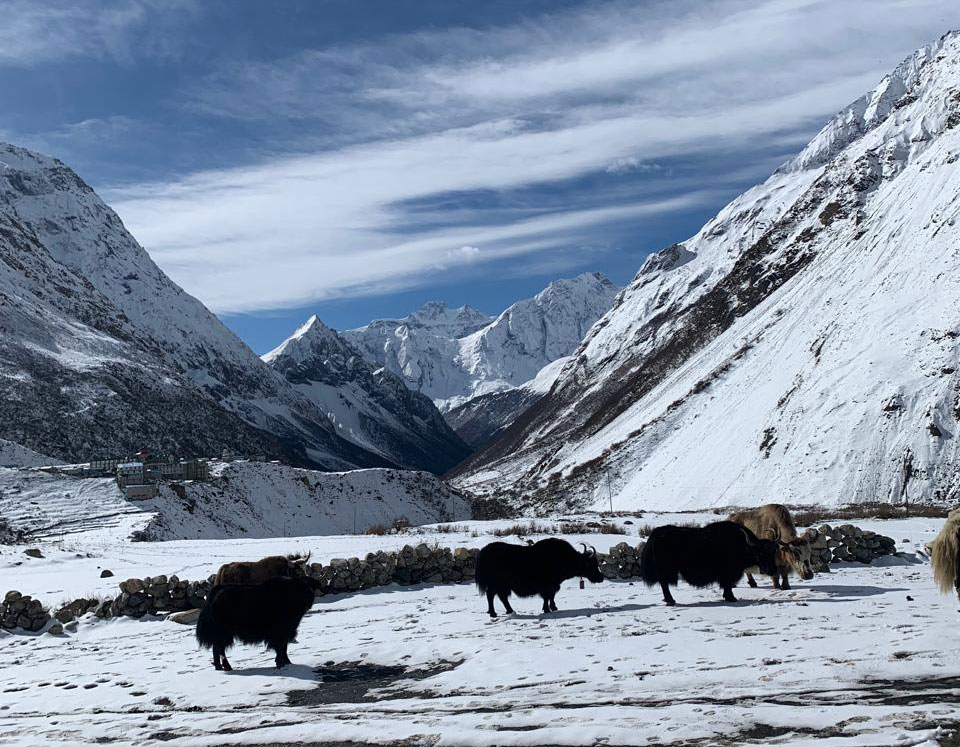
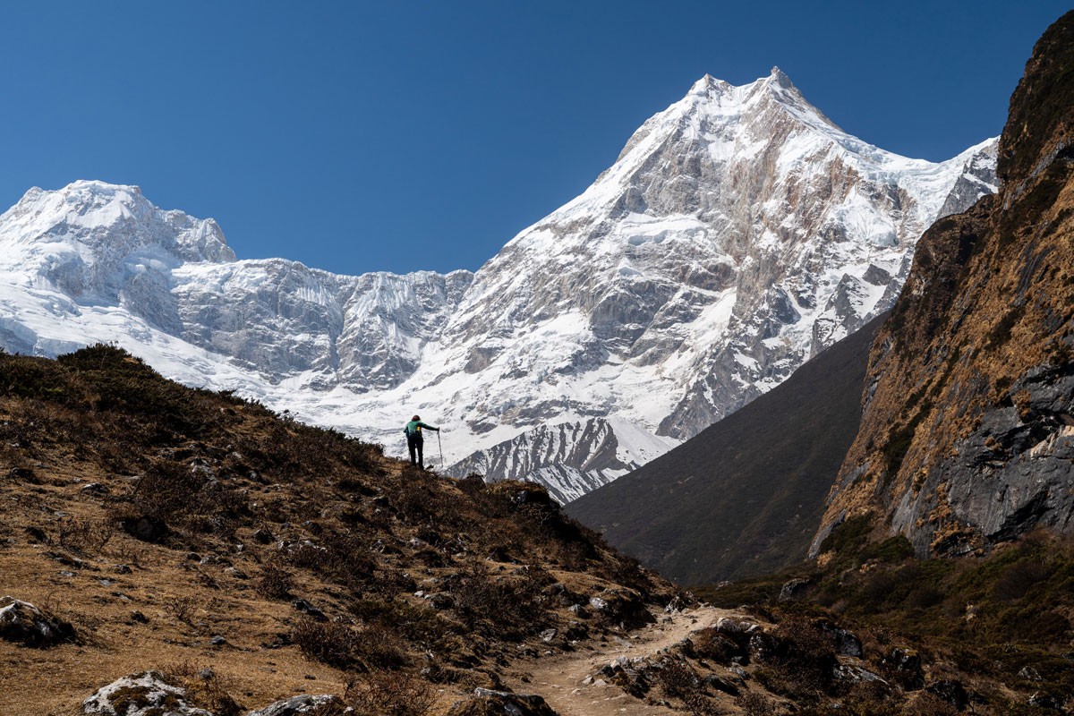
As the route moves higher toward Samagaun and Samdo, the landscape opens up noticeably. Trails become wider, drier, and more exposed, with fewer trees and broader mountain views.
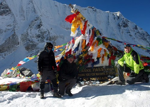
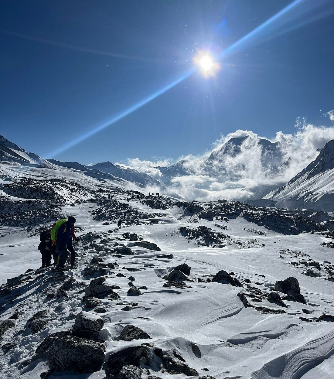
Above Samdo, toward Dharmasala and Larkya La Pass, the trekking environment becomes quieter, colder, and more rugged. The route crosses rocky terrain, glacial sections, alpine slopes, and exposed mountain paths before reaching the pass.
Early morning conditions near Larkya La may include frost, wind, or light snow depending on the season.
After crossing the pass, the trail descends toward Bimthang through a long downhill section with loose stones, alpine terrain, and eventually greener forest trails lower down the valley.
This section can feel tiring on the knees after the long pass-crossing day, especially on uneven ground.
Altitude and Acclimatization on the Manaslu Circuit
| Location | Altitude |
|---|
| Machha Khola | 930 m |
| Namrung | 2,630 m |
| Samagaun | 3,530 m |
| Samdo | 3,875 m |
| Dharmasala | 4,460 m |
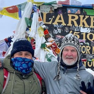
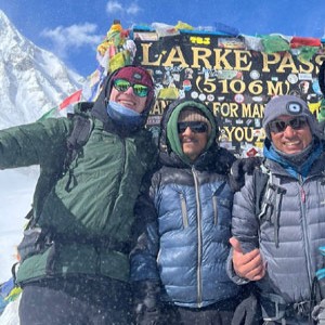
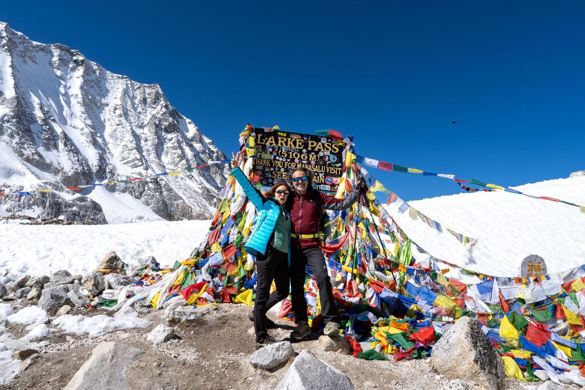
| Larkya La Pass | 5,160 m |
| Bimthang | 3,590 m |
The Manaslu Circuit Trek begins at around 900 meters in Machha Khola and reaches its highest point at Larkya La Pass (5,160 m). As the trek moves higher through Deng, Namrung, Lho, and Samagaun, the air becomes thinner and walking naturally feels slower above 3,500 meters.
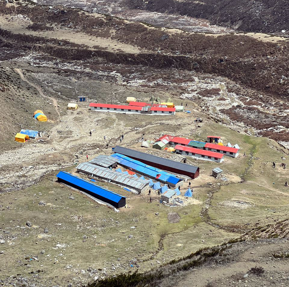
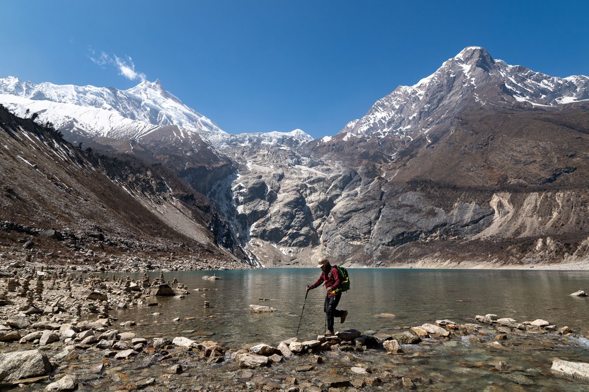
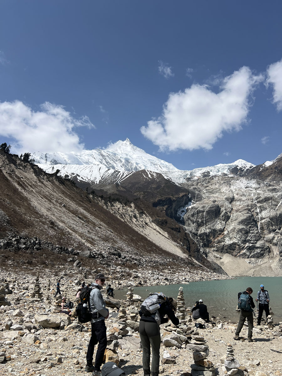
Samagaun (3,520 m) is the first main acclimatization stop on the trek. Trekkers usually spend an extra day here with short hikes toward Birendra Lake, Manaslu Base Camp, or nearby viewpoints before continuing higher into the valley.
The second acclimatization stop is Samdo (3,875 m), located close to the Tibetan border. Short hikes around Samdo are commonly used to help the body adjust before moving toward Dharmasala and the pass section.
After Samdo, the route enters a more exposed alpine environment toward Dharmasala, where temperatures become colder and weather conditions can change quickly before the crossing of Larkya La Pass.
Proper hydration, steady pacing, and regular rest play an important role throughout the trek, especially in the higher sections above Samagaun. For more detailed guidance, you can also explore our guide on Altitude Sickness and Trek Challenges on the Manaslu Circuit.
Best Time to Trek Manaslu Circuit
For most trekkers, spring (March to May) and autumn (September to November) provide the most reliable conditions for the Manaslu Circuit Trek, especially for crossing Larkya La Pass. During these periods, weather is usually more stable, visibility is clearer, and trail conditions are generally safer for high-altitude trekking.
Spring Season (March to May)
By late March and April, the lower Budhi Gandaki valley becomes greener and warmer, while upper villages such as Samdo and Dharmasala can still feel cold during mornings and evenings. Rhododendron forests begin blooming below Namrung, and higher sections near Larkya La sometimes still hold patches of snow from winter storms earlier in the season.
Spring is also an active climbing season in the Himalayas, so villages like Samagaun become busier with trekking and expedition movement around the Manaslu region.
Autumn Season (September to November)
Autumn is usually the busiest trekking season on the Manaslu route because weather conditions tend to become more stable after the summer monsoon. Trails are generally drier, mountain views clearer, and temperatures more comfortable for long trekking days.
October and early November are often considered the most reliable months for crossing Larkya La Pass. Early mornings near Dharmasala can still feel very cold, especially before sunrise when most trekkers begin the pass crossing.
Winter Season (December to February)
Winter conditions become much colder above Samdo, especially around Dharmasala and Larkya La Pass where snowfall and strong wind can affect trail conditions quickly. Heavy snow sometimes makes the pass difficult or temporarily inaccessible depending on weather patterns during the season.
At the same time, stable winter weather can bring exceptionally clear mountain views and quieter trails for trekkers properly prepared for cold temperatures and changing mountain conditions.
Monsoon Season (June to August)
During the monsoon season, the lower Budhi Gandaki valley becomes wetter, greener, and more humid, with muddy sections, occasional landslides, and possible transportation delays after heavy rain.
However, parts of the upper Manaslu region near Samdo and Larkya La fall within a partial Himalayan rain-shadow zone, which sometimes creates drier conditions compared to lower trekking areas during the monsoon period. Even so, weather conditions in the higher mountains can still change quickly around the pass section.
In recent years, Himalayan weather patterns have become less predictable, and unexpected snowfall or sudden weather changes can occasionally affect the trail even during traditionally stable trekking months. Strong wind near Larkya La Pass, especially during colder mornings, can also make the crossing feel significantly colder than the actual temperature.
For a month-by-month season breakdown, read our full guide on the best time for Manaslu Circuit Trek.
Manaslu Circuit Trek Difficulty
The Manaslu Circuit Trek is considered a moderately challenging high-altitude trek, mainly because of the altitude, long walking days, and the crossing of Larkya La Pass (5,160 m).
Trek Difficulty at a Glance
- Daily walking: Approximately 5-7 hours on most trekking days
- Highest point: Larkya La Pass (5,160 m)
- Most demanding day: Dharmasala to Bimthang via Larkya La Pass
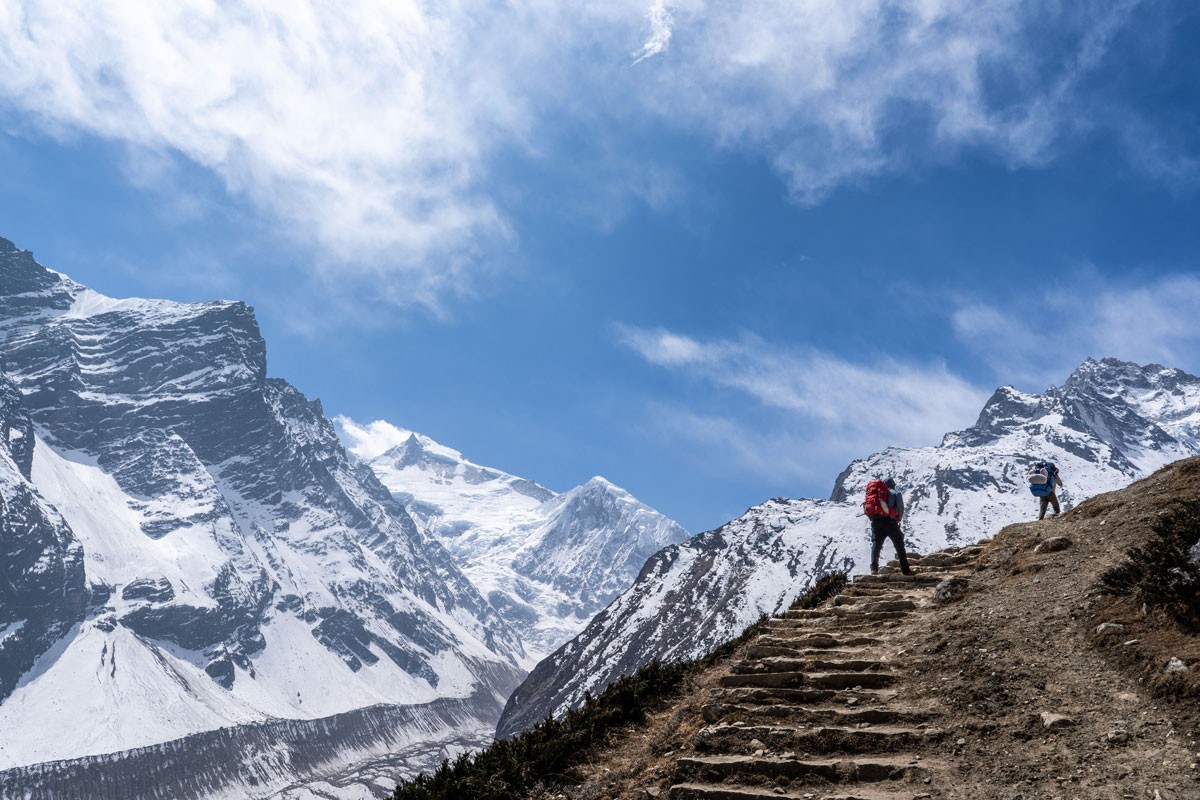
- Trail type: Stone staircases, suspension bridges, alpine paths, and rocky mountain terrain
- Technical climbing: Not required
- Main challenge: Altitude, long walking days, and changing mountain weather conditions
- Best approach: Slow pacing, proper acclimatization, and steady energy management throughout the trek
Above 3,500 meters, oxygen levels become lower, and walking naturally feels slower and more physically demanding, especially around Samagaun, Samdo, and Dharmasala. Even gradual uphill sections can feel tiring at higher altitude.
What makes the Manaslu Circuit physically demanding is not technical terrain but the combination of consecutive trekking days, increasing altitude, and the long crossing of Larkya La Pass. Recovering well each evening, maintaining a steady pace, and allowing your body time to adapt to the elevation are far more important than trying to cover ground quickly. Trekkers with good fitness and realistic preparation generally find the challenge manageable, especially when following a well-paced itinerary with proper acclimatization.
Most trekkers begin the pass-crossing day before sunrise, usually around 4:00 AM, as weather and wind conditions are often more stable during the early morning hours.
The climb to Larkya La Pass is mostly gradual, but the combination of high altitude, an early pre-dawn start, and one of the longest trekking days of the journey makes it physically demanding. The descent to Bimthang is equally important, as the long, uneven trail places continued strain on tired legs after the pass has been crossed. Although the route does not require technical climbing or mountaineering experience, good stamina, proper acclimatization, and sensible pace management are essential for completing the day comfortably and safely.
Some trekkers may experience mild altitude-related symptoms above 3,500 meters, including headache, disturbed sleep, lower appetite, or unusual tiredness. Proper acclimatization, hydration, rest, and guide support play an important role in helping trekkers adjust safely during the trek.
For more detailed preparation advice, you can also explore our guide on how difficult the Manaslu Circuit Trek is.
Accommodation and Meals on the Manaslu Circuit Trek
Accommodation on the Manaslu Circuit Trek is in traditional teahouses run by local families, offering a simple local mountain experience throughout the journey.
In the lower villages such as Machha Khola, Jagat, and Deng, teahouses are relatively comfortable, with basic private rooms, twin beds, blankets, and shared bathrooms. Some places may offer attached bathrooms and hot showers, depending on availability.
As you move higher toward Namrung, Lho, Samagaun, and Samdo, the facilities become more basic due to the remote location. Rooms are simple, usually with wooden beds, foam mattresses, and shared toilets. In higher villages, especially in Dharmasala, accommodation is very limited, and during busy seasons rooms may need to be shared.
Rooms are generally not heated along the entire Manaslu trail, while the shared dining area is usually the warmest part of the teahouse. Carrying a warm sleeping bag makes a big difference for comfort during colder nights.
Charging phones, power banks, hot showers, and Wi-Fi are usually available in many villages for an additional cost, although these services become more limited and less reliable at higher altitude.
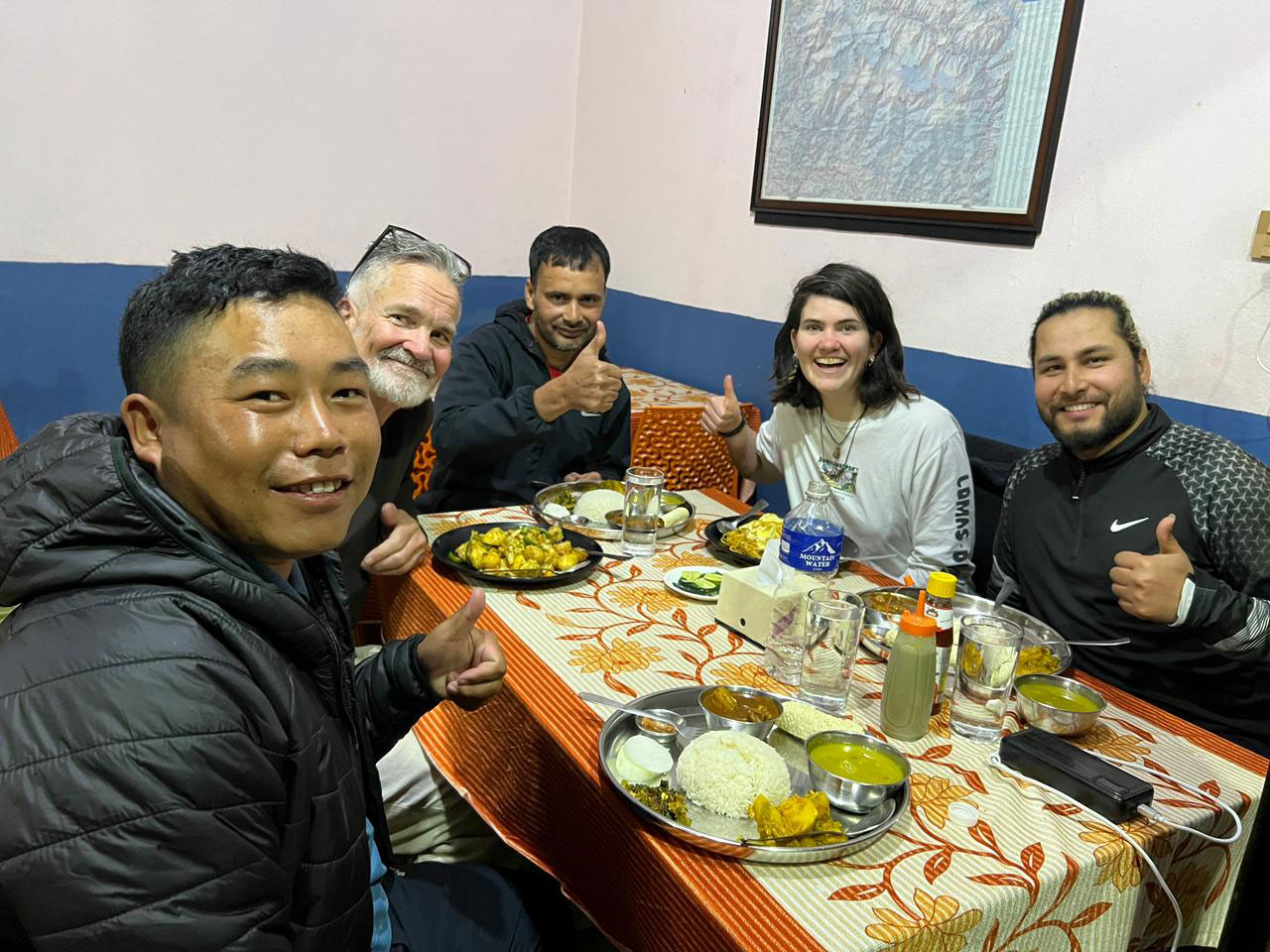
Meals are freshly prepared in the teahouses using locally available ingredients. The most common and recommended meal is dal bhat (rice, lentil soup, vegetables, and pickles), which provides good energy and is often refillable. Other options include noodle soup, fried rice, pasta, potatoes, eggs, pancakes, and simple Western-style dishes.
In villages like Namrung and Samagaun, some bakeries and teahouses now serve fresh bread, coffee, cappuccino, and simple espresso-based drinks, although facilities become much more basic after Samdo.
You can also explore our detailed Manaslu Circuit Trek Tea House Guide for more information about accommodation, meals, charging facilities, and sleeping conditions along the route.
Along the descent from Larkya La Pass toward Bimthang, there is a very basic stop locally known as Phedi. This small shelter-style teahouse is sometimes used by trekkers who are unable to continue the full descent after crossing the pass, especially older trekkers or those feeling exhausted after the long high-altitude crossing.
Accommodation here is extremely basic, usually with simple mattresses and limited facilities, but basic meals and hot drinks are generally available when the teahouse is operating.
In the evenings, trekkers usually gather in the shared dining hall around the central stove to relax and warm up after the day’s walk. For many trekkers, this simple teahouse atmosphere becomes one of the memorable parts of the Manaslu Circuit Trek.
Why Dharamsala Feels Different on the Manaslu Trekking Route
Dharamsala, also known as Larkya Phedi, is one of the most distinct stops on the Manaslu trekking route. Dharamsala feels noticeably different from the lower villages on the Manaslu Circuit, both in the surrounding landscape and in the overall atmosphere of the trail.
The landscape is more open and exposed, with no trees and very little natural shelter. The air feels colder, and the wind can be stronger, especially later in the day. By this stage of the trek, the environment already feels fully alpine, with wider open terrain and very little separation between the trail and the surrounding mountains.
Accommodation at Dharamsala is very basic compared to other villages on the trek. During busy trekking periods, rooms are often shared, and the overall focus here is more on rest and preparation than comfort.
By late afternoon, most trekkers at Dharmasala are already preparing gear, organizing layers, and resting early before the next morning’s pass crossing.
Transportation for the Manaslu Circuit Trek
The Manaslu Circuit Trek begins and ends with overland travel, connecting Kathmandu to the starting and ending points of the trail.
The journey starts with a drive from Kathmandu to Machha Khola, which usually takes around 8 to 10 hours depending on road conditions and traffic.
The first part of the drive follows a paved highway, while the later section becomes rough and bumpy as the road follows the Budhi Gandaki valley.
Road conditions in the lower Manaslu region can change after heavy rain, particularly during the monsoon and early post-monsoon seasons when small landslides may occasionally affect sections of the road. As a result, travel times can sometimes be longer than expected before reaching the trailhead at Machha Khola.
Trekkers can choose between a local bus or a private jeep. Local buses are more economical but can be crowded and slower, while private jeeps offer a more comfortable ride, flexible stops, and shorter travel time.
After completing the trek and crossing Larkya La Pass, the route finishes near Tilje in the Annapurna region. From here, transportation is arranged by shared jeep to Besisahar, followed by either a local bus or private vehicle back to Kathmandu.
With the current road access up to Tilje, the trek can finish more comfortably without continuing on vehicle tracks, keeping the final section more efficient.
Before every departure, we review current road conditions and coordinate transportation accordingly. This allows our team to respond quickly to temporary weather-related changes and provide the most suitable travel arrangements for the conditions at the time of your trek.
Guide and Porter Support on the Manaslu Circuit Trek
Your guide and porter each play a different role throughout the trek, working together to make the journey more comfortable, well organized, and enjoyable from the first day on the trail to the final descent.
As the Manaslu region is a restricted area, trekking with a licensed guide is compulsory. Beyond this requirement, your guide plays a key role in managing the overall journey, including navigation, daily planning, accommodation arrangements, and communication with local teahouses.
During the trek, your guide manages daily navigation, coordinates overnight stops, communicates with local tea houses, and helps the journey run smoothly from one village to the next.
Porters provide essential support by carrying your main luggage, usually up to 20-22 kg, allowing you to walk comfortably with a light daypack. This makes a significant difference, especially on longer days and during the Larkya La Pass crossing, where conserving energy is important.
We follow an ethical porter policy, ensuring fair wages, proper clothing, safe load limits, and full insurance coverage. Our porters are experienced and accustomed to high-altitude conditions, and their role is essential in making the trek more comfortable and manageable.
Because your guide and porter handle the practical aspects of the trek, you are free to focus on the walking experience, mountain scenery, and local culture without worrying about the day-to-day logistics along the route.
Manaslu Circuit Trek Permits
The Manaslu region is a restricted trekking area, and independent trekking without a licensed guide is not allowed. All trekkers must obtain special permits before entering the route.
Three permits are required for the Manaslu Circuit Trek:
- Manaslu Restricted Area Permit (RAP)
- Manaslu Conservation Area Permit (MCAP)
- Annapurna Conservation Area Permit (ACAP)
Permit checkpoints are located along the route, especially around Jagat and after crossing Larkya La Pass into the Annapurna region. During the trek, all permit checkpoints along the route are managed by your guide or local trek leader, including restricted-area and conservation permit verification points.
You can also read our detailed Manaslu Circuit Trek Permit guide for updated 2026 permit costs, solo trekking rules, required documents, and seasonal permit information.
Solo trekkers, private departures, and small groups can obtain Manaslu permits through a licensed trekking company with a licensed guide. A local Chumnubri Rural Municipality fee (around NPR 1,000 per person) is also collected along the trail to support local conservation and community management.
All permit arrangements are handled in Kathmandu before the trek using your passport copy, Nepal visa details, and required documents.
Travelers booking close to their departure date can also read our last-minute Manaslu Circuit Trek booking guide.
Manaslu Circuit Trek Altitude Sickness and Safety
The Manaslu Circuit Trek reaches high-altitude terrain, so understanding altitude sickness and following proper safety practices is essential.
Altitude-related symptoms can begin above 3,000 meters. Common early signs include headache, loss of appetite, dizziness, nausea, difficulty sleeping, or unusual tiredness. These symptoms should never be ignored, as early attention helps prevent more serious conditions.
Safety on this trek is based on awareness, proper monitoring, and timely decision-making. Your guide carries an oximeter to regularly check oxygen saturation levels at higher altitudes, especially during acclimatization days and before crossing Larkya La Pass. This helps track how your body is adapting and identify early warning signs.
Our guides are trained in high-altitude safety, first aid, and real-time decision-making in remote mountain conditions. They carry a basic medical kit, including essential medicines for common issues such as headaches, stomach problems, and mild altitude discomfort. For more serious situations, immediate descent is always the first and safest response.
In higher villages such as Samagaun and Samdo, some teahouses and health posts may have access to emergency oxygen if required. While this is not a replacement for proper acclimatization, it can provide short-term support in certain situations.
Early recognition of altitude-related symptoms is one of the most important parts of staying safe on the Manaslu Circuit. If you experience persistent headache, unusual fatigue, dizziness, nausea, or any symptoms that concern you, it is important to inform your guide immediately so your condition can be assessed before it becomes more serious.
In remote sections of the Manaslu region, medical facilities are very limited. In case of serious emergencies, helicopter evacuation is the fastest and most reliable option, which can be arranged through your travel insurance.
With proper awareness, experienced guide support, regular monitoring, and a well-planned itinerary, most trekkers complete the Manaslu Circuit safely and comfortably.
If conditions require a change of plan, safety decisions are always based on the trekker's condition, weather, and trail circumstances rather than the planned itinerary. Reaching Larkya La Pass is important, but completing the trek safely always takes priority.
Practical Information for the Manaslu Circuit Trek
Understanding basic facilities along the trail helps you prepare better for the Manaslu Circuit Trek, especially in remote sections where services are limited.
Drinking Water
Clean drinking water is available in all villages along the route. Trekkers usually choose between boiled water from teahouses, bottled mineral water, or using purification methods such as tablets, UV filters, or filter bottles.
Boiled water is the most common and recommended option, as it is safe and helps reduce plastic waste. Bottled water is available in lower and mid-altitude villages but becomes more limited and expensive as you go higher.
Toilets and Hygiene
Toilet facilities vary depending on altitude and location. In lower villages such as Machha Khola, Jagat, and Deng, many teahouses offer Western-style toilets with running water.
As you move higher toward Namrung, Samagaun, and Samdo, squat-style toilets become more common, and facilities are more basic. In remote places like Dharmasala (Larkya Phedi), toilets are very simple due to limited infrastructure.
Hot showers are available in most villages, usually for an additional cost. In lower areas, showers are often gas-heated, while at higher altitude they are typically bucket showers using boiled or solar-heated water.
Internet and Connectivity
Mobile network coverage is available in some lower areas, but it becomes weak or unavailable as you go higher.
In villages like Machha Khola, Jagat, and Deng, NTC and Ncell networks may work in certain locations. Around Samagaun and Samdo, connectivity is very limited or unstable.
Many teahouses offer paid Wi-Fi, but the speed is basic and mainly suitable for messaging rather than streaming or large data use.
There is no reliable mobile network or Wi-Fi in Dharmasala (Larkya Phedi), so it is normal to be completely offline in this section of the trek.
Electricity and Charging
Electricity is available throughout most of the Manaslu Circuit, allowing trekkers to charge phones, cameras, and power banks at tea houses for a small additional fee. Charging is generally more reliable in the lower villages, while higher settlements rely more heavily on solar power, so availability may vary with weather conditions and charging points can become busier during the evening.
Charging points are usually available in dining halls rather than in rooms. Carrying a power bank, spare batteries, and charging cables is strongly recommended.
Money and Personal Expenses
There are no ATMs along the Manaslu Circuit Trek, so all necessary cash should be withdrawn in Kathmandu before starting the trek.
It is also a good idea to buy snacks, energy bars, batteries, and other small personal items in Kathmandu before starting the trek, as options become more limited and expensive in remote mountain villages.
Teahouses, shops, and services along the route accept cash only, and digital payments are generally not available.
In addition to your main package, personal expenses may include Wi-Fi, charging, hot showers, drinks, snacks, and tips for guides and porters.
A comfortable budget is typically around NPR 25,000 to 35,000 per person for the full trek, depending on spending habits.
Culture and Local Experience on the Manaslu Circuit Trek
The Manaslu Circuit Trek passes through different cultural regions as the trail gradually moves from the lower Budhi Gandaki valley toward the upper Himalayan villages near the Tibetan border.
In the lower section of the trek, daily life is closely connected to farming, livestock, and local trade routes along the river valley. As the trail climbs higher toward Namrung, Lho, Samagaun, and Samdo, the cultural atmosphere gradually changes and becomes more closely connected to Tibetan-influenced mountain communities.
Samdo, located close to the Tibetan border, has historically been linked with seasonal trade and yak caravans moving through the high Himalayan valleys. Life here is shaped by altitude, weather, and limited mountain resources, creating a very different atmosphere from the lower villages earlier in the trek.
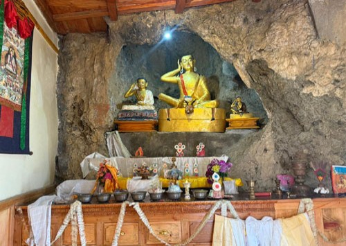
Along the route, trekkers pass mani walls, prayer wheels, chortens, and monasteries that remain an important part of daily village life. In villages such as Lho and Samagaun, Buddhist traditions are still visible in local architecture, religious ceremonies, and everyday routines. These cultural encounters add another dimension to the trek beyond the mountain scenery and help create a deeper connection with the region.
Respecting local customs remains an important part of the trekking experience. Walking clockwise around religious structures, dressing respectfully in villages and monasteries, and maintaining a calm approach around local communities help create a more meaningful connection along the route.
For trekkers interested in the cultural side of the region, our Manaslu Tsum Valley Trek guide explores the deeper Buddhist heritage, remote mountain villages, and traditional lifestyle found in the upper Himalayan valleys of the Manaslu region.
Travel Insurance for the Manaslu Circuit Trek
Travel insurance is not compulsory for the Manaslu Circuit Trek, but it is strongly recommended, as the route enters remote and high-altitude terrain where medical facilities are very limited.
Your insurance policy should clearly cover high-altitude trekking up to at least 6,000 meters, including emergency helicopter evacuation. Many standard travel insurance plans do not include this level of coverage, so it is important to check the details carefully before your trip.
For solo travelers booking a private trip, travel insurance is required as part of the permit application and overall safety process for the Manaslu restricted area.
In case of serious illness, injury, or altitude-related problems, helicopter evacuation is often the fastest and safest option in this region. Our team assists with coordination and communication with your insurance provider if needed.
A comprehensive policy should also include medical treatment, trip delays, cancellations, and baggage coverage for a more secure travel experience.
While most trekkers complete the Manaslu Circuit without issues, having proper insurance provides peace of mind and allows you to focus fully on the trek.
Packing Checklist for the Manaslu Circuit Trek
Packing the right clothing and equipment makes the Manaslu Circuit Trek safer, warmer, and more comfortable. The route passes through warm lowlands and cold high-altitude terrain, so layering is the most effective way to stay comfortable throughout the trek.
Below is a recommended packing list based on real on-trail experience. Many items can also be rented or purchased in Kathmandu before the trek begins.
Essential Clothing
- Warm thermal base layers
- Light trekking shirts
- Mid-layer fleece or soft-shell jacket
- Insulated down jacket
- Waterproof and windproof outer shell
- Comfortable trekking pants
- Thermal leggings for cold nights
- Warm hat and sun hat
- Buff or neck gaiter
- Inner and outer gloves
- Wool or synthetic trekking socks (multiple pairs)
Footwear
- Strong, waterproof trekking boots (well broken-in)
- Light shoes or sandals for teahouses
- Optional gaiters in snowy conditions
Sleeping and Trekking Gear
- Warm sleeping bag suitable for high altitude
- 30-40L daypack with rain cover
- Trekking poles
- Headlamp with spare batteries
- Reusable water bottles or hydration bladder
- Dry bags or packing cubes
- Power bank and charging cables
- Lightweight towel
Personal and Medical Items
- Sunscreen and lip balm
- Basic toiletries
- Wet wipes and hand sanitizer
- Personal first-aid supplies
- Altitude medication if prescribed
- Any personal medicines
Optional Useful Items
- Camera or GoPro
- Notebook or book
- Snacks such as nuts, chocolate, or energy bars
- Water purification tablets or filter bottle
Packing light while keeping essential warm layers easily accessible makes the trek more comfortable. A porter usually carries your main duffel bag, while you walk with a small daypack containing water, snacks, and essential layers.
At higher altitudes, temperatures drop quickly in the evening, so keeping warm clothing easily accessible is important. For detailed preparation, you can check our complete Manaslu Circuit Trek Packing List to understand what to bring for different altitudes and conditions.
Current Trail Update - July 2026
As of July 2026, the Manaslu Circuit Trek remains open, and our scheduled trekking departures are operating normally. So far, there have been no major weather-related disruptions or landslides affecting the main trekking route.
Minor monsoon-related landslides recently affected sections of the road between Kathmandu and Machha Khola, but the affected areas have been cleared and vehicle access has resumed. Temporary delays may still occur after periods of heavy rainfall, while the trekking trail from Machha Khola onward remains in good condition.
All tea houses and lodges along the Manaslu Circuit are open and operating normally.
During the monsoon season, occasional afternoon rain is common in the lower Budhi Gandaki Valley. Trekkers should carry basic rain protection, including a waterproof jacket, backpack cover, and dry bags for important gear.
Conditions around Dharmasala and Larkya La Pass can change quickly depending on mountain weather, so our guides continue to monitor local trail and weather conditions before each pass crossing.
Why This Manaslu Circuit Trek Is Designed for 12 Days
This 12-day Manaslu Circuit Trek itinerary is designed around actual trekking conditions, road access, acclimatization needs, and daily walking rhythm to create a more balanced high-altitude journey.
The acclimatization days in Sama Gaun and Samdo allow your body time to adjust naturally to the altitude while also providing opportunities to explore nearby viewpoints before continuing higher toward Larkya La Pass.
Another key factor is updated route planning based on current road conditions. The drive now reaches Machha Khola, allowing trekkers to start directly from the main trail without unnecessary walking on lower road sections. Similarly, after crossing the pass and reaching Tilje, road access is available, so there is no need to continue walking on dusty road tracks toward Besisahar.
Daily walking hours are arranged to maintain a steady and realistic progression toward Larkya La Pass, with the longer trekking days scheduled only after your body has had time to adapt to the increasing altitude. The itinerary is designed to use time efficiently without adding extra days that do not meaningfully improve acclimatization or the overall trekking experience.
Planning Your Manaslu Trek?
Our Nepal-based team can help you choose the right trekking season, transportation option, acclimatization pace, and itinerary style based on your travel dates, fitness level, and overall comfort preference.
Whether you are planning a private departure, looking to join a small group, or need updated information about current trail conditions and permits, we can help you plan the journey with the right pace, route, and local support.

.jpg)