Gokyo Lakes Trek

4 reviews
Trip Fact:
  • Duration 12 Days
  • Difficulty Level Moderate
  • DestinationNepal
  • Max Altitude5,357m / 17575 ft
  • AccommodationHotels in Kathmandu and Guest houses during trekking
  • MealsBreakfast in Kathmandu and All meals during trekking
  • Trip Start/EndLukla
  • Group Size1-30 pax
  • Best SeasonMarch, April, May, September, October and November

Gokyo Lakes Trek Overview

The Gokyo Lakes Trek is a scenic trekking journey in the Everest region that leads to the turquoise glacial lakes of Gokyo Valley and the panoramic viewpoint of Gokyo Ri. Compared with the classic Everest Base Camp Trek, this route is generally quieter and less crowded while still offering spectacular Himalayan scenery and Sherpa culture.

Trekkers looking for the classic Everest route can also explore our Everest Base Camp Trek itinerary.

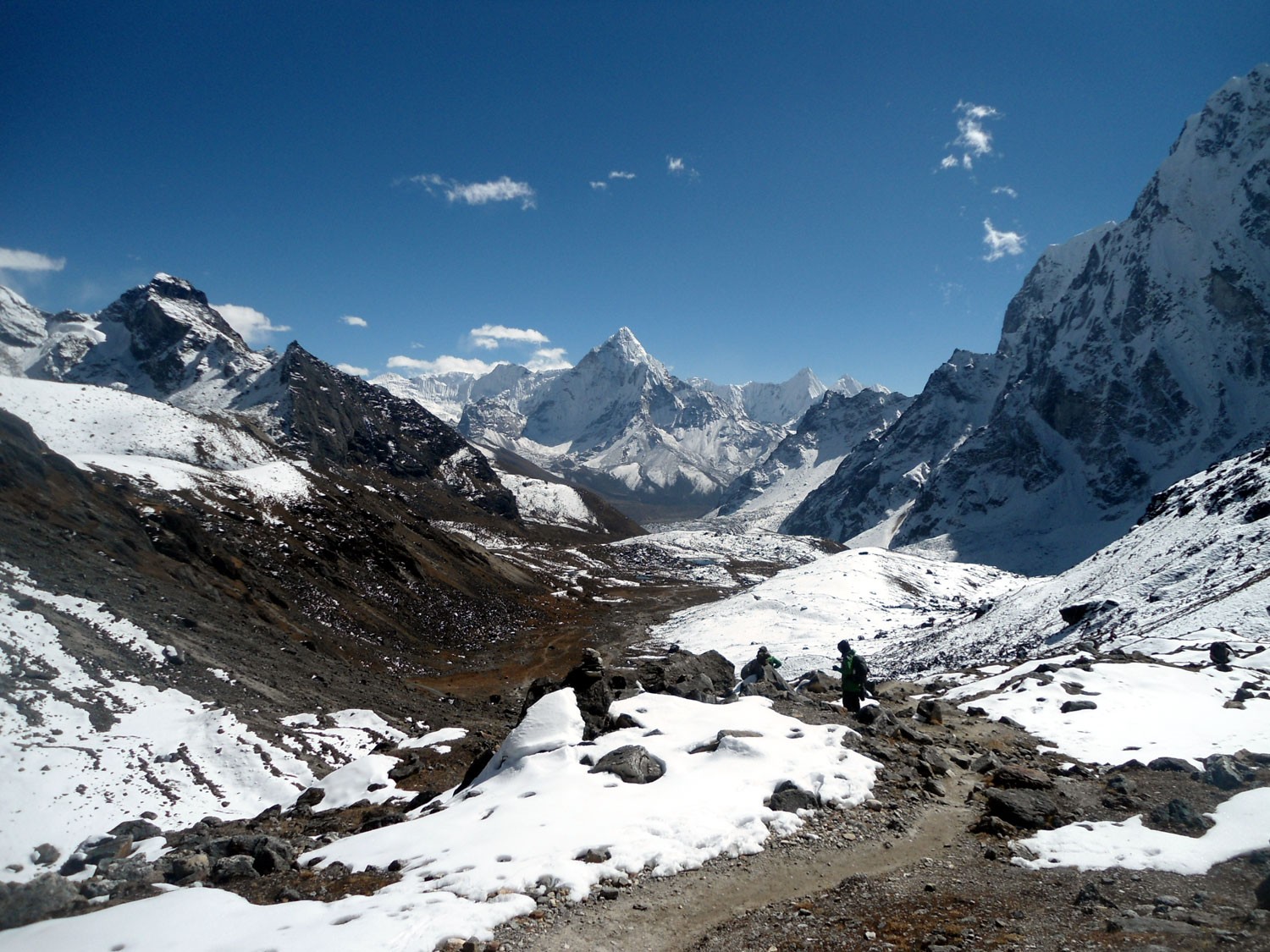
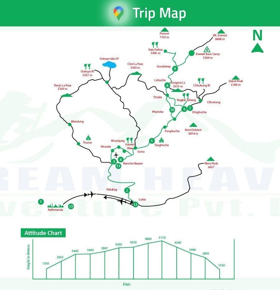
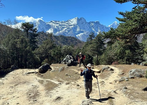
The trek begins with a flight to Lukla and follows the lower Everest trail through Phakding and Namche Bazaar before separating toward the Gokyo Valley route. The trail gradually passes through Dole, Machhermo, and high alpine landscapes surrounded by mountains, glaciers, and glacial lakes.

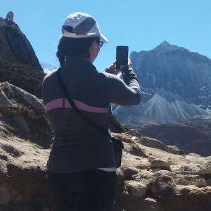
The main highlights of the trek include the Gokyo Lakes, Ngozumpa Glacier, Gokyo village, and the sunrise hike to Gokyo Ri. From Gokyo Ri, trekkers can enjoy panoramic views of Everest, Lhotse, Makalu, Cho Oyu, Ama Dablam, and many surrounding Himalayan peaks.

The Gokyo Lakes Trek is a good option for trekkers looking for Everest-region scenery with a more peaceful trekking experience away from the busier Everest Base Camp route.

Gokyo Lakes and Ngozumpa Glacier

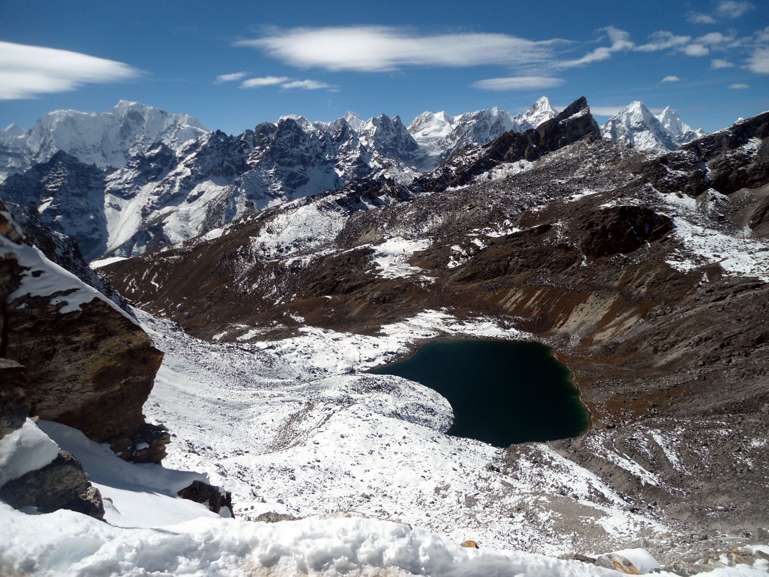
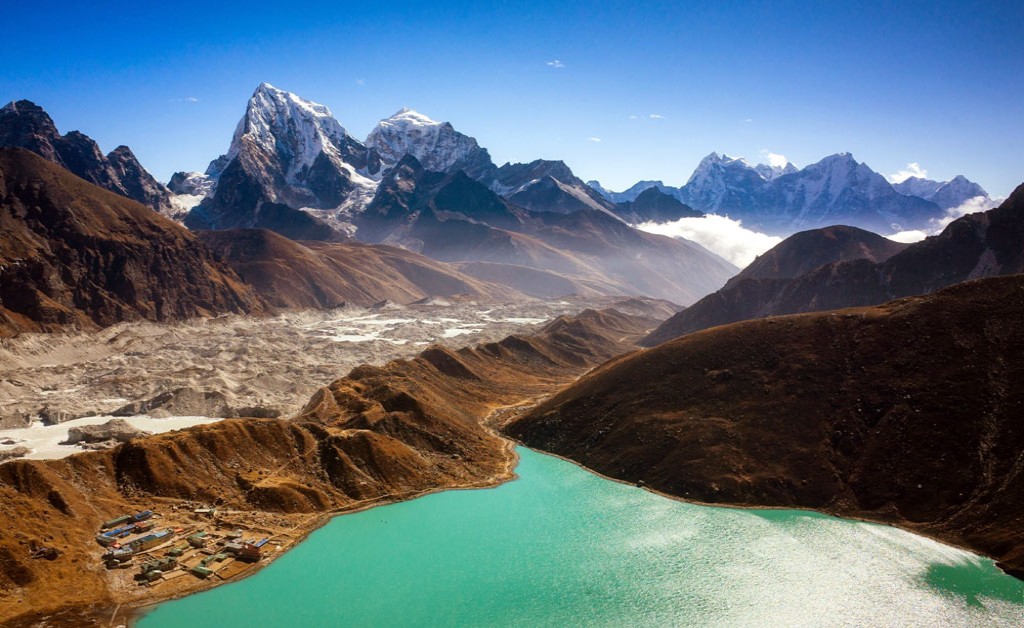
The Gokyo Lakes are a group of high-altitude glacial lakes located between approximately 4,700 and 5,000 meters inside Sagarmatha National Park. These lakes are considered one of the world’s highest freshwater lake systems and are an important natural feature of the Everest region.

The Gokyo lake system includes several lakes, with Thonak Lake being the largest. The lake most trekkers refer to as Gokyo Lake is Dudh Pokhari, also known as Gokyo Cho, located beside Gokyo village.

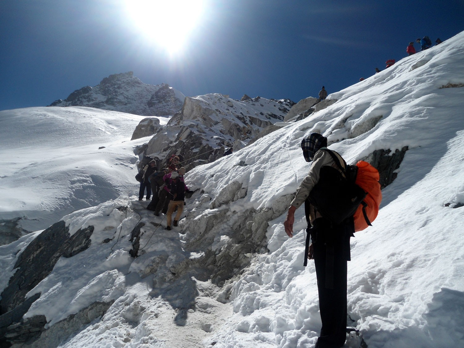
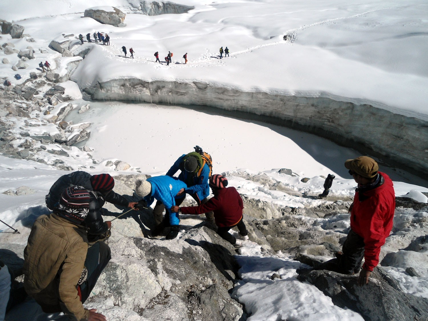
The lakes are mainly fed by the Ngozumpa Glacier, the longest glacier in Nepal, which stretches for around 32 kilometers through the upper Gokyo Valley. The combination of turquoise lakes, glaciers, snow-covered mountains, and high alpine landscapes makes this region one of the most scenic parts of the Everest area.

What Can You See from Gokyo Ri?

Gokyo Ri is one of the best viewpoints in the Everest region and one of the major highlights of the trek. The hike usually starts early in the morning for sunrise views over the Himalayas.

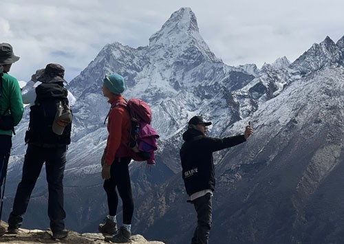
From the summit of Gokyo Ri, trekkers can see Mount Everest, Lhotse, Makalu, Cho Oyu, Ama Dablam, Thamserku, and many surrounding Himalayan peaks. The viewpoint also overlooks the Ngozumpa Glacier, Gokyo Valley, and the turquoise lakes below.

Compared with many viewpoints on the Everest Base Camp trail, Gokyo Ri offers wider panoramic views with fewer crowds.

The dark rocky surface visible across much of the Ngozumpa Glacier is formed by layers of debris carried down from surrounding Himalayan peaks over many years.

Cultural and Religious Importance of Gokyo Lakes

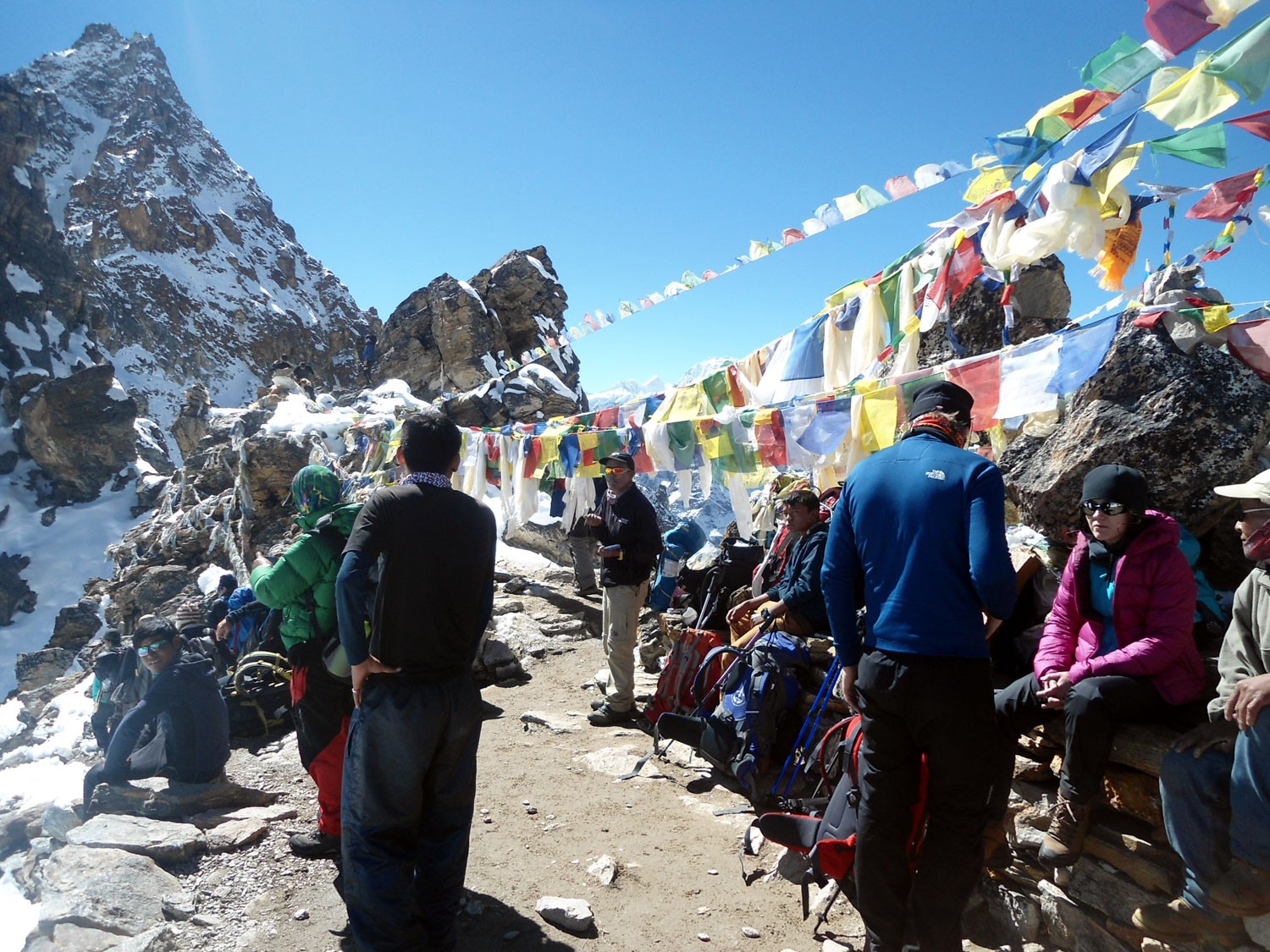
The Gokyo Lakes hold cultural and religious importance for both Buddhist and Hindu communities in the Everest region. Prayer flags, stone shrines, and traditional beliefs connected to the lakes can still be seen around Gokyo Valley today.

For local communities, the lakes are considered sacred, and many pilgrims visit the area during special religious occasions. The peaceful environment, surrounding mountains, and spiritual atmosphere add another unique dimension to the Gokyo Lakes Trek experience.

What Makes Gokyo Lakes Trek Different from Everest Base Camp?

The Gokyo Lakes Trek and Everest Base Camp Trek both follow the Everest region trail through Namche Bazaar, but the experience becomes very different after the route separates toward Gokyo Valley.

Compared with the Everest Base Camp route, the Gokyo trail is generally quieter and less crowded. Instead of following the busy trail toward Tengboche and Lobuche, the route heads toward Dole, Machhermo, and the glacial lakes of Gokyo Valley.

The scenery also feels different. While Everest Base Camp focuses more on the Khumbu Glacier and the journey to base camp itself, the Gokyo route is known for turquoise lakes, panoramic mountain views, and the Ngozumpa Glacier.

Many trekkers choose the Gokyo Lakes Trek because it offers a more peaceful trekking experience while still providing spectacular views of Everest and other Himalayan peaks.

Trekkers interested in combining Gokyo Valley with Everest Base Camp and Cho La Pass can also explore our Everest Base Camp Cho La Pass Trek.

Gokyo Lakes Trek Difficulty

The Gokyo Lakes Trek is generally considered a moderate to challenging trek. Our standard 12-day Gokyo Lakes itinerary does not include high pass crossings such as Cho La Pass or Renjo La Pass, making it more manageable compared to the Everest Three Passes Trek.

There are no technical climbing sections on the trek. However, the trail beyond Namche Bazaar becomes more rugged, with rocky paths, glacier moraines, uneven terrain, and gradual altitude gain toward Gokyo Valley.

The trek covers approximately 75 kilometers in total, with average daily walking distances of around 9 to 11 kilometers. Most trekking days involve about 5 to 6 hours of walking depending on pace, weather, and trail conditions.

As the altitude increases above Dole and Machhermo, thinner air can make walking feel slower and more physically demanding. Proper acclimatization, steady pacing, and basic physical preparation help make the trek achievable for both fit beginners and experienced trekkers.

Overall, the Gokyo Lakes Trek is suitable for trekkers who are physically prepared for multiple walking days at high altitude and comfortable with basic mountain accommodation.

Travelers looking for a shorter and easier Everest experience may also consider our Everest View Hotel Trek.

Best Time for Gokyo Lakes Trek

Spring (March to May) and autumn (September to November) are considered the best seasons for the Gokyo Lakes Trek. These months usually offer stable weather, clear mountain views, and comfortable trekking conditions in the Everest region.

During spring, rhododendron forests bloom along the lower trails, and daytime temperatures are generally moderate. Autumn is known for dry weather, crisp visibility, and excellent panoramic mountain views after the monsoon season.

Temperatures become colder as the trek moves above Namche Bazaar and Dole, especially during mornings and nights. Even during the warmer trekking seasons, warm clothing and a sleeping bag are recommended for higher elevations.

Winter trekking is also possible for experienced trekkers who are prepared for colder temperatures and snow-covered trails. During winter, the Gokyo Lakes may partially freeze, and the trails are generally quieter with fewer trekkers in the region.

Afternoon cloud buildup and changing mountain weather are common in the Everest region, especially at higher elevations.

What the Gokyo Lakes Trek Feels Like

Compared with the busier Everest Base Camp route, the Gokyo Valley trail often feels quieter and more remote after leaving Namche Bazaar. The combination of high alpine landscapes, glacial lakes, Sherpa villages, and wide Himalayan views creates a more peaceful trekking atmosphere throughout the journey.

Gokyo Lakes Trek Itinerary

Kathmandu: 1,400 m / 4,593 ft

After arriving at Tribhuvan International Airport in Kathmandu, our airport representative will welcome you and transfer you to your hotel in Thamel. The drive from the airport passes through busy local streets filled with shops, temples, motorcycles, prayer flags, and daily city life that gives your first impression of Nepal.

Kathmandu is the cultural heart of Nepal and the main gateway to the Himalayas. Around Thamel, you will find trekking shops, cafes, local restaurants, monasteries, and narrow streets filled with travelers preparing for mountain journeys across the country.

Depending on your arrival time, you may explore nearby places, purchase any last-minute trekking gear, or simply relax after your international flight. In the evening, we will hold a short trek briefing where your guide will explain the route, weather conditions, altitude information, and final preparation details for the Gokyo Lakes Trek.

  • Hotel

Phakding: 2,610 m / 8,563 ft
Flight: 35 minutes
Trek Distance: 6.2 km / 3.8 miles
Trek Duration: 2-3 hours

Early in the morning, you will take a scenic mountain flight to Lukla, one of the most famous airstrips in the world. During peak trekking seasons, flights often operate from Ramechhap instead of Kathmandu due to air traffic in the Everest region. The flight offers spectacular views of green hills, deep valleys, rivers, terraced villages, and distant Himalayan peaks.

After landing at Tenzing Hillary Airport in Lukla, the trek officially begins. Lukla is a busy mountain town filled with teahouses, bakeries, trekking shops, porters, and mule caravans preparing for Everest journeys.

The trail from Lukla to Phakding is mostly gradual and follows the Dudh Koshi River through pine forests, small Sherpa villages, mani walls, prayer wheels, and suspension bridges. Colorful prayer flags flutter above the trail while yaks and mule trains regularly pass carrying goods toward higher villages.

You will pass settlements such as Chheplung, Ghat, and Toktok before reaching Phakding, a peaceful riverside village surrounded by forested hills and flowing glacial water.

The word “Dudh Koshi” means “Milk River” in Nepali because of its milky white glacial water flowing from the Everest region.

  • Tea House
  • Breakfast, Lunch & Dinner

Namche Bazaar: 3,440 m / 11,290 ft
Trek Distance: 7.4 km / 4.6 miles
Trek Duration: 5-6 hours

Today is one of the most important trekking days as the trail gradually enters Sagarmatha National Park and climbs toward Namche Bazaar, the main Sherpa town of the Everest region.

The morning trail follows the Dudh Koshi River through pine forests, small villages, prayer stones, and long suspension bridges hanging high above the river. You will pass several small settlements including Benkar and Monjo before reaching the entrance gate of Sagarmatha National Park.

After Monjo, the route continues through forested river valleys and crosses the famous Hillary Suspension Bridge, one of the highest and most photographed bridges on the Everest trail.

From here, the trail becomes steeper as it climbs through dense forest toward Namche Bazaar. During clear weather, trekkers often catch their first distant view of Mount Everest along this section of the climb.

Namche Bazaar is the largest Sherpa settlement in the Khumbu region and has historically served as a trading center between Nepal and Tibet. Today, it is a lively mountain town with bakeries, coffee shops, gear stores, hotels, museums, local markets, and mountain lodges built into a natural amphitheater-shaped hillside.

The atmosphere in Namche feels very different from the lower villages, with strong mountain culture, trekking energy, and wide Himalayan scenery surrounding the town.

  • Tea House
  • Breakfast, Lunch & Dinner

Everest View Hotel: 3,962 m / 13,000 ft
Hiking Duration: 4-5 hours

Today is an acclimatization day to help your body gradually adjust to higher altitude before continuing deeper into the Everest region. Instead of resting completely, short hikes to higher elevation are recommended for better acclimatization.

After breakfast, the trail climbs gradually above Namche through rhododendron forest and open hillsides with panoramic mountain scenery. As the elevation increases, wide views of Everest, Lhotse, Ama Dablam, Thamserku, and Kongde begin to open.

One of the popular acclimatization hikes leads to the famous Everest View Hotel, known for its spectacular panoramic mountain views. Located high above Namche, this hotel is considered one of the highest luxury hotels in the world.

Some trekkers also continue toward Khumjung Village, one of the largest Sherpa settlements in the region. Khumjung is known for its stone houses, potato farms, monastery, and the historic Hillary School established by Sir Edmund Hillary to support education in the Everest region.

Compared with the busy lower trail, the surroundings above Namche feel quieter and more open, with traditional Sherpa culture strongly visible in daily village life.

After the hike, you return to Namche Bazaar for overnight stay.

  • Tea House
  • Breakfast, Lunch & Dinner
  • 3440m/11286 ft

Dole: 4,200 m / 13,270 ft
Trek Distance: 12 km / 7.5 miles
Trek Duration: 5 hours

Today the trail separates from the main Everest Base Camp route and gradually enters the quieter Gokyo Valley trail. After leaving Namche Bazaar, the path contours high above the valley with spectacular views of Everest, Ama Dablam, Thamserku, and Kangtega.

Compared with the classic Everest Base Camp trail toward Tengboche, the Gokyo route feels noticeably more peaceful with fewer trekkers and quieter mountain landscapes.

The trail passes through small settlements such as Kyangjuma and Mong La. Mong La is a small ridge-top village known for its mountain scenery and steep descent toward the Dudh Koshi valley below.

As the route continues, the environment gradually changes from dense forest into thinner alpine vegetation. Rhododendron trees, juniper bushes, waterfalls, grazing yaks, and stone-built lodges become common along the trail.

You will pass through Phortse Thanga, a riverside resting place surrounded by forest, before climbing steadily toward Dole. Along this section, trekkers sometimes spot Himalayan pheasants, mountain goats, and other wildlife inside Sagarmatha National Park.

Dole is a small Sherpa settlement located on an exposed hillside with beautiful views of Khumbila and surrounding snow-covered peaks.

  • Tea House
  • Breakfast, Lunch & Dinner

Machhermo: 4,470 m / 14,450 ft
Trek Distance: 7 km / 4.3 miles
Trek Duration: 5-6 hours

The trail above Dole gradually climbs through open alpine terrain where the landscape becomes more rugged and exposed. Tree lines slowly disappear, replaced by rocky hillsides, dry yak pastures, and wide mountain valleys.

The route passes through small seasonal grazing settlements such as Lhabarma and Luza, where herders traditionally bring yaks during warmer months. Stone walls, prayer flags, and isolated teahouses appear scattered across the valley.

As you gain elevation, the surrounding Himalayan scenery becomes increasingly dramatic. Long glacier valleys, towering cliffs, and snow-covered peaks dominate the landscape while the air becomes noticeably colder and thinner.

The trail eventually reaches Machhermo, a quiet settlement located beside a wide valley below the mountains of Cho Oyu and Gyachung Kang. Machhermo is historically known in local stories connected to the legendary Yeti sightings reported in the Khumbu region many decades ago.

Compared with the greener lower Everest trail, this section of the Gokyo Valley feels more remote, peaceful, and alpine in character.

  • Tea House
  • Breakfast, Lunch & Dinner

Gokyo Village: 4,790 m / 15,584 ft
Gokyo Ri: 5,400 m / 17,814 ft
Trek Distance: 5.7 km / 3.5 miles
Trek Duration: 4-6 hours

Today is one of the most scenic and memorable days of the entire Gokyo Lakes Trek. After leaving Machhermo, the trail gradually climbs through open alpine terrain with increasingly dramatic views of snow-covered peaks, glacier valleys, and rocky Himalayan landscapes.

As the route gains elevation, the first small glacial lakes of the Gokyo system begin to appear beside the trail. The scenery changes noticeably from dry alpine valleys into a high mountain basin filled with turquoise lakes, stone ridges, and glacier-fed streams flowing from the Ngozumpa Glacier.

The trail eventually reaches the famous Gokyo Lakes, one of the highest freshwater lake systems in the world. The turquoise color of the lakes against the surrounding snow-covered mountains creates one of the most iconic landscapes in the Everest region.

Gokyo Village itself is a small seasonal settlement located beside Dudh Pokhari, the main lake of the Gokyo system. Compared with the busy villages on the Everest Base Camp route, Gokyo feels quieter and more isolated, surrounded by wide open Himalayan scenery.

After reaching Gokyo and having lunch or short rest, trekkers usually continue the steep hike toward Gokyo Ri. The climb is physically demanding because of the altitude, but the panoramic view from the summit is one of the best viewpoints in the Everest region.

From Gokyo Ri, trekkers can see Mount Everest, Lhotse, Makalu, Cho Oyu, Ama Dablam, Thamserku, Ngozumpa Glacier, and the entire Gokyo Valley below. During clear weather, the contrast between glaciers, lakes, and Himalayan peaks creates an unforgettable mountain panorama.

After spending some time at the viewpoint, the trail descends back to Gokyo Village for overnight stay.

  • Tea House
  • Breakfast, Lunch & Dinner

Machhermo: 4,470 m / 14,450 ft
Trek Distance: 5.7 km / 3.5 miles
Trek Duration: 5-6 hours

Early in the morning, the trail continues further north beyond Gokyo Village toward the upper Gokyo Lakes. Compared with the lower valley, this section feels much more remote and rugged, with wide glacier landscapes, rocky terrain, and very few trekkers on the trail.

The route passes the 4th Gokyo Lake, often called Thonak Tsho, the largest lake in the Gokyo system. The surroundings here feel raw and untouched, with massive glacier valleys and snow-covered mountains surrounding the high-altitude basin.

Trekkers who continue further toward the 5th Gokyo Lake are rewarded with even wider views of Everest, Cho Oyu, Nuptse, and the upper Ngozumpa Glacier. On clear mornings, the reflection of the surrounding mountains in the turquoise glacial lakes creates one of the most beautiful natural scenes in the Everest region.

Compared with the crowded viewpoints near Everest Base Camp, the upper Gokyo Valley often feels peaceful and isolated, making this section especially rewarding for trekkers who enjoy quieter mountain landscapes.

After exploring the lakes, the trail gradually descends back through Gokyo Village and follows the valley down toward Machhermo. The descent offers beautiful views back toward the lakes, glacier basin, and surrounding peaks from a different perspective.

Machhermo feels noticeably greener and more sheltered after returning from the exposed high alpine terrain around Gokyo.

  • Tea House
  • Breakfast, Lunch & Dinner

Namche Bazaar: 3,440 m / 11,290 ft
Trek Distance: 11 km / 7 miles
Trek Duration: 7-8 hours

Today the trail descends steadily from the high Gokyo Valley back toward the main Everest region trail. As you lose altitude, the air gradually feels warmer and oxygen levels increase, making the walking easier compared with the higher sections near Gokyo.

The route retraces the trail through Dole, Phortse Thanga, Mong La, and Kyangjuma. During the descent, trekkers can enjoy wide final views of Cho Oyu, Thamserku, Kangtega, and the surrounding mountain ridges before re-entering the forested lower valleys.

The trail passes through rhododendron forests, yak grazing areas, prayer walls, and small Sherpa settlements where local mountain life continues quietly beside the trekking route.

Compared with the remote atmosphere of Gokyo Valley, the approach back toward Namche feels busier again as trekkers reconnect with the main Everest Base Camp trail.

After several hours of descending and traversing mountain hillsides, the route eventually reaches Namche Bazaar. Returning to Namche after days in the higher valleys often feels comfortable, with warmer temperatures, bakeries, coffee shops, and a lively trekking atmosphere.

  • Tea House
  • Breakfast, Lunch & Dinner

Lukla: 2,846 m / 9,337 ft
Trek Distance: 13.6 km / 8.3 miles
Trek Duration: 8 hours

Today is the final trekking day of the journey as the trail descends from Namche Bazaar back toward Lukla. The route follows the familiar Dudh Koshi valley through pine forests, suspension bridges, riverside villages, and stone pathways.

The long descent from Namche toward Monjo and Phakding passes through Sagarmatha National Park checkpoints, waterfalls, prayer stones, and busy trekking trails shared by porters, yaks, and mule caravans transporting supplies throughout the Everest region.

As the elevation decreases, the environment gradually changes back into greener forested hillsides with thicker vegetation and milder temperatures compared with the exposed upper valleys near Gokyo.

After crossing several suspension bridges and passing villages such as Benkar, Phakding, and Ghat, the trail makes a final gradual climb toward Lukla.

Reaching Lukla marks the completion of the trekking portion of the Gokyo Lakes Trek. The town often feels lively in the evening as trekkers celebrate the end of their Himalayan journey with guides, porters, and fellow travelers.

  • Tea House
  • Breakfast, Lunch & Dinner

Kathmandu: 1,400 m / 4,593 ft
Flight Duration: 35 minutes

Early in the morning, you will take a return flight from Lukla back to Kathmandu or Ramechhap depending on seasonal flight operations. During clear weather, the flight offers one final aerial view of the Everest region, glacier valleys, forested hills, and Himalayan ridges stretching across eastern Nepal.

After arriving in Kathmandu, our team will transfer you back to your hotel. The rest of the day can be used for relaxing, exploring Kathmandu, shopping for souvenirs, or visiting nearby cultural sites around Thamel.

Compared with the quiet mountain villages of the Khumbu region, Kathmandu feels energetic and busy again with traffic, markets, temples, restaurants, and city life.

In the evening, a farewell dinner is arranged to celebrate the successful completion of your Gokyo Lakes Trek in Nepal.

  • Hotel
  • Breakfast
  • 1400m/4593 ft

Depending on your international flight schedule, our team will transfer you to Tribhuvan International Airport for your final departure.

As the journey comes to an end, you leave Nepal with memories of turquoise glacial lakes, Sherpa villages, suspension bridges, high Himalayan landscapes, and panoramic mountain views from Gokyo Ri in the Everest region.

  • Breakfast

Gokyo Lakes Trek Map

Gokyo Lakes Trek map

Cost Details

Includes

  • Airport transfers ( pickup and drop)
  • 2-night stay in Kathmandu with breakfast ( 3 star hotel)
  • Round trip flight from Kathmandu to Lukla
  • All trek lodging and meals in the mountain ( as per itinerary)
  • Experienced, licensed, and insured English-speaking trekking guide
  • Trekking porter (1 porter for 2 trekkers) with all their expenses covered
  • All required paperwork, trekking permits, TIMS card
  • A comprehensive medical kit, trekking equipment for the staff, and all taxes

Good to Know

Gokyo Lakes Trek Permits

The Gokyo Lakes Trek route lies inside Sagarmatha National Park and the Khumbu region of eastern Nepal, so trekkers need specific permits before starting the journey. Permit checkpoints are located at multiple places along this Everest region trekking route, and guides usually manage the permit verification process during the trek.

Trekkers need the following permits for the Gokyo Lakes Trek in Nepal:

  • Khumbu Pasang Lhamu Rural Municipality Permit: NPR 2,000 per person
  • Sagarmatha National Park Entry Permit: NPR 3,000 per person

These permits are non-refundable and valid for a single entry only. Most trekking agencies arrange the permits in Kathmandu before the trek begins, making the process easier for trekkers.

Sagarmatha National Park is a UNESCO World Heritage Site known for its Himalayan landscapes, glaciers, forests, Sherpa culture, suspension bridges, and mountain wildlife. Along the lower trail, trekkers pass pine forests, waterfalls, mani walls, small Sherpa villages, and glacial rivers before gradually entering the exposed alpine terrain of the upper Everest region.

Altitude Sickness During the Gokyo Lakes Trek

The Gokyo Lakes Trek itinerary gradually reaches high altitude as the trail climbs deeper into the Everest region toward Gokyo Ri. At around 5,400 meters, Gokyo Ri is the highest point of the journey.

Most trekkers begin noticing the effects of altitude after Namche Bazaar as oxygen levels gradually decrease. Walking pace naturally becomes slower, especially above Dole and Machhermo, where the landscape becomes more rugged and exposed.

Our Gokyo Valley Trek itinerary is designed with gradual altitude gain and an acclimatization day in Namche Bazaar to help reduce the risk of altitude sickness during the trek.

Common symptoms of altitude sickness may include:

  • Headache
  • Nausea
  • Dizziness
  • Difficulty sleeping
  • Loss of appetite
  • Shortness of breath

Trekkers should immediately inform their guide if they feel uncomfortable or notice symptoms at higher altitude. Our experienced mountain guides are trained in altitude awareness, pacing management, and basic first aid during high-altitude trekking in Nepal.

Proper hydration, slower walking pace, warm clothing, and sufficient rest all play an important role in helping the body gradually adapt during the trek to Gokyo Lakes.

Lukla Flight Information

The Gokyo Lakes Trek in Nepal begins with a scenic mountain flight to Lukla, the main gateway to the Everest region. Flights usually operate either from Kathmandu or Ramechhap depending on trekking season and air traffic conditions in the Everest region.

The flight itself is considered one of the highlights of the Everest region trekking experience, offering aerial views of deep valleys, rivers, terraced hillsides, forested ridges, and snow-covered Himalayan peaks.

Because Lukla Airport is located in a mountainous region with rapidly changing weather conditions, delays and cancellations can occasionally happen, especially during poor visibility or strong wind conditions.

During peak trekking seasons in spring and autumn, Lukla flights are often shifted to Ramechhap Airport to manage heavy air traffic between Kathmandu and Lukla. In such cases, trekkers usually drive from Kathmandu to Ramechhap early in the morning before taking the Lukla flight.

Keeping one or two extra buffer days after the trek is highly recommended in case weather conditions affect return flight schedules.

Accommodation During the Gokyo Lakes Trek

Accommodation during the Gokyo Lakes Trek in Nepal is mainly in locally operated teahouses and mountain lodges along the Everest region trail. These lodges are simple but play an important role in supporting trekking life throughout the Himalayas.

Rooms are generally twin-sharing with basic wooden beds, mattresses, blankets, and pillows. In lower villages such as Lukla and Namche Bazaar, some lodges offer upgraded facilities including attached bathrooms, hot showers, bakeries, cafes, charging facilities, and Wi-Fi services.

As the trek moves higher toward Dole, Machhermo, and Gokyo Valley, accommodation gradually becomes more basic because of the remote high-altitude environment. Shared bathrooms are common in many villages, and rooms are usually not heated. Heated dining halls often become the warmest gathering place during evenings.

Compared with the busier Everest Base Camp route, accommodation along the Gokyo Valley Trek often feels quieter and less crowded after leaving Namche Bazaar.

The atmosphere inside teahouses is also part of the trekking experience itself. Trekkers, guides, and porters from different countries gather around dining halls each evening while mountain weather, trail stories, and Himalayan views shape the environment of the journey.

Meals During the Gokyo Lakes Trek

Meals during the Everest region teahouse trek are prepared fresh each day in local mountain lodges along the route to Gokyo Valley. Although menus become simpler at higher altitude, trekkers still have a variety of food options available throughout the journey.

Dal Bhat is one of the most common meals during trekking in Nepal. It includes rice, lentil soup, vegetables, pickles, and curry, providing a balanced and energy-rich meal for long walking days.

Other commonly available foods include:

  • Fried rice
  • Noodles
  • Thukpa
  • Momos
  • Pasta
  • Potatoes
  • Chapati
  • Eggs
  • Pancakes
  • Porridge
  • Soups
  • Tea and coffee

As the altitude increases, food prices gradually become more expensive because supplies are transported by porters, yaks, and mules through mountain trails.

Warm meals and hot drinks become especially important during colder sections of the Gokyo Ri trek above Dole and Machhermo, where temperatures drop significantly during mornings and evenings.

Vegetarian meals are widely available and are often recommended during high-altitude trekking because meat transportation and storage become more difficult in remote Himalayan regions.

Drinking Water on the Trail

Safe drinking water is very important during the Gokyo Lakes Trek. Trekkers should drink plenty of water throughout the journey because dehydration becomes more common at higher altitude due to dry mountain air and long walking hours.

Most teahouses provide boiled drinking water for an additional cost. Bottled water is available in many villages but becomes increasingly expensive at higher elevations and creates more plastic waste in the mountains.

Many trekkers prefer using reusable water bottles together with purification tablets, filters, or UV purification devices during the Everest region trek.

Hot lemon, ginger tea, garlic soup, and herbal drinks are also commonly consumed by trekkers during colder days in the Himalayas.

Electricity, Internet, and Charging Facilities

Electricity and charging facilities are available in most villages along the Gokyo Lakes Trek route. Lower villages such as Lukla and Namche Bazaar generally have better charging access, Wi-Fi connectivity, and mobile network coverage.

As the trek moves higher toward Gokyo Valley, internet connections become slower and less reliable because of weather conditions and remote mountain terrain.

Charging phones, cameras, and power banks usually costs an additional fee at higher-altitude teahouses. Carrying a power bank or spare batteries is highly recommended, especially during colder conditions where batteries drain faster.

Some trekking sections beyond Namche Bazaar may have limited mobile signal, allowing trekkers to experience quieter Himalayan surroundings away from constant online connection.

Guide and Porter Support During the Trek

Experienced trekking guides and porters play an important role in making the Gokyo Lakes Trek safer, smoother, and more enjoyable.

Guides help manage trekking pace, accommodation arrangements, route navigation, weather awareness, altitude monitoring, and daily coordination throughout the Everest region journey. Hiring experienced local guides for the Gokyo Lakes Trek in Nepal also helps trekkers better understand Sherpa culture, monasteries, mountain traditions, and trail conditions throughout the Khumbu region.

Porters carry trekking bags and equipment through mountain trails, allowing trekkers to walk more comfortably at higher altitude. One porter usually carries luggage for two trekkers with a combined weight limit.

Along the trail, trekkers often pass yak caravans, suspension bridges, prayer flags, stone mani walls, glacier-fed rivers, alpine valleys, and traditional Sherpa settlements that reflect daily life in the Everest region.

The quieter route toward Gokyo Valley combined with glacial lakes, panoramic Himalayan scenery, Sherpa villages, and the Ngozumpa Glacier creates a very different trekking atmosphere compared with busier Everest Base Camp sections.

Gokyo Lakes Trek FAQs

  • Q1. How far is Gokyo Lake from Everest Base Camp?

    Gokyo Valley and Everest Base Camp are located in different sections of the Everest region. Trekkers usually combine both routes through Cho La Pass during the Everest Base Camp Cho La Pass Trek. The distance between Gokyo and Everest Base Camp depends on the exact trekking route and overnight stops.

  • The Gokyo Lakes Trek starts with a flight to Lukla and follows the main Everest trail through Phakding and Namche Bazaar before turning toward Dole, Machhermo, and Gokyo Valley.

  • Yes, fit beginners with good physical preparation can complete the Gokyo Lakes Trek successfully. The trail does not involve technical climbing, but trekkers should be prepared for multiple walking days at high altitude.

  • Mobile network and Wi-Fi are available in many villages along the Gokyo Valley route, especially in Lukla and Namche Bazaar. Internet connections become slower and less reliable at higher altitude villages such as Machhermo and Gokyo.

  • The Gokyo lake system includes 19 glacial lakes located inside Sagarmatha National Park in the Everest region of Nepal.

  • Gokyo Lake is famous for its turquoise glacial water, panoramic Himalayan scenery, and the viewpoint of Gokyo Ri. The region is also known for the Ngozumpa Glacier, the longest glacier in Nepal.

  • The standard Gokyo Lakes Trek itinerary usually takes around 10 to 14 days depending on route, acclimatization days, and flight schedules.

  • The Gokyo Lakes Trek is generally considered similar in difficulty to the Everest Base Camp Trek. However, the Gokyo route often feels quieter and includes more rugged alpine terrain beyond Namche Bazaar

  • The cost of the Gokyo Lakes Trek depends on group size, accommodation standard, guide and porter services, transportation, and overall itinerary length.

  • Yes, Gokyo Ri is one of the best viewpoints in the Everest region and offers panoramic views of Mount Everest, Lhotse, Makalu, Cho Oyu, Ama Dablam, and surrounding Himalayan peaks.

  • Yes, hiring an experienced guide is highly recommended for navigation, altitude awareness, local support, and overall trekking safety in the Everest region.

  • Gokyo Ri, at around 5,400 meters, is the highest point of the standard Gokyo Lakes Trek itinerary.

  • The depth of individual lakes in the Gokyo system varies, and scientific measurements differ between lakes. Thonak Lake is considered the largest and deepest lake in the Gokyo Valley system.

Gokyo Lakes Trek Reviews

  • Tom W
    Tom WGermany |April 02, 2023
    TripAdvisor

    Gokyo Ri Trek and Dream Heaven Adventure 10/10

    We took the Gokyo Ri Trek and it was amazing. We were fully supported and got all informations beforehand of our contact Suman. This was very helpful. On the Trek we were with Shambhu, who was a great guide. He had so many information and managed everything so great. He did everything so we could get the best of our Trek. Also the Gokyo Ri Trek and the experience was a 10/10. We can really recommend. Dream Heaven Adventure was a great contact for our trekking experience and a perfect choice.

  • Yow Sim
    Yow SimSingapore |May 21, 2018
    TripAdvisor

    Excellent customer services

    Very good experience with Suman and Team of DHA. They have been very helpful since our arrival to departure. Our guide Huparaj is very kind person, who took care of us in our entire trip to ebc. The price they gave us is very reasonable. Will definately comeback for our next trip.

  • J
    Jamie LefrakUnited States |April 15, 2016
    Google

    Short everest trek

    I have been stayed in Kathmandu for my private concern. I found Dream Heaven Adventure which has best schemes to give me my feel. They arranged a great trip to Everest. It was an excellent overall experience. Very helpful people and great company,Don’t forget to explore Himalayan beauty guys!!

  • M
    Mohammad KUnited Arab Emirates |November 24, 2014
    TripAdvisor

    Excellent Everest Trip

    It was excellent experience with Dream Heaven Adventure Pvt. Ltd. The Company is great. Director Suman, the young man is very friendly and has a good eye for detail in his service. The service was extremely professional, and the staffs were terrific. Thanks for all who make our holiday memorable!

Suggested Itineraries

Ask a Question