Trail and Terrain Conditions on the Dhaulagiri Circuit
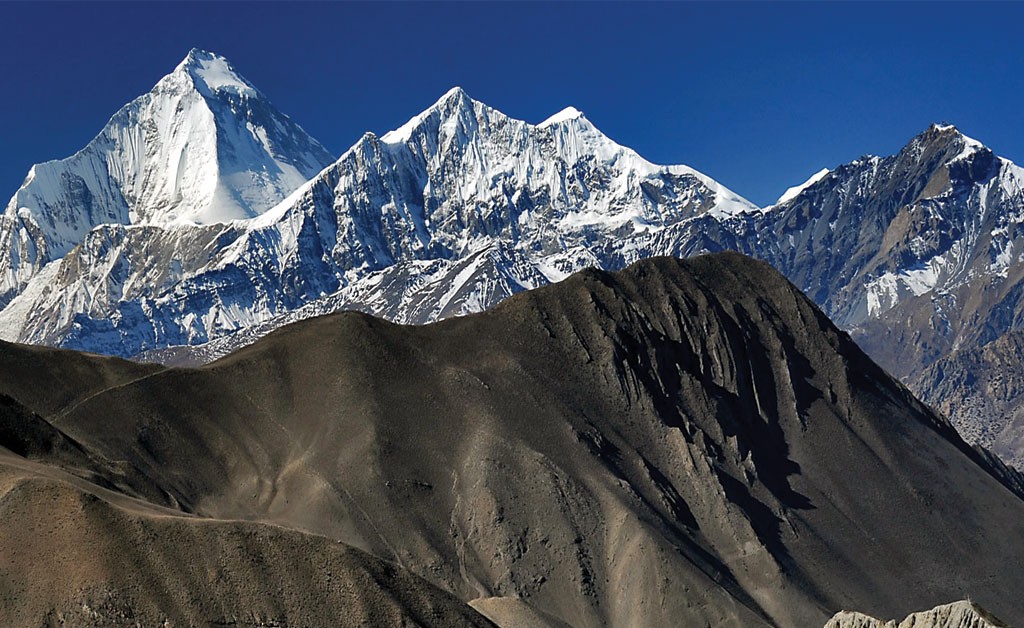
The Dhaulagiri Circuit does not follow the same kind of trail from beginning to end. The first days are spent on lower Myagdi Valley footpaths, but above Italian Base Camp the ground changes considerably. Forest trails give way to loose rock, moraine and glacier-influenced terrain before the route crosses French Pass and Dhampus Pass and makes the long descent toward the Kali Gandaki Valley.
This changing surface is one reason we do not judge a Dhaulagiri walking day by kilometers alone. Ten kilometers on a clear valley trail and ten kilometers across broken moraine are two very different days.
Lower Myagdi Valley: Naura to Sallaghari
From Naura through Bagar, Dovan and Sallaghari, much of the walking follows the Myagdi Valley through forest and increasingly sparsely inhabited country. Expect earth and stone paths, repeated short climbs and descents, stream crossings and narrower sections above the river.
The trail can feel quite different after rain. Mud, wet stone and steep ground require more careful foot placement, particularly on downhill sections. Vegetation remains a major part of the landscape here, and in places the valley feels enclosed by forest and steep slopes on either side.
The important change is gradual. You do not suddenly leave a village and step onto a glacier the next morning. Settlements become fewer, the valley becomes wilder, and the quality of the trail changes progressively as we approach Italian Base Camp.
Above Italian Base Camp: Where Walking Becomes Slower
Italian Base Camp marks the clearest transition in the trail. Above here, the greener lower-valley walking begins giving way to loose rock, glacial debris and increasingly uneven ground.
This is where the kilometer figures in the itinerary become less useful for judging effort. A relatively short stage can occupy much of the day because you cannot maintain the same rhythm over broken moraine that you can on a well-defined village path.
We encourage trekkers to find a steady rhythm rather than continually trying to regain speed after every rough section. On this part of Dhaulagiri, careful foot placement saves more energy than rushing and repeatedly correcting your balance.
Japanese Camp to Dhaulagiri Base Camp
Between Japanese Camp and Dhaulagiri Base Camp, moraine and glacier terrain become a much bigger part of the walking.
Expect loose stones, uneven glacial debris and sections where there is no smooth trail beneath your feet. The safest line can also change because glaciers and meltwater continually reshape the ground. A route that looks obvious from a distance may require a different line once we reach it.
This is not normally technical climbing, but it demands more concentration than an established trekking path. The challenge is often not one dramatic obstacle; it is spending several hours placing your feet carefully on irregular ground while continuing to gain altitude.
That difference is easy to underestimate when looking only at the day's distance on an itinerary.
French Pass and Hidden Valley
The terrain becomes more open and exposed as we climb toward French Pass at 5,360 meters.
Depending on recent weather and the time of the season, we may encounter dry rocky ground, hard-frozen surfaces or snow. Tracks can also become much less obvious after fresh snowfall, particularly in the broad terrain approaching and beyond the pass.
After crossing French Pass, the route descends into Hidden Valley, but the character of the ground does not suddenly become easy. The valley is broad and visually open compared with the enclosed Myagdi approach, yet we are still walking at around 5,000 meters through exposed high-mountain terrain.
This contrast can be deceptive. A wide valley can look straightforward from a distance while still requiring slow progress because of altitude, surface conditions and the scale of the landscape.
Dhampus Pass and the Descent to Yak Kharka
The approach to Dhampus Pass, approximately 5,240 meters, can again involve a mixture of rock, snow and frozen ground depending on conditions.
The character of the trek changes much more dramatically after the pass. Instead of continuing through the broad high country, we begin a substantial descent toward Yak Kharka, losing well over 1,000 meters from the pass.
This descent deserves as much attention as the climb. Loose ground and repeated downhill steps place different demands on the legs, particularly after several days in the high circuit. The temptation is to move faster because the altitude is finally dropping, but this is exactly where controlled footwork still matters.
As we descend farther, vegetation begins to return and the exposed high-pass terrain gradually gives way to the lower slopes leading toward the Kali Gandaki Valley.
Why Trail Conditions Can Change Between Departures
There is no single set of trail conditions that applies to every Dhaulagiri Circuit departure.
Rain affects the lower valley. Glacial movement and meltwater alter sections of moraine. Fresh snow can cover tracks around the passes, while colder periods can leave sections hard and frozen. Conditions seen by an October group therefore should not automatically be expected by a group trekking the following spring.
This is why our guide works with the trail that is actually in front of the group, rather than assuming that every section will look exactly as it did on a previous departure.
For trekkers, the practical lesson is simple: Dhaulagiri rewards steady movement more than speed. The lower valley requires endurance over changing hill trails, the middle section demands patience on moraine and glacier-influenced ground, and the high circuit requires controlled walking through exposed terrain before the long descent toward Yak Kharka.
How Difficult Is the Dhaulagiri Circuit Trek?
The Dhaulagiri Circuit Trek is a strenuous high-altitude trek, and we do not recommend it as a first trekking experience in Nepal. You do not need to be a technical mountaineer in normal trekking conditions, but you should already be comfortable with consecutive mountain days, basic camping and walking at altitude. Being fit is important, but fitness alone does not prepare someone for the full Dhaulagiri circuit.
The lower approach through the Myagdi Valley can give a misleading first impression of what lies ahead. The walking becomes much more demanding above Italian Base Camp at around 3,660 meters, where the route leaves the easier lower-valley environment and moves toward Japanese Camp and Dhaulagiri Base Camp. From here, shorter distances can still take several hours because altitude, rough ground and the need to maintain a controlled pace all begin working together.
The most demanding part comes after Dhaulagiri Base Camp at approximately 4,748 meters. The route climbs to French Pass at 5,360 meters, but reaching the highest point does not mean the hard part is finished. We descend into Hidden Valley and camp at roughly 5,100 meters, still higher than the summit elevation of many trekking peaks. The following day, Dhampus Pass at around 5,240 meters is still ahead before the long descent toward Yak Kharka finally takes us out of the highest part of the circuit.
That sequence is important when judging the difficulty. On some Himalayan treks, reaching the highest pass is followed by a major descent and noticeably easier sleeping altitude. On Dhaulagiri, you cross French Pass, spend another night above 5,000 meters and wake up with a second high pass still to cross. The body does not get much recovery between those stages.
Camping adds another layer that is easy to underestimate before the trek. At the end of a long day above Italian Base Camp, there may be no lodge dining room, hot shower or permanent bedroom waiting for you. The crew establishes camp, meals are prepared in the field, and you recover in a tent before starting again the next morning. One night like this is straightforward for most experienced trekkers. Several nights combined with increasing altitude and accumulated fatigue are what make Dhaulagiri different.
Most days involve roughly 4 to 7 hours of walking, while the French Pass and Dhampus Pass stages can take around 7 to 9 hours or longer when conditions slow the group. We do not treat those times as targets. A trekker who can maintain a steady pace for seven hours and still recover for the following day is better prepared for Dhaulagiri than someone who can walk very fast for four hours and arrive exhausted.
Before joining this trek, we strongly prefer guests to have completed at least one multi-day trek at high altitude, ideally with previous experience around or above 4,000 meters. That experience matters because you already know something about how you sleep, eat, recover and walk when the air becomes thinner. Experience with consecutive trekking days and simple mountain accommodation is more useful here than being exceptionally fast at sea level.
Training should therefore focus on endurance rather than speed. In the weeks before departure, regular hill walking, stairs, longer hikes with a daypack and back-to-back walking days are more relevant than relying only on gym fitness. Do not train only for climbing. The descent after Dhampus Pass places considerable strain on already tired legs, so downhill conditioning deserves attention as well.
We classify the Dhaulagiri Circuit Trek as strenuous and best suited to experienced trekkers with good endurance and realistic expectations about high-altitude camping. If this would be both your first multi-day trek and your first experience above 4,000 meters, we would normally recommend gaining experience on another Himalayan route first.
We would rather tell someone that Dhaulagiri is not yet the right trek for them than make the route sound easier simply to secure a booking. You should arrive already knowing that you are comfortable spending several days in the mountains. Dhaulagiri should test experience you already have, not be the place where you discover whether you enjoy high-altitude trekking.
Acclimatization and Altitude on the Dhaulagiri Circuit
On the Dhaulagiri Circuit Trek, the highest point is French Pass at 5,360 meters, but that number alone does not explain the altitude challenge. What matters more is the progression of sleeping elevations and the fact that the route remains very high after French Pass instead of immediately descending to a lower valley.
Our main dedicated acclimatization day is at Italian Base Camp, around 3,660 meters. We spend a second night here before moving farther into the high circuit. Depending on weather and how the group is responding, the day can include a short acclimatization walk followed by a return to camp. We are not trying to cover distance; the purpose is to give the body additional time at the same sleeping altitude before moving higher.
After Italian Base Camp, there is no reason to hurry. The route continues to Japanese Camp at around 3,890 meters and then rises sharply to Dhaulagiri Base Camp at approximately 4,748 meters. From this point, we pay particular attention to how each trekker is eating, sleeping, walking and recovering. Someone keeping pace with the group does not automatically mean they are acclimatizing well.
We also ask trekkers to tell the guide about symptoms rather than hiding them to avoid slowing the group. Persistent or worsening headache, nausea, dizziness, unusual fatigue, poor appetite or problems with coordination need attention at altitude. How somebody felt two days earlier is not enough to judge how they will respond as the sleeping elevation approaches 5,000 meters.
Dhaulagiri Base Camp is an especially important point for assessment because the next stage commits the group toward French Pass and Hidden Valley. If someone is showing concerning signs of poor acclimatization at Base Camp, the correct decision is not automatically to continue because French Pass appears on the following day's itinerary. The guide has to consider the trekker's condition before moving farther into the high section.
The altitude pattern beyond Base Camp is what makes this circuit particularly important to manage carefully. We climb to French Pass at 5,360 meters and descend into Hidden Valley, but the camp there remains at roughly 5,100 meters. In other words, reaching the highest point does not give the body the relief of sleeping much lower that evening.
The following morning, we are still at very high altitude with Dhampus Pass at approximately 5,240 meters ahead. Only after crossing Dhampus Pass does the route make its major descent toward Yak Kharka. This means the group spends an extended period around 5,000 meters rather than briefly touching that elevation and immediately returning to thicker air.
We encourage a deliberately steady pace throughout this section. Eating properly, drinking regularly and getting as much rest as possible at camp all matter, but there is no trick that guarantees acclimatization. People respond differently to altitude, including trekkers who are extremely fit and have previous mountain experience.
Our guide may use a pulse oximeter as an additional check during the trek, but we do not judge a trekker from one oxygen-saturation reading alone. The person's symptoms, behavior, walking ability and whether their condition is improving or deteriorating are more important than trying to achieve a particular number on the device.
If symptoms become concerning, gaining more altitude is not the objective. Depending on the situation, the appropriate response may be to stop ascending, reassess, descend or arrange further assistance. No pass crossing is important enough to justify ignoring clear signs that somebody should not continue higher.
For us, acclimatization on Dhaulagiri is therefore not simply a scheduled “rest day” at Italian Base Camp. It continues every day through pace, observation and decisions made as the group moves higher. The itinerary gives us the planned progression, but how each trekker is responding determines whether continuing with that progression remains sensible.
Camping and Expedition Support on the Dhaulagiri Circuit
The Dhaulagiri Circuit cannot be operated in the same way as a normal teahouse trek. In the lower Myagdi Valley there are a few basic places to stay, but as we move into the upper route, permanent accommodation disappears. From this point, the tents, food, cooking equipment and other supplies needed for the journey have to move through the mountains with our trekking team. This camping-supported approach is also how current Dhaulagiri operators describe the high circuit.
For us, this changes the entire organization of the trek. A guide and porter arrangement that works well on Everest or Annapurna is not enough by itself for Dhaulagiri. The camping section requires a trekking crew capable of moving the group's equipment and supplies, preparing meals and keeping the camp functioning as we progress through the route.
Once we are camping, meals are no longer ordered from a teahouse menu. The kitchen crew prepares food from the supplies carried for the trek. This means food planning begins before we enter the high section because there may be nowhere to simply purchase whatever is needed for the following night's meal. High Pass similarly describes its camping trek as carrying food with the group and using a trekking cook to prepare meals along the route.
The difference becomes especially clear around Dhaulagiri Base Camp and Hidden Valley. There is no village to walk into at the end of these stages and no lodge owner expecting our arrival. What we need for the night has effectively travelled there with the trekking team.
Trekkers normally walk with a personal daypack containing the things they may need before reaching camp, while the main trekking load and group equipment move separately with the crew. Warm layers, waterproof protection, drinking water, sun protection, snacks, personal medication and other essentials needed during the walking day should therefore remain in the daypack rather than inside the main luggage.
Expect the high camps to be simple. Wi-Fi, charging points, hot showers and heated lodge dining rooms are not part of life on this section of Dhaulagiri. Once we leave the developed lower route, the priorities become much more basic: somewhere protected to sleep, warm food, sufficient supplies and a functioning camp for the night.
This is also why the crew matters so much on Dhaulagiri. Guests may see tents standing and dinner being served when they arrive, but that is only the visible end of the work. The same camp equipment has to be packed, carried through the route and made ready again as the group moves farther around the circuit.
For anyone considering this trek, this distinction is worth understanding before booking. The Dhaulagiri Circuit is not a teahouse trek with a few camping nights added for adventure. On the high route, the camp and the people who move it are part of the trekking system itself. Without that support, there is no lodge infrastructure to take its place.
Best Time to Trek the Dhaulagiri Circuit
The best time for the Dhaulagiri Circuit Trek is usually late April to May and October to early November. For this route, we choose departure dates with the conditions around French Pass (5,360 m) and Dhampus Pass (approx. 5,240 m) in mind, not simply because a particular month is considered trekking season elsewhere in Nepal. Current Dhaulagiri-specific guidance identifies the same spring and autumn windows because snow on the two high passes can determine whether the circuit is practical.
October is our preferred month for most departures. By then the summer monsoon has normally withdrawn, the lower Myagdi Valley is drying out, and post-monsoon weather generally provides a good combination of visibility and workable conditions for the high crossings. The nights are already cold around Dhaulagiri Base Camp and Hidden Valley, but October normally avoids the deeper cold and increasing chance of fresh snow that come later in autumn.
Early November can still be an excellent time to trek, particularly when the weather remains settled. We become more cautious as November progresses because the high camps get colder and new snowfall can change French Pass and Dhampus Pass quickly. A clear morning in Marpha or Pokhara tells us very little about what the passes will look like several days later, which is why recent information from the high route matters more than a general seasonal forecast.
Spring gives us the second main window. Late April through May is usually preferable to pushing the trip too early because winter snow can remain around the high passes well into spring. The lower Myagdi Valley is greener at this time, daylight is longer, and temperatures generally become more manageable as the season progresses. The trade-off is that winter snow may still influence the crossings and afternoon cloud tends to become more noticeable as spring advances.
We would not choose the monsoon simply because the lower elevations are warm. Heavy rain affects the Myagdi approach through mud, wet forest trails, swollen waterways and increased landslide exposure, while persistent cloud and unstable conditions are poor companions for a route that eventually has to cross two passes above 5,200 meters. Current Dhaulagiri guidance consistently treats the monsoon as outside the normal operating season.
Winter presents the opposite problem. The lower valley may be comparatively dry, but deep snow, severe cold and blocked high passes can make the normal circuit impractical. This matters even more on Dhaulagiri because the group has to camp around the highest part of the route rather than descend each evening to an established lodge.
For us, the most useful way to choose a departure is therefore not to ask, “What is the best trekking month in Nepal?” The better question is, “When do we have the best realistic window to cross both French Pass and Dhampus Pass?”
For most trekkers, our answer is October to early November, with late April to May as the main spring alternative. Even within these periods, we still work with the conditions actually developing on the mountain rather than assuming that a date on the calendar guarantees an open pass.
Dhaulagiri Circuit Trek Permits
For the Dhaulagiri Circuit Trek, the standard route we operate requires an Annapurna Conservation Area Permit (ACAP) and TIMS card. The normal Dhaulagiri Circuit is not currently listed by Nepal Tourism Board as a restricted trekking area, so a separate Restricted Area Permit is not required for this itinerary.
The ACAP permit becomes relevant as our route comes out of the high circuit toward Marpha and the Kali Gandaki side of the Annapurna Conservation Area. TIMS also applies to Round Dhaulagiri under Nepal Tourism Board's current trekking system. NTB specifically includes Round Dhaulagiri among the routes covered by the revised TIMS provision.
Guests trekking with us do not need to spend their time in Kathmandu visiting permit offices. We arrange the required trekking permits and documentation before departure, using the passport information provided during the booking process. You should carry the documents with you during the trek so they are available whenever they are requested along the route.
This is one detail we prefer to confirm again before every departure rather than relying on an old permit list. Nepal's trekking regulations and fees can change, and Dhaulagiri information published online is not always consistent. We therefore work with the requirements in effect when your trek is being prepared.
Dhaulagiri Circuit Trek Packing List
Packing for the Dhaulagiri Circuit Trek is less about carrying more gear and more about carrying the right gear. Once we move beyond the lower Myagdi Valley, replacing a forgotten jacket, unsuitable boots or a weak sleeping bag becomes difficult. Your equipment needs to work through cold tented nights, high passes above 5,000 meters and several days away from normal trekking shops and lodge facilities.
We recommend keeping your personal kit practical and reasonably light. Warmth, weather protection, reliable footwear and a good sleeping system matter far more on Dhaulagiri than carrying several changes of trekking clothes.
Clothing
Bring a layering system that can handle both the warmer lower valley and the cold high camps:
- Moisture-wicking trekking shirts
- Trekking trousers
- Thermal base-layer top and bottom
- Warm fleece or insulated mid-layer
- Warm down jacket
- Waterproof and windproof shell jacket
- Waterproof over-trousers
- Trekking underwear
- Several pairs of trekking socks
- Warm hat covering the ears
- Sun hat or cap
- Neck gaiter or Buff
- Lightweight inner gloves
- Warm insulated outer gloves
Avoid packing one heavy outfit for the coldest day and little else. Several compatible layers are more useful because temperatures change considerably as the route climbs from the Myagdi Valley toward Dhaulagiri Base Camp and Hidden Valley.
Trekking Boots and Footwear
Your main boots should be waterproof, supportive and already broken in before arriving in Nepal. Do not begin Dhaulagiri in brand-new boots.
- Pack:
- Waterproof trekking boots with good grip
- Lightweight camp shoes or sandals
- Gaiters
- Spare boot laces
- Trekking poles
Trekking poles are particularly worthwhile on this circuit. They help with balance on irregular ground and become useful again during the long descent after Dhampus Pass when the legs are already tired.
Sleeping Equipment
A dependable sleeping system is one item we would not compromise on for Dhaulagiri.
You will need:
- Four-season sleeping bag suitable for approximately -15°C to -20°C
- Sleeping-bag liner
- Small travel pillow if preferred
- Headlamp with spare batteries
The temperature rating is a recommended sleeping-bag performance range, not a forecast of the temperature on your trek. Actual nighttime conditions depend on the season and weather.
When choosing your sleeping bag, think about the nights around Dhaulagiri Base Camp and Hidden Valley, not the temperature when you leave Kathmandu.
Daypack and Main Trekking Bag
A 25–35 litre daypack is normally suitable for the items you need while walking.
Keep accessible during the day:
- Waterproof jacket
- Warm layer
- Drinking water
- Sun protection
- Personal snacks
- Personal medication
- Phone or camera
- Headlamp when needed
- Important documents
Your main trekking luggage travels separately with the porter team. If you might need something before reaching camp, keep it in your daypack rather than your main bag.
Using waterproof stuff sacks or a protective liner inside both bags is useful even when the outer bag itself is water-resistant.
Sun Protection
Sun exposure becomes much stronger at altitude and can be particularly harsh when light reflects from snow.
Bring:
- Good-quality UV-protection sunglasses
- High-SPF sunscreen
- SPF lip balm
- Sun hat
- Neck protection
For Dhaulagiri, sunglasses are essential equipment rather than an optional comfort item.
Drinking Water and Trail Snacks
Carry enough reusable bottle capacity for your normal walking day rather than depending on disposable bottled water.
Useful items include:
- Two reusable water bottles or equivalent capacity
- Personal water-purification backup
- Electrolyte sachets
- A few familiar trail snacks
Bring snacks you already know you enjoy. At altitude, the energy bar that looked excellent in a Kathmandu trekking shop is not particularly useful if you cannot convince yourself to eat it.
An insulated bottle or bottle cover can also be useful around the coldest camps.
Personal Health and Hygiene
Keep this kit compact:
- Regular prescription medication
- Personal first-aid items
- Blister treatment
- Hand sanitizer
- Toothbrush and toothpaste
- Wet wipes
- Toilet paper
- Quick-drying towel
- Personal toiletries
Any medication you may need during the walking day should remain with you, not inside porter-carried luggage.
Electronics and Power
Do not plan your electronics around having a charging socket every evening. Once the camping section begins, normal charging facilities become limited or unavailable.
Bring:
- Power bank
- Charging cables
- Spare camera batteries if required
- Protective storage for electronics
Cold also reduces battery performance. Around the highest camps, keep your phone, power bank and important batteries protected rather than leaving them exposed inside a cold tent overnight.
Microspikes or Crampons for French Pass and Dhampus Pass
There is no honest one-equipment answer for every Dhaulagiri departure.
Conditions around French Pass (5,360 m) and Dhampus Pass (approx. 5,240 m) can range from relatively dry ground to hard snow, ice or fresh snowfall. The traction equipment appropriate for one departure may therefore be unnecessary or inadequate for another.
We check the expected high-pass conditions before departure and advise you what additional traction equipment should be carried. Do not buy heavy technical equipment simply because an old packing list says every Dhaulagiri trekker needs it.
What We Recommend Leaving Behind
Overpacking is particularly unhelpful on a camping trek.
You do not need a fresh trekking outfit for every day, several heavy casual clothes or duplicate equipment for every possible situation. Prioritize the items that have a real job on this route: warm layers, weather protection, dependable boots, sleeping equipment, sun protection and the personal essentials that cannot easily be replaced once we enter the high circuit.
Before leaving Kathmandu, we go through the important equipment with you. If a jacket is inadequate, boots are unsuitable or an essential item is missing, Kathmandu is the place to solve that problem, not Italian Base Camp.